Driedorp
Driedorp is a hamlet in the Dutch province of Gelderland. It is a part of the municipality of Nijkerk, and lies about 10 km east of Amersfoort.[2]
Driedorp | |
|---|---|
Hamlet | |
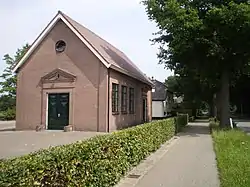
 Church of Driedorp | |
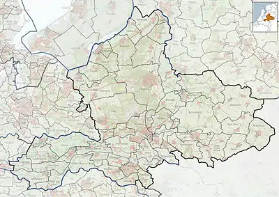
 Driedorp in the municipality of Nijkerk. | |
 Driedorp Location in the province of Gelderland in the Netherlands  Driedorp Driedorp (Netherlands) | |
| Coordinates: 52.20663°N 5.51876°E | |
| Country | Netherlands |
| Province | Gelderland |
| Municipality | Nijkerk |
| Area | |
| • Total | 5.35 km2 (2.07 sq mi) |
| Population (2021)[1] | |
| • Total | 340 |
| • Density | 64/km2 (160/sq mi) |
| Time zone | UTC+1 (CET) |
| • Summer (DST) | UTC+2 (CEST) |
| Postal code | 3862[1] |
| Dialing code | 033 |
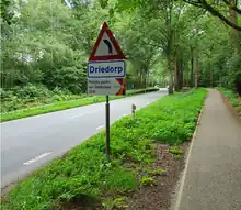
It was first mentioned in 1874 as Driedorp and probably means "village of three houses".[3] The postal authorities have placed it under Nijkerk.[4] The village developed in the late 19th century, and used to have a railway stop from 1903 until 1933. A little church was built in 1867 and since 2010, it is an independent church, because it did not want to join the united Protestant Church in the Netherlands. In 2019, it won the competition for most beautiful place name in Gelderland.[5]

Place name sign
References
- "Kerncijfers wijken en buurten 2021". Central Bureau of Statistics. Retrieved 23 March 2022.
Combined listing with Kruishaar
- ANWB Topografische Atlas Nederland, Topografische Dienst and ANWB, 2005.
- "Driedorp - (geografische naam)". Etymologiebank (in Dutch). Retrieved 23 March 2022.
- "Postcode 3862 in Nijkerk". Postcode bij adres (in Dutch). Retrieved 23 March 2022.
- "Driedorp". Plaatsengids (in Dutch). Retrieved 23 March 2022.
This article is issued from Wikipedia. The text is licensed under Creative Commons - Attribution - Sharealike. Additional terms may apply for the media files.