Paulpietersburg
Paulpietersburg is a small town in KwaZulu-Natal, South Africa. It was established in 1888 and was then part of the Transvaal Republic. It was named after then President Paul Kruger and Voortrekker hero Piet Joubert.
Paulpietersburg | |
|---|---|
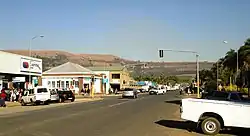
 View up Hoog Street with Dumbe hill in background | |
 Paulpietersburg  Paulpietersburg | |
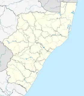
| Coordinates: 27°25′S 30°49′E | |
| Country | South Africa |
| Province | KwaZulu-Natal |
| District | Zululand |
| Municipality | eDumbe |
| Established | 1888[1] |
| Government | |
| • Councillor | BM Nxusa (NFP) |
| Area | |
| • Total | 36.56 km2 (14.12 sq mi) |
| Population (2011)[2] | |
| • Total | 1,859 |
| • Density | 51/km2 (130/sq mi) |
| Racial makeup (2011) | |
| • Black African | 56.7% |
| • Coloured | 1.0% |
| • Indian/Asian | 1.5% |
| • White | 37.3% |
| • Other | 3.6% |
| First languages (2011) | |
| • Zulu | 48.8% |
| • Afrikaans | 23.1% |
| • English | 11.5% |
| • Other | 16.6% |
| Time zone | UTC+2 (SAST) |
| Postal code (street) | 3180 |
| PO box | 3180 |
| Area code | 034 |
Town 72 km south of Piet Retief and 151 km north-east of Dundee. It was established in 1888, proclaimed a township in 1910, and attained municipal status in 1958. Named after President Paul Kruger and General Piet Joubert, it was first called Paulpietersrust, then Paulpietersdorp, and Paulpietersburg in 1896.[3]
Notable residents
References
- Robson, Linda Gillian (2011). "Annexure A" (PDF). The Royal Engineers and settlement planning in the Cape Colony 1806–1872: Approach, methodology and impact (PhD thesis). University of Pretoria. pp. xlv–lii. hdl:2263/26503.
- "Main Place Paulpietersburg". Census 2011.
- "Dictionary of Southern African Place Names (Public Domain)". Human Science Research Council. p. 360.
This article is issued from Wikipedia. The text is licensed under Creative Commons - Attribution - Sharealike. Additional terms may apply for the media files.
.svg.png.webp)