Durazno Department
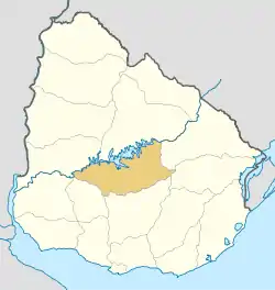
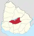
Durazno (Spanish pronunciation: [duˈɾasno]; Uruguayan Spanish: [duˈɾahno]) is a department of Uruguay. Its capital is Durazno. Its name means "peach" in Spanish, referring to the department's peaches and its status as an agricultural breadbasket. It is located in the centre of the country, and is bounded to the north by the Río Negro and the Río Yi to the South. To its north are the departments of Río Negro and Tacuarembó, to it southeast the departments of Treinta y Tres, to its south the departments of Flores and Florida, while on its east is the department of Cerro Largo.
Durazno Department | |
|---|---|
 Flag  Coat of arms | |
 Location of Durazno Department and its capital | |
| Coordinates (Durazno): 33°22′S 56°31′W | |
| Country | |
| Capital of Department | Durazno |
| Government | |
| • Intendant | Carmelo Vidalín[1] |
| • Ruling party | Partido Nacional |
| Area | |
| • Total | 11,643 km2 (4,495 sq mi) |
| Population (2011 census) | |
| • Total | 57,088 |
| • Density | 4.9/km2 (13/sq mi) |
| Demonym | Duraznense |
| Time zone | UTC-3 (UYT) |
| ISO 3166 code | UY-DU |
| Website | durazno.gub.uy |

History

In 1827, while the territory was under Portuguese dominion, the Portuguese asked their ally, General Fructuoso Rivera to establish a military body of cavalry and artillery in the area of Paso del Durazno on the banks of Río Yi. For this, the town of San Pedro del Durazno was founded, named after the regent of Brazil. In 1828 the department named "Entre Ríos Yí y Negro" was formed, which was soon after renamed to Durazno. When the First Constitution of Uruguay was signed in 1830, Durazno was one of the nine original departments of the Republic.
Demographics
As of the census of 2011, Durazno Department had a population of 57,088 (28,216 male and 28,872 female) and 23,023 households.[3]
Demographic data for Florida Department in 2010:
- Population growth rate: 0.696%
- Birth Rate: 15.62 births/1,000 people
- Death Rate: 8.08 deaths/1,000 people
- Average age: 31.3 (30.6 male, 32.1 female)
- Life Expectancy at Birth:
- Total population: 78.24 years
- Male: 74.34 years
- Female: 82.12 years
- Average per household income: 21,515 pesos/month
- Urban per capita income: 7,934 pesos/month
2010 Data Source:[4]
| Main Urban Centres | Other towns and villages | ||||||||||||||||||||||||||
|---|---|---|---|---|---|---|---|---|---|---|---|---|---|---|---|---|---|---|---|---|---|---|---|---|---|---|---|
| Population stated according to the 2011 census.[5] | |||||||||||||||||||||||||||
|
| ||||||||||||||||||||||||||
- Rural population
According to the 2011 census, Durazno department has a rural population of 4,951.[3]
Economy
The economy of Durazno largely depends on agriculture and agrotourism. The raising of sheep, and of cattle, both dairy and for beef are of great importance. The Rural Society of Durazno groups together many of the landowning businesses in the department.
In the 1930s the Government of Gabriel Terra undertook considerable hydroelectric development in the department.
Map of the department

Notable people
- Juan José de Amézaga served as a deputy for the department in the early years of the 20th century and later served as President of Uruguay from 1943 to 1947.
- Santiago Bordaberry, himself from a prominent political family, is a noted rural affairs activist in Durazno.
- Francisco Davant was a prominent local arboriculturist, active in local government. (see: Villa del Carmen)
References
- "Vidalín marca un hito y logra su tercer gobierno". elpais.com.uy (in Spanish). Retrieved 29 November 2017.
- "Población por sexo y ascendencia étnico racial, según departamento" (in Spanish). National Institute of Statistics. Archived from the original on 30 November 2020.
- "Censos 2011 Durazno (needs flash plugin)". INE. 2012. Retrieved 31 August 2012.
- "Uruguay en cifras" (PDF) (in Spanish). INE. 2011. Archived from the original (PDF) on 13 November 2012. Retrieved 25 October 2012.
- "Censos 2011 Cuadros Durazno". INE. 2012. Archived from the original on 10 October 2012. Retrieved 25 August 2012.
