Godmanchester
Godmanchester (/ˈɡɒdməntʃɛstər/ GOD-mən-ches-tər)[2] is a town and civil parish in the Huntingdonshire district of Cambridgeshire, England. It is separated from Huntingdon, 1 mile (1.6 km) to the north, by the valley of the River Great Ouse. Being on the Roman road network, the town has a long history. It has a waterside location, surrounded by open countryside of high value for its biodiversity but it remains highly accessible, with a railway line to London, the A1 road and M11/A14 which run nearby.[3]
| Godmanchester | |
|---|---|
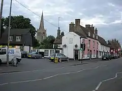
 Post Street in Godmanchester, with the tower of St Mary's Church | |
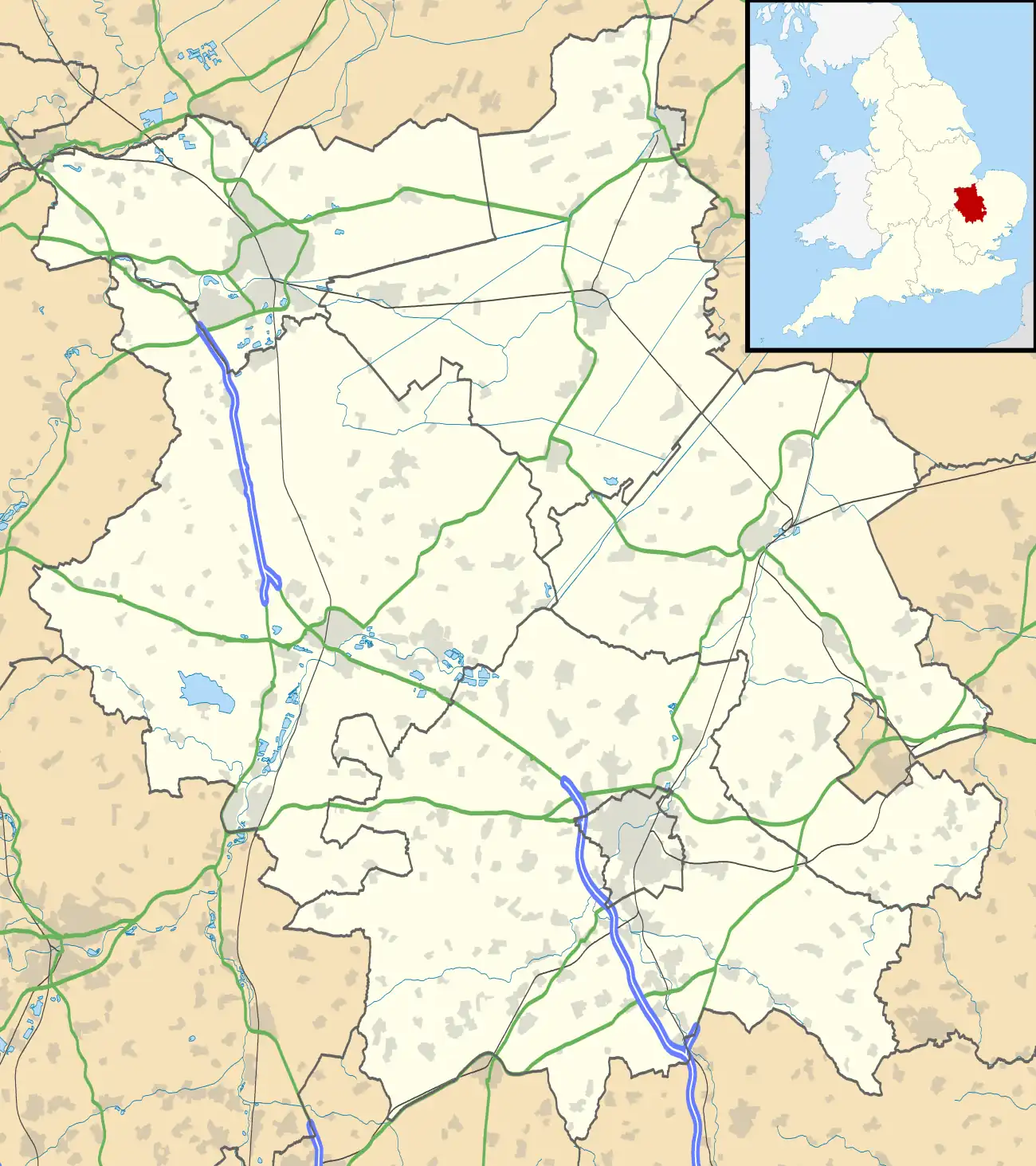
 Godmanchester Location within Cambridgeshire | |
| Area | 1.983 km2 (0.766 sq mi) civil parish |
| Population | 7,893 (2021) |
| • Density | 3,980/km2 (10,300/sq mi) |
| OS grid reference | TL245704 |
| • London | 56 miles (90 km) |
| Civil parish |
|
| District | |
| Shire county | |
| Region | |
| Country | England |
| Sovereign state | United Kingdom |
| Post town | HUNTINGDON |
| Postcode district | PE29 |
| Dialling code | 01480 |
| Police | Cambridgeshire |
| Fire | Cambridgeshire |
| Ambulance | East of England |
| UK Parliament | |
Etymology
The town was listed as Godmundcestre in the Domesday Book, and was subsequently known as Gutmuncetre, Gudmencestre, Gudmundcestria, Gum(m)uncestre, Gumencestre, Guncestre, Gumcestria, Gumecestre, Gommecestre, Gomecestria, Gummecestre, Gurmund(es)cestre, Gormecestre, Gormancestre, Gomecestre, Gunnecestre, Gurmecestre, Godmechestre, Gurminchestre, Gumchestre, Gurmencestre, Gumcestre, Gumestre, Godmonchestre, Gumecestur and Gumycestre.[4]
The root itself is uncertain but the same as the town of Godalming, suggesting it may be derived from the ethnonym of the Goths[5] who settled Sub-Roman Britain.[6][7] The second element mund is the nominative plural of the Old English word munda, meaning "protector" or "guardian."[8] The suffix chester derives from the Middle English cognate of the Latin word castrum, and was used by the Anglo-Saxons to denote the location of a former Roman (or sometimes pre-Roman) military fort.[9]
The most likely translation is thus the nouns "Goths-guards-fort." Attributions to the Saxon King Guðrum c.835–890 are considered to be ahistorical founding myths[10] reflective of the changes in Anglo-Saxon perceptions of the Goths over time.[11]
A minority of visitors, former residents and residents continue to pronounce the place as Gumster (/ˈɡʌmstər/), though this has long-since been superseded by Godmunchester, with stress on the first syllable.[12][13]
History
The town is on the site of the Roman town of Durovigutum.[14] There is archaeological evidence of Celtic and earlier habitation prior to the establishment of a key Roman town and a mansio (inn), so the area has probably been continuously occupied for more than 2,000 years.
The remains of a neolithic temple circa 2900 BC, aligned to the Beltane sunrise, were documented between the town and the village of Hemingford Abbots.[15] The location is likely to have been originally settled due to the gravel beds providing a ford across the River Great Ouse.
The settlement was at a crossroads of Roman roads Ermine Street, the Via Devana (from Cambridge, between Colchester and Chester) and a military road from Sandy, Bedfordshire. The Roman settlement was sacked by Anglo-Saxons in the third century. In contrast to Huntingdon, archaeological finds have been extensive in the centre of Godmanchester, which has two conservation areas of early recognition,[16] including many timber-framed Tudor houses, the largest being Tudor Farm, dating from 1600 and restored in 1995.
The town's prosperity over the centuries has been closely tied to its strategic position on the old Roman Road from London to York. It is suggested that, in the Middle Ages, the Danes allowed development of an inland port by digging the Mill Lade.[17]
The place was listed as Godmundcestre in the Domesday Book of 1086 in the Hundred of Leightonstone in Huntingdonshire.[18] The survey records that there were 26 ploughlands, with capacity for a further 31 and, in addition to the arable land, there were 160 acres (65 hectares) of meadows, 50 acres (20 hectares) of woodland and three water mills, a church and a priest.[19]
Godmanchester was first recognised with a town charter by King John in 1212, although it had been a market town and royal manor for some years. King James I granted a second Royal Charter in 1604.[17]
Farm Hall, on West Street, was used as a bugged detention centre for German nuclear scientists as part of Operation Epsilon, from July 1945 to January 1946.[20]
Government
Godmanchester was a municipal borough based at Godmanchester Town Hall in the county of Huntingdonshire until 1961.[21] It was then part of the borough of Huntingdon and Godmanchester until 1974.[21] At county level, the town was in Huntingdonshire until 1965, when it became part of the new administrative county of Huntingdon and Peterborough.[22] In 1974, the former, relatively diminutive, county of Huntingdon and Peterborough was absorbed into the administrative county of Cambridgeshire.[23]
The highest tier of local government is Cambridgeshire County Council, locally represented by two county councillors serving Godmanchester and Huntingdon East (electoral division).[24][25]
The second tier of local government, the planning authority and council-tax collecting body, is Huntingdonshire District Council, a non-metropolitan district, locally represented by two councillors elected for an eponymous ward.[24][26]
The third and lowest tier of local government is Godmanchester town council. The council comprises 17 councillors, including a mayor and a deputy mayor.[27]
At Westminster, Godmanchester is represented in the Huntingdon seat in the House of Commons since 2001 by Jonathan Djanogly (Con).[24]
Demography
Population
Since 1801, the population has been recorded every ten years by the UK census, the only exception being in 1941 due to the Second World War. In the 19th century, the population ranged from 1,573 (in 1801) to 2,438 (recorded in 1861).[28] The fastest growth, an 81% increase in population, was between 1981 and 1991[29]
Population figures since 1911 are:
| Parish |
1911 |
1921 |
1931 |
1951 |
1961 |
1971 |
1981 |
1991 |
2001 |
2011 |
2021 |
|---|---|---|---|---|---|---|---|---|---|---|---|
| Godmanchester | 2,130 | 2,035 | 1,993 | 2,502 | 2,955 | 5,255 | 5,996 | 6,711 | 7,893 | ||
Population census figures from report Historic Census figures Cambridgeshire to 2011 by Cambridgeshire Insight.[28][30]
In 2021, the parish covered an area of 4,900 acres (1,983 hectares)[28] and so the population density for Godmanchester in 2021 was 10,300 persons per square mile (3,980 per square kilometre).[31]
By 2016 Godmanchester had a population of about 6800 in 3,100 homes;[32] it is expected that this will further increase to at least 4050 homes and 8600 residents by 2036.[33][34]
Culture and community
The town has a waterside location surrounded by open countryside of high value for its biodiversity, agricultural land value, scenic beauty and landscape quality.[35]

There are several bridges across the Great Ouse to Huntingdon. The Old Bridge, Huntingdon, a historic, medieval bridge, was the only road until 1975. In that year the original bypass route which is now used as a local road was built. Pedestrian traffic across the river is principally served by three additional footbridges.
England's largest meadow Portholme may be accessed from Godmanchester or Huntingdon, but lies within the Parish of Brampton.[36] It remains an important flood plain, but has served as an equestrian racecourse and centre for early aviation.
To the North and East of the town are West and Eastside Common (SSSI), and Godmanchester Nature Reserve. These commons are intersected by The Ouse Valley Way and Pathfinder Way[37] long-distance footpaths, and the route of a disused railway which connected the demolished Godmanchester Station and St Ives.
South of the town centre are the headquarters and a large operational shelter of veterinary/rescue charity Wood Green Animal Shelters.
A number of small businesses, plus DHL and Coop warehouses are situated on the southern edge of the town, on Chord Business park, Roman Way Industrial Estate and Cardinal Business Park.
Original historical documents relating to Godmanchester, including the original church parish registers, local government records, maps, photographs and the surviving borough charters, are held by Cambridgeshire Archives and Local Studies at the County Record Office, Huntingdon.
In October 2003, BBC1's Songs Of Praise was once again (previous transmission 1976) hosted by the parish church of St Mary the Virgin and featured the new hymn tune Godmanchester, written by the then vicar, Peter Moger.[38]
Landmarks
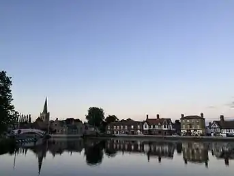
Chinese Bridge

One of the town's largest public works of art and of landscaping is its Chinese Bridge, which connects to a water meadow. Local legend has it that the bridge was built without the use of nails or other fixings. The bridge was removed by crane on 9 February 2010. A new replica was built off-site in two parts and was installed on 15–16 February 2010.[39] Today the Chinese Bridge does feature nails. The claims are believed to be false; a bridge in Queens' College, Cambridge, had the same urban myth. Expert commentators write that the original nails had corroded away, masking their presence.
Twin towns – sister cities
Godmanchester is twinned with:
 Wertheim am Main, Germany
 Salon-de-Provence, France
 Szentendre, Hungary
 Gubbio, Italy
Facilitated by Huntingdon and Godmanchester Twinning Association[40]
Sport and leisure
The non-League football club Godmanchester Rovers F.C. play at Bearscroft Lane, whose teams play in various regional divisions.
Transport
In 2019 the six lane A14 was opened allowing heavy traffic to pass unhindered over the 0.5 miles (0.80 km) long Great Ouse Viaduct, 2.1 miles (3.4 km) south of the town.[41][42] The arterial road connects the West Midlands to the Haven ports of Ipswich, Harwich and Felixstowe and via the M11 to London. Since opening in 2020 the A1307 provides a resilient route for light vehicles, north across the river into Huntingdon, or south to St. Ives and Cambridge .[43] (Historically this route has been repeatedly renamed: most recent first, A1307, A14, A604, Via Devana). The A1198 road, Ermine Street links traffic to the A14 or to Royston, and is used for shorter journeys south avoiding the A1.
Huntingdon railway station, a semi-major stop on the East Coast Main Line is less than 1.8 miles (2.9 km) from the town centre by car.
The town of Huntingdon and railway station may also be accessed on foot via the expansive meadow or by National Cycle Network route 51.
Local buses from Godmanchester are provided by Whippet (bus company) on routes 66 (to Huntingdon and St Neots) and X2/X3 (to Huntingdon or Papworth and Cambridge).
Notable people
- Stephen Marshall ( 1594 – 1655), prominent non-conformist churchman, before and during the Interregnum,
- Sir Oliver Cromwell (1562-1655), Uncle to the Lord Protector and ruler of England, Oliver Cromwell,
- Sir William Prescott 1st Baronet of Godmanchester, (1874–1945), Civil Engineer and Member of Parliament. Father of Sir Richard Stanley Prescott.[44] On the death of his uncle, Sir Mark Prescott, a race horse trainer from Newmarket became 3rd Baronet ,
- Fred Beart (1850–1895), cricketer, was born in Godmanchester,
- Nigel Bonner (1928-1994), Antarctic marine mammal specialist, retired to Godmanchester and died there,
- Timothy Machin (born 1948), cricketer, was born in Godmanchester,
- Simon Thurley (born 1962), historian and presenter, grew up in Godmanchester,
- Darren Bent (born 1984), England international and Premier League footballer played for Godmanchester Rovers F.C. as a youth.
Notes
References
- "Godmanchester Town Council – Town Hall, Post Street, Godmanchester, Cambridgeshire. PE29 2NB". gmccouncil.com. Retrieved 9 November 2017.
- "Guide wrongly corrects the pronunciation of Godmanchester to Gumster | Cambridge News". 17 September 2016. Archived from the original on 17 September 2016. Retrieved 15 July 2023.
- "Report on Godmanchester Neighbourhood Plan 2017-2036" (PDF). Huntingdon District Council. 30 August 2017.
- "Godmanchester: Major Settlement in the Parish of Godmanchester". Survey of English Place-Names. English Place-name Society. 1 January 1923. Retrieved 3 June 2020.
- Shore, Thomas William (1906). Origin of the Anglo-Saxon Race: A Study of the Settlement of England and the Tribal Origin of the Old English People. Louis Erle Shore, T. W. Jr. Shore (eds.). London: E. Stock. p. 259.
- Del Mar, Alex (1900). Ancient Britain in the Light of Modern Archaeological Discoveries. New York: Cambridge Press. p. 143.
- Procopius (1914). The Gothic Wars of Procopius, Vol. III, Book II. London: W. Heinemann. p. 345.
- Wiktionary.
- Ekwell, E. (1960). The Concise Oxford Dictionary of English Place-Names (4th ed.). Oxford. p. 92.
{{cite book}}: CS1 maint: location missing publisher (link) - Camden's Britannia newly translated into English, with large additions and improvements. Edmund Gibson. pp. 421–322.
- Godden, M. R. (1 January 2002). "The Anglo-Saxons and the Goths: rewriting the sack of Rome". Anglo-Saxon England. Cambridge University Press. 31: 47–68. doi:10.1017/S0263675102000030. JSTOR 44510557. S2CID 162761333. Retrieved 4 June 2020.
- "Guide wrongly corrects the pronunciation of Godmanchester to Gumster - Cambridge News". 17 September 2016. Archived from the original on 17 September 2016. Retrieved 9 November 2017.
{{cite web}}: CS1 maint: bot: original URL status unknown (link) - Candida Lycett Green, England: travels through an unwrecked landscape (1996), p. 74: "GODMANCHESTER Huntingdonshire... As a child I was taught to pronounce it 'Gumster'."
- Rivet, A.L.F.; Smith, Colin (1979). The Place-Names of Roman Britain. London. p. 354.
{{cite book}}: CS1 maint: location missing publisher (link) - Keys, David (23 March 1991). "Godmanchester's temple of the Sun". New Scientist.
- "Conservation Areas in Godmanchester (c) Stuart Bond 2002". godmanchester.net. Archived from the original on 9 January 2006.
- Sneath, Pam; Sneath, Ken (2011). Godmanchester A Celebration of 800 Years. EAH Press. p. 34. ISBN 978-0-9560384-4-9.
- Ann Williams; G.H. Martin, eds. (1992). Domesday Book: A Complete Translation. London: Penguin Books. p. 1349. ISBN 0-141-00523-8.
- J.J.N. Palmer. "Open Domesday: Place - Godmanchester". www.opendomesday.org. Anna Powell-Smith. Retrieved 25 February 2016.
- Bernstein 2001, p. 60
- "Godmanchester MB". Vision of Britain. Retrieved 12 December 2021.
- "Local Government (East Midlands) HC Deb 09 March 1964 vol 691 cc170-211". Parliamentary Debates (Hansard). 9 March 1964. Retrieved 5 June 2008.
- Local Government Act 1972
- "Ordnance Survey Election Maps". www.ordnancesurvey.co.uk. Ordnance Survey. Retrieved 23 February 2016.
- "Cambridgeshire County Council: Councillors". www.cambridgeshire.gov.uk. Cambridgeshirte County Council. Archived from the original on 22 February 2016. Retrieved 15 February 2016.
- "Huntingdonshire District Council: Councillors". www.huntingdonshire.gov.uk. Huntingdonshire District Council. Retrieved 23 February 2016.
- "Godmanchester Town Council: Councillors". www.gmccouncil.com. Godmanchester Town Council. Archived from the original on 6 February 2016. Retrieved 6 February 2016.
- "Historic Census figures Cambridgeshire to 2011". www.cambridgeshireinsight.org.uk. Cambridgeshire Insight. Archived from the original (xlsx - download) on 15 February 2016. Retrieved 12 February 2016.
- "Population - godmanchester.net (c) All rights reserved 1998-2006 - The authoritative site about Godmanchester and its residents, more than 330 pages about the town, forums and events". Stuart Bond.
- "Census data". City Population (in Chinese). Retrieved 15 July 2023.
- "United Kingdom: East of England (Local Authority Districts and Parishes) - Population Statistics, Charts and Map". www.citypopulation.de. Retrieved 15 July 2023.
- "Huntingdonshire Annual demographic and socio-economic report, Appendix 6-7" (PDF). Cambridgeshire County Council. 1 April 2011. pp. 50–52.
- "Godmanchester Neighbourhood Plan 2017-2036" (PDF). Godmanchester Town Council. p. 9.
- "Huntingshire District Report 2011" (PDF). Cambridgeshire Insight.
- "Report on Godmanchester Neighbourhood Plan 2017-2036" (PDF). Huntingdon District Council. 30 August 2017.
- "Portholme Godmanchester (c) Stuart Bond 2002". godmanchester.net. Archived from the original on 27 May 2012.
- www.jameskirby.me.uk, MKH Computer Services Ltd-www mkh-computer-services co uk / James Kirby-. "Long Distance Walkers Association". www.ldwa.org.uk.
- "St Mary the Virgin, Godmanchester - Archived Event". Archived from the original on 20 August 2008.
- "The Chinese Bridge". Godmanchester Museum. Retrieved 2 October 2021.
- "Home". hgta.co.uk.
- "New A14 Huntingdon bypass officially opens to traffic". 9 December 2019.
- "Timelapse video shows how huge A14 viaduct was constructed". 26 February 2019.
- "New link road for Huntingdon Town Centre is open". 31 October 2020.
- "The Ashforth profile: An engaging disciplinarian; Sir Mark Prescott has long been recognised as a skilful and intelligent trainer. - Free Online Library". www.thefreelibrary.com.
Sources
- Bernstein, Jeremy (2001). Hitler's Uranium Club: The Secret recordings at Farm Hall (2nd ed.). New York: Springer-Verlag. ISBN 978-0-387-95089-1.
.jpg.webp)