Early County, Georgia
Early County is a county located on the southwest border of the U.S. state of Georgia. As of the 2020 census, the population was 10,854.[1] The county seat is Blakely, where the Early County Courthouse is located.[2] Created on December 15, 1818, it was named for Peter Early, 28th Governor of Georgia.[3] The county is bordered on the west by the Chattahoochee River, forming the border with Alabama.
Early County | |
|---|---|
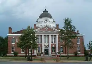 Early County Courthouse in Blakely | |
 Location within the U.S. state of Georgia | |
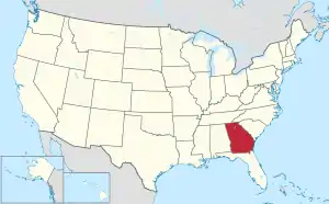 Georgia's location within the U.S. | |
| Coordinates: 31°20′N 84°55′W | |
| Country | |
| State | |
| Founded | 1818 |
| Named for | Peter Early |
| Seat | Blakely |
| Largest city | Blakely |
| Area | |
| • Total | 516 sq mi (1,340 km2) |
| • Land | 513 sq mi (1,330 km2) |
| • Water | 3.8 sq mi (10 km2) 0.7% |
| Population (2020) | |
| • Total | 10,854 |
| • Density | 21/sq mi (8/km2) |
| Time zone | UTC−5 (Eastern) |
| • Summer (DST) | UTC−4 (EDT) |
| Congressional district | 2nd |
| Website | earlycounty |
History
Prehistoric and nineteenth-century history has been preserved in some of Early County's attractions. It is the site of the Kolomoki Mounds, a park preserving major earthworks built by indigenous peoples of the Woodland culture more than 1700 years ago, from 350 CE to 600 CE. This is one of the largest mound complexes in the United States and the largest in Georgia; it includes burial and ceremonial mounds. The siting of the mounds expresses the ancient people's cosmology, as mounds are aligned with the sun at the spring equinox and summer solstice.
The county area was long territory of the historic Creek Indian peoples of the Southeast, particularly along the Chattahoochee River. Beginning in the early nineteenth century, European-American settlers began to encroach on this territory, pushing the Muscogee out during Indian Removal in the 1830s. The Muscogee were forced to Indian Territory west of the Mississippi River.
This area was developed by European-American settlers and their African-American enslaved workers for cotton plantations. Agriculture was critical to the economy into the 20th century. The Cohelee Creek Bridge in the county is the southernmost covered bridge still standing. One of the last wooden flagpoles from the American Civil War era is located at the historic courthouse in downtown Blakely.
According to the Equal Justice Initiative, in the period from 1877 to 1950, Early County had 24 documented lynchings of African Americans, the second-highest total in the state after the more densely populated Fulton County.[4][5] Most were committed around the turn of the 20th century, in the period of Jim Crow conditions and suppression of black voting. This was still a largely agricultural area, and some disputes arose from confrontations between black sharecroppers or tenant farmers and white landowners, particularly at times to settle accounts. Another, Sidney Grist, was lynched on December 31, 1896, for "political activity".[5]
Among these cases were five African-American men lynched by whites in less than a month in the summer of 1899: three on July 23, one on July 25 (all reportedly for rape and robbery), and one on August 3 for attempted rape.[6] Black men were frequently identified as suspects in such cases and lynched before any trial took place; further investigations have sometimes revealed consensual sex or other persons having committed the crime. A mass lynching took place in the county on December 30, 1915, when seven black men were lynched, allegedly as suspects in a murder.[6]
Geography
According to the U.S. Census Bureau, the county has a total area of 516 square miles (1,340 km2), of which 513 square miles (1,330 km2) is land and 3.8 square miles (9.8 km2) (0.7%) is water.[7]
The northeastern and eastern portions of Early County, east of Blakely, and extending south to a line east of Jakin, are located in the Spring Creek sub-basin of the ACF River Basin (Apalachicola-Chattahoochee-Flint River Basin). The western portion of the county is located in the Lower Chattahoochee River sub-basin of the same ACF River Basin.[8]
Major highways
Adjacent counties
- Clay County (north)
- Calhoun County (northeast)
- Baker County (east)
- Miller County (southeast)
- Seminole County (south or east)
- Houston County, Alabama (southwest/CST Border)
- Henry County, Alabama (west/CST Border)
Demographics
| Census | Pop. | Note | %± |
|---|---|---|---|
| 1820 | 768 | — | |
| 1830 | 2,051 | 167.1% | |
| 1840 | 5,444 | 165.4% | |
| 1850 | 7,246 | 33.1% | |
| 1860 | 6,149 | −15.1% | |
| 1870 | 6,998 | 13.8% | |
| 1880 | 7,611 | 8.8% | |
| 1890 | 9,792 | 28.7% | |
| 1900 | 14,828 | 51.4% | |
| 1910 | 18,122 | 22.2% | |
| 1920 | 18,983 | 4.8% | |
| 1930 | 18,273 | −3.7% | |
| 1940 | 18,679 | 2.2% | |
| 1950 | 17,413 | −6.8% | |
| 1960 | 13,151 | −24.5% | |
| 1970 | 12,682 | −3.6% | |
| 1980 | 13,158 | 3.8% | |
| 1990 | 11,854 | −9.9% | |
| 2000 | 12,354 | 4.2% | |
| 2010 | 11,008 | −10.9% | |
| 2020 | 10,854 | −1.4% | |
| U.S. Decennial Census[9] 1790-1960[10] 1900-1990[11] 1990-2000[12] 2010-2019[13] | |||
2000 census
As of the census[14] of 2000, there were 12,354 people, 4,695 households, and 3,295 families living in the county. The population density was 24 people per square mile (9.3 people/km2). There were 5,338 housing units at an average density of 10 units per square mile (3.9 units/km2). The racial makeup of the county was 50.3% White, 48.1% Black or African American, 0.2% Native American, 0.2% Asian, 0.1% Pacific Islander, 0.4% from other races, and 0.8% from two or more races. 1.2% of the population were Hispanic or Latino of any race.
There were 4,695 households, out of which 32.00% had children under the age of 18 living with them, 45.00% were married couples living together, 20.80% had a female householder with no husband present, and 29.80% were non-families. 26.90% of all households were made up of individuals, and 12.70% had someone living alone who was 65 years of age or older. The average household size was 2.58 and the average family size was 3.13.
In the county, the population was spread out, with 28.70% under the age of 18, 7.80% from 18 to 24, 25.90% from 25 to 44, 21.90% from 45 to 64, and 15.70% who were 65 years of age or older. The median age was 36 years. For every 100 females there were 87.10 males. For every 100 females age 18 and over, there were 80.60 males.
The median income for a household in the county was $25,629, and the median income for a family was $31,215. Males had a median income of $36,458 versus $27,277 for females. The mean income for the county was $147,364. The per capita income for the county was $14,936. About 22.20% of families and 25.70% of the population were below the poverty line, including 37.20% of those under age 18 and 20.10% of those age 65 or over.
2010 census
As of the 2010 United States Census, there were 11,008 people, 4,228 households, and 2,924 families living in the county.[15] The population density was 21.5 inhabitants per square mile (8.3/km2). There were 4,975 housing units at an average density of 9.7 units per square mile (3.7 units/km2).[16] The racial makeup of the county was 49.6% black or African American, 48.4% white, 0.4% American Indian, 0.3% Asian, 0.5% from other races, and 0.8% from two or more races. Those of Hispanic or Latino origin made up 1.6% of the population.[15] In terms of ancestry, 8.2% were American, 6.1% were Irish, and 5.5% were German.[17]
Of the 4,228 households, 34.9% had children under the age of 18 living with them, 42.5% were married couples living together, 21.3% had a female householder with no husband present, 30.8% were non-families, and 27.3% of all households were made up of individuals. The average household size was 2.56 and the average family size was 3.12. The median age was 39.3 years.[15]
The median income for a household in the county was $26,928 and the median income for a family was $40,238. Males had a median income of $36,250 versus $28,401 for females. The per capita income for the county was $16,330. About 22.9% of families and 28.9% of the population were below the poverty line, including 46.4% of those under age 18 and 15.2% of those age 65 or over.[18]
2020 census
| Race | Num. | Perc. |
|---|---|---|
| White (non-Hispanic) | 4,813 | 44.34% |
| Black or African American (non-Hispanic) | 5,534 | 50.99% |
| Native American | 31 | 0.29% |
| Asian | 47 | 0.43% |
| Other/Mixed | 243 | 2.24% |
| Hispanic or Latino | 186 | 1.71% |
As of the 2020 United States census, there were 10,854 people, 4,074 households, and 2,659 families residing in the county.
Education
The Early County School District holds grades pre-school to grade twelve, and consists of one elementary school, a middle school, and a high school.[20] The district has 156 full-time teachers and over 2,764 students.[21]
- Early County Elementary School
- Early County Middle School
- Early County High School
Communities
Unincorporated communities
Politics
Despite being a Black-majority county, Early County leans Republican. As recently as 2012, the county selected Barack Obama (D) over Mitt Romney (R). However, Early County voted for Donald Trump (R) both in 2016 and 2020, even though Joe Biden (D) defeated Trump statewide in 2020. In both 2016 and 2020, it was the most Black county or equivalent won by Trump.In the 2022 midterms, Governor Kemp carried it by 19.5 points while Brad Raffensperger carried it by over 21%
| Year | Republican | Democratic | Third party | |||
|---|---|---|---|---|---|---|
| No. | % | No. | % | No. | % | |
| 2020 | 2,710 | 52.24% | 2,450 | 47.22% | 28 | 0.54% |
| 2016 | 2,552 | 53.13% | 2,168 | 45.14% | 83 | 1.73% |
| 2012 | 2,557 | 47.71% | 2,765 | 51.60% | 37 | 0.69% |
| 2008 | 2,711 | 50.74% | 2,603 | 48.72% | 29 | 0.54% |
| 2004 | 2,495 | 59.14% | 1,701 | 40.32% | 23 | 0.55% |
| 2000 | 1,938 | 54.06% | 1,622 | 45.24% | 25 | 0.70% |
| 1996 | 1,374 | 41.98% | 1,648 | 50.35% | 251 | 7.67% |
| 1992 | 1,457 | 35.17% | 1,970 | 47.55% | 716 | 17.28% |
| 1988 | 1,918 | 58.46% | 1,359 | 41.42% | 4 | 0.12% |
| 1984 | 2,239 | 59.98% | 1,494 | 40.02% | 0 | 0.00% |
| 1980 | 1,538 | 41.77% | 2,110 | 57.31% | 34 | 0.92% |
| 1976 | 1,157 | 32.48% | 2,405 | 67.52% | 0 | 0.00% |
| 1972 | 2,396 | 82.37% | 513 | 17.63% | 0 | 0.00% |
| 1968 | 327 | 8.37% | 785 | 20.08% | 2,797 | 71.55% |
| 1964 | 2,398 | 75.67% | 771 | 24.33% | 0 | 0.00% |
| 1960 | 254 | 11.77% | 1,904 | 88.23% | 0 | 0.00% |
| 1956 | 193 | 9.60% | 1,818 | 90.40% | 0 | 0.00% |
| 1952 | 307 | 14.55% | 1,803 | 85.45% | 0 | 0.00% |
| 1948 | 94 | 6.95% | 1,110 | 82.04% | 149 | 11.01% |
| 1944 | 77 | 4.21% | 1,753 | 95.79% | 0 | 0.00% |
| 1940 | 104 | 5.60% | 1,751 | 94.29% | 2 | 0.11% |
| 1936 | 46 | 3.98% | 1,107 | 95.68% | 4 | 0.35% |
| 1932 | 19 | 1.65% | 1,131 | 98.18% | 2 | 0.17% |
| 1928 | 231 | 25.52% | 674 | 74.48% | 0 | 0.00% |
| 1924 | 22 | 5.06% | 351 | 80.69% | 62 | 14.25% |
| 1920 | 34 | 8.19% | 381 | 91.81% | 0 | 0.00% |
| 1916 | 4 | 0.88% | 442 | 97.14% | 9 | 1.98% |
| 1912 | 7 | 1.31% | 501 | 93.64% | 27 | 5.05% |
See also
References
- "Census - Geography Profile: Early County, Georgia". United States Census Bureau. Retrieved December 27, 2022.
- "Find a County". National Association of Counties. Archived from the original on July 12, 2012. Retrieved June 7, 2011.
- "Early County". Georgia.gov. Archived from the original on August 7, 2008. Retrieved March 19, 2018.
- Lynching in America, 2nd edition Archived June 27, 2018, at the Wayback Machine, Supplement by County: "Georgia, Early County", p. 3
- "THE LYNCHING PROJECT: EARLY COUNTY". Archived from the original on June 18, 2020. Retrieved June 17, 2020.
- "Known Georgia Lynching Victims" Archived March 8, 2018, at the Wayback Machine, Mary Turner Project, 2014; based on F.W. Brundage (1993) and R. Ginzburg (1988)
- "US Gazetteer files: 2010, 2000, and 1990". United States Census Bureau. February 12, 2011. Retrieved April 23, 2011.
- "Georgia Soil and Water Conservation Commission Interactive Mapping Experience". Georgia Soil and Water Conservation Commission. Retrieved November 24, 2015.
- "U.S. Decennial Census". United States Census Bureau. Retrieved June 22, 2014.
- "Historical Census Browser". University of Virginia Library. Retrieved June 22, 2014.
- "Population of Counties by Decennial Census: 1900 to 1990". United States Census Bureau. Retrieved June 22, 2014.
- "Census 2000 PHC-T-4. Ranking Tables for Counties: 1990 and 2000" (PDF). United States Census Bureau. Archived (PDF) from the original on March 27, 2010. Retrieved June 22, 2014.
- "State & County QuickFacts". United States Census Bureau. Archived from the original on June 7, 2011. Retrieved June 22, 2014.
- "U.S. Census website". United States Census Bureau. Retrieved May 14, 2011.
- "DP-1 Profile of General Population and Housing Characteristics: 2010 Demographic Profile Data". United States Census Bureau. Archived from the original on February 13, 2020. Retrieved December 29, 2015.
- "Population, Housing Units, Area, and Density: 2010 - County". United States Census Bureau. Archived from the original on February 13, 2020. Retrieved December 29, 2015.
- "DP02 SELECTED SOCIAL CHARACTERISTICS IN THE UNITED STATES – 2006-2010 American Community Survey 5-Year Estimates". United States Census Bureau. Archived from the original on February 13, 2020. Retrieved December 29, 2015.
- "DP03 SELECTED ECONOMIC CHARACTERISTICS – 2006-2010 American Community Survey 5-Year Estimates". United States Census Bureau. Archived from the original on February 13, 2020. Retrieved December 29, 2015.
- "Explore Census Data". data.census.gov. Retrieved December 17, 2021.
- Georgia Board of Education, Retrieved June 8, 2010.
- School Stats, Retrieved June 8, 2010.
- Leip, David. "Dave Leip's Atlas of U.S. Presidential Elections". uselectionatlas.org. Retrieved March 19, 2018.
External links
- Early County Official Website - The official website of Early County
- Early County 2055 - a non-profit corporation established by native son Charles Barton Rice and Catherine B. Rice to support the revitalization, economic development and preservation of Blakely and Early County, Georgia.
- Blakely - Early County Chamber of Commerce Archived April 15, 2008, at the Wayback Machine - Chamber of Commerce for Blakely and surrounding communities of Jakin, Arlington and Damascus.
- Southwest Georgia Academy(SGA)-a private school is located in Damascus and its adjoining Counties by Georgia Independent School Association (GISA)
- Early County News, a local newspaper founded by the Fleming Family in 1859
- Early County historical marker
Further reading
- Jerald T. Milanich, The Archaeology of Precolumbian Florida (Gainesville: University Press of Florida, 1994).
- Jerald T. Milanich, et al., McKeithen Weeden Island: The Culture of Northern Florida, A.D. 200-900 (New York: Academic Press, 1984).
- Thomas J. Pluckhahn, Kolomoki: Settlement, Ceremony, and Status in the Deep South, A.D. 350 to 750 (Tuscaloosa: University of Alabama Press, 2003).
- William H. Sears, Excavations at Kolomoki: Final Report (Athens: University of Georgia Press, 1956).
- Christopher Trowell, "A Kolomoki Chronicle: The History of a Plantation, a State Park, and the Archaeological Search for Kolomoki's Prehistory," Early Georgia 26, no. 1 (1998).
- Mark Williams and Daniel T. Elliott, eds., A World Engraved: Archaeology of the Swift Creek Culture (Tuscaloosa: University of Alabama Press, 1998).
Places adjacent to Early County, Georgia | ||||||||||||||||
|---|---|---|---|---|---|---|---|---|---|---|---|---|---|---|---|---|
| ||||||||||||||||
Municipalities and communities of Early County, Georgia, United States | ||
|---|---|---|
| Cities | Map of Georgia highlighting Early County | |
| CDP | ||
| Unincorporated communities | ||
| Footnotes | ‡This populated place also has portions in an adjacent county or counties | |