East Basin, Utah
East Basin is an unincorporated area and census-designated place (CDP) in Summit County, Utah, United States. It was first listed as a CDP prior to the 2020 census.[2]
East Basin, Utah | |
|---|---|
 East Basin  East Basin | |
| Coordinates: 40°44′6″N 111°27′20″W | |
| Country | United States |
| State | Utah |
| County | Summit |
| Area | |
| • Total | 9.01 sq mi (23.33 km2) |
| • Land | 9.00 sq mi (23.31 km2) |
| • Water | 0.008 sq mi (0.02 km2) |
| Elevation | 6,640 ft (2,020 m) |
| Time zone | UTC-7 (Mountain (MST)) |
| • Summer (DST) | UTC-6 (MDT) |
| ZIP Code | 84098 (Park City) |
| Area code | 435 |
| FIPS code | 49-20850 |
| GNIS feature ID | 2807121[2] |
It is in the southwest part of the county, bordered to the northwest by Silver Summit and to the southwest by Snyderville. It is 8 miles (13 km) northeast of Park City. Interstate 80 forms the northwest border of the CDP; the highway leads northeast 15 miles (24 km) to Coalville and west 26 miles (42 km) to Salt Lake City. U.S. Routes 40 and U.S. Route 189 turn south from I-80 at Silver Creek Junction along the northwest edge of the CDP; the U.S. highways lead south 16 miles (26 km) to Heber City.
East Basin is drained by Silver Creek, which flows north to the Weber River, carving a canyon followed by Interstate 80.
Education
Different portions of the CDP are in the North Summit School District, the Park City School District, and the South Summit School District.[3] Park City High School is the Park City district's comprehensive high school.
References
- "2020 U.S. Gazetteer Files – Utah". United States Census Bureau. Retrieved October 1, 2021.
- "East Basin Census Designated Place". Geographic Names Information System. United States Geological Survey, United States Department of the Interior.
- "2020 CENSUS - SCHOOL DISTRICT REFERENCE MAP: Summit County, UT" (PDF). U.S. Census Bureau. Retrieved November 2, 2022.
Municipalities and communities of Summit County, Utah, United States | ||
|---|---|---|
| Cities | 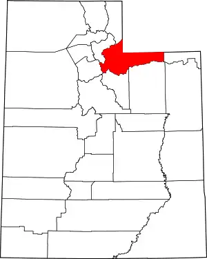 Map of Utah highlighting Summit County | |
| Towns | ||
| CDPs | ||
| Unincorporated communities | ||
| Ghost towns | ||
| Footnotes | ‡This populated place also has portions in an adjacent county or counties | |