Felton, Queensland
Felton is a rural locality in the Toowoomba Region, Queensland, Australia.[2] In the 2016 census, Felton had a population of 276 people.[1]
| Felton Queensland | |||||||||||||||
|---|---|---|---|---|---|---|---|---|---|---|---|---|---|---|---|
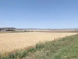 Farms along Southbrook Road, 2014 | |||||||||||||||
 Felton | |||||||||||||||
| Coordinates | 27.7491°S 151.7372°E | ||||||||||||||
| Population | 276 (2016 census)[1] | ||||||||||||||
| • Density | 1.596/km2 (4.134/sq mi) | ||||||||||||||
| Postcode(s) | 4358 | ||||||||||||||
| Area | 172.9 km2 (66.8 sq mi) | ||||||||||||||
| Time zone | AEST (UTC+10:00) | ||||||||||||||
| Location | |||||||||||||||
| LGA(s) | Toowoomba Region | ||||||||||||||
| State electorate(s) | Condamine | ||||||||||||||
| Federal division(s) | |||||||||||||||
| |||||||||||||||
Geography
Hodgson Creek flows across the area and forms part of the southwest boundary.[3]
Felton East is a neighbourhood (27.8°S 151.7666°E).[4]
Felton has the following mountains:
- Mount Perkins, named after local politician Patrick Perkins (27.7819°S 151.8141°E) 580 metres (1,900 ft)[5][6]
- Mount Rolleston, named after Christopher Rolleston, Commissioner of Crown Lands for the Darling Downs (27.7983°S 151.7178°E) 604 metres (1,982 ft)[5][7]
History
The name Felton is taken from a pastoral run, which was named by pastoralist Charles Mallard, after his birthplace in England.[2]
In 1877, 7,800 acres (3,200 ha) were resumed from the Felton pastoral run and offered for selection on 17 April 1877.[8]
Mount Kent State School opened on 14 May 1883 and closed on 1959.[9] It was on Ted Mengel Road (27.8446°S 151.8292°E).[10][11]
Nunkulla State School opened in 1912 and closed in 1959.[9] It was at 34 Nunkulla Road (27.77930°S 151.78772°E).[10][11]
East Felton State School opened in October 1921 and closed in 1967.[9] It was at 2981 Toowoomba Karara Road (27.81674°S 151.75785°E).[10][11]
Felton Hall was built in 1931. In 2015 a new hall was built by relocating a building from St Anthony's Catholic School in Harristown, Toowoomba.[12]
In the 2016 census, Felton had a population of 276 people.[1]
Education
There are no schools in Felton. The nearest government primary schools are:
- Pittsworth State School in Pittsworth to the north-west
- Southbrook Central State School in neighbouring Southbrook to the north
- Cambooya State School in neighbouring Cambooya to the north
- Greenmount State School in neighbouring Greenmount to the north-east
- Nobby State School in neighbouring Nobby to the east
- Back Plains State School in neighbouring Back Plains to the south
The nearest government secondary schools are:
- Pittsworth State High School in Pittsworth to the north-west
- Clifton State High School in Clifton to the south-east
Amenities
Felton Hall is at 2775 Toowoomba Karara Road (27.8018°S 151.7713°E).[12][13]
References
- Australian Bureau of Statistics (27 June 2017). "Felton (SSC)". 2016 Census QuickStats. Retrieved 20 October 2018.
- "Felton – locality in Toowoomba Region (entry 49261)". Queensland Place Names. Queensland Government. Retrieved 21 July 2021.
- "Queensland Globe". State of Queensland. Retrieved 30 November 2022.
- "Felton East – locality unbounded in Toowoomba Regional (entry 12266)". Queensland Place Names. Queensland Government. Retrieved 21 July 2021.
- "Mountain peaks and capes - Queensland". Queensland Open Data. Queensland Government. 12 November 2020. Archived from the original on 25 November 2020. Retrieved 25 November 2020.
- "Mount Perkins – mountain in Toowoomba Region (entry 26461)". Queensland Place Names. Queensland Government. Retrieved 25 November 2020.
- "Mount Rolleston – mountain in Toowoomba Region (entry 28953)". Queensland Place Names. Queensland Government. Retrieved 25 November 2020.
- "Proclamations under the New Land Acts". The Brisbane Courier. Queensland, Australia. 2 March 1877. p. 3. Archived from the original on 27 August 2020. Retrieved 19 February 2020 – via Trove.
- Queensland Family History Society (2010), Queensland schools past and present (Version 1.01 ed.), Queensland Family History Society, ISBN 978-1-921171-26-0
- "Parish of Hodgson County of Aubigny" (Map). Queensland Government. 1930. Archived from the original on 30 November 2022. Retrieved 6 September 2023.
- "Queensland Globe". State of Queensland. Retrieved 6 September 2023.
- "Felton Hall - Community Halls - Toowoomba Region". Community Directory. Archived from the original on 14 December 2021. Retrieved 14 December 2021.
- "Felton Hall". Festival of Small Halls. Archived from the original on 14 December 2021. Retrieved 14 December 2021.
External links
![]() Media related to Felton, Queensland at Wikimedia Commons
Media related to Felton, Queensland at Wikimedia Commons