Echo, Utah
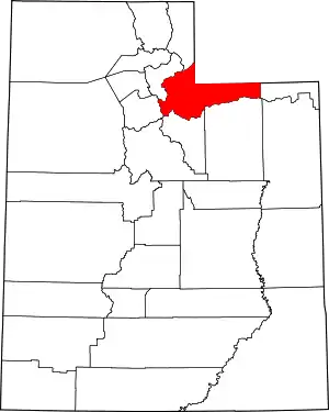
Echo is a census-designated place located in northwestern Summit County, Utah, United States. The population was 56 at the 2010 census.
Echo | |
|---|---|
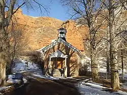
 The Old Echo Church | |
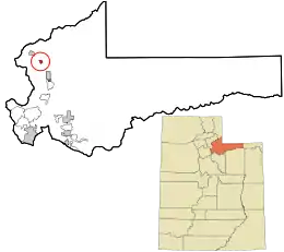
 Location in Summit County and the state of Utah | |
| Coordinates: 40.976966°N 111.443092°W | |
| Country | United States |
| State | Utah |
| County | Summit |
| Settled | 1854 |
| Founded by | James Bromley |
| Named for | Echo Canyon |
| Elevation | 5,777 ft (1,761 m) |
| Population | |
| • Total | 56 |
| Time zone | UTC-7 (Mountain (MST)) |
| • Summer (DST) | UTC-6 (MDT) |
| ZIP code | 84024 |
| Area code | 435 |
| GNIS feature ID | 2584763[1] |
Echo was founded in 1854.[3] The community took its name from nearby Echo Canyon.[4]
History
Echo originated as a stopover along the Mormon trail. Later the town served as a junction between the First transcontinental railroad and a spur line to serve silver mines near Park City. Since the creation of U.S. Highways Echo has served as a highway junction, where the main road coming from Wyoming splits with one branch proceeding towards Salt Lake City, continuing towards San Francisco, California, and the other towards Ogden, continuing to Portland, Oregon. Originally the main highway was numbered U.S. Route 30S and the branch was U.S. Route 530; the modern freeway equivalents are numbered Interstate 80 and Interstate 84.
.jpg.webp)
Echo was significant to the Union Pacific Railroad. The town served as a coaling and watering station for trains entering Echo Canyon. From Echo, helper locomotives were added, when needed, to push trains up the steep grade to Wahsatch. A large coaling tower and many other railroad infrastructures existed in and around the town. Echo saw the most action during World War II.
The introduction of diesel power, especially after the war, negated the need for the services previously required by steam. The coaling tower, most trackage, and structures were removed.
Echo had faded by the sixties, yet was still alive by the junction of two major highways. However, the arrival of the interstate relegated the town to a few quaint buildings; some homes, a motel, restaurant and bus station. A tavern sells cigarettes, food, and beer. Nearby; Echo Canyon is a magnificent spectacle with its high rock sides and colorful scenery. The canyon begins just east of Echo and ends outside of Wahsatch, Utah.
Demographics
As of the census[2] of 2010, there were 56 people living in the CDP. There were 31 housing units. The racial makeup of the town was 96.4% White and 3.6% American Indian and Alaska Native. Hispanic or Latino of any race were 19.6% of the population.
Education
It is in the North Summit School District.[5]
Climate
Echo has a continental climate (Köppen Dfb) characterized by cold, snowy winters and hot summers with high diurnal temperature variation.
| Climate data for Echo Dam, Utah, 1991–2020 normals, extremes 1940–present | |||||||||||||
|---|---|---|---|---|---|---|---|---|---|---|---|---|---|
| Month | Jan | Feb | Mar | Apr | May | Jun | Jul | Aug | Sep | Oct | Nov | Dec | Year |
| Record high °F (°C) | 59 (15) |
67 (19) |
76 (24) |
85 (29) |
91 (33) |
101 (38) |
100 (38) |
100 (38) |
99 (37) |
86 (30) |
75 (24) |
65 (18) |
101 (38) |
| Mean maximum °F (°C) | 48.5 (9.2) |
53.8 (12.1) |
66.0 (18.9) |
74.4 (23.6) |
82.3 (27.9) |
90.7 (32.6) |
95.4 (35.2) |
93.9 (34.4) |
88.3 (31.3) |
78.9 (26.1) |
65.0 (18.3) |
50.9 (10.5) |
96.0 (35.6) |
| Average high °F (°C) | 35.1 (1.7) |
40.6 (4.8) |
51.9 (11.1) |
59.4 (15.2) |
69.1 (20.6) |
80.3 (26.8) |
88.9 (31.6) |
87.2 (30.7) |
78.3 (25.7) |
64.5 (18.1) |
48.4 (9.1) |
35.6 (2.0) |
61.6 (16.4) |
| Daily mean °F (°C) | 23.7 (−4.6) |
28.3 (−2.1) |
38.3 (3.5) |
45.1 (7.3) |
53.5 (11.9) |
62.0 (16.7) |
69.9 (21.1) |
68.3 (20.2) |
59.5 (15.3) |
47.7 (8.7) |
35.3 (1.8) |
24.9 (−3.9) |
46.4 (8.0) |
| Average low °F (°C) | 12.2 (−11.0) |
16.0 (−8.9) |
24.8 (−4.0) |
30.7 (−0.7) |
37.8 (3.2) |
43.8 (6.6) |
50.8 (10.4) |
49.4 (9.7) |
40.8 (4.9) |
30.9 (−0.6) |
22.3 (−5.4) |
14.2 (−9.9) |
31.1 (−0.5) |
| Mean minimum °F (°C) | −10.1 (−23.4) |
−7.0 (−21.7) |
7.2 (−13.8) |
17.2 (−8.2) |
24.8 (−4.0) |
32.0 (0.0) |
40.8 (4.9) |
38.6 (3.7) |
27.5 (−2.5) |
16.4 (−8.7) |
2.9 (−16.2) |
−7.1 (−21.7) |
−14.3 (−25.7) |
| Record low °F (°C) | −34 (−37) |
−34 (−37) |
−25 (−32) |
2 (−17) |
16 (−9) |
22 (−6) |
30 (−1) |
23 (−5) |
14 (−10) |
−7 (−22) |
−21 (−29) |
−32 (−36) |
−34 (−37) |
| Average precipitation inches (mm) | 1.22 (31) |
0.94 (24) |
1.19 (30) |
1.47 (37) |
1.93 (49) |
1.18 (30) |
0.71 (18) |
0.83 (21) |
1.22 (31) |
1.43 (36) |
1.32 (34) |
1.29 (33) |
14.73 (374) |
| Average snowfall inches (cm) | 17.3 (44) |
12.0 (30) |
8.2 (21) |
4.9 (12) |
0.7 (1.8) |
0.0 (0.0) |
0.0 (0.0) |
0.0 (0.0) |
0.5 (1.3) |
2.0 (5.1) |
10.3 (26) |
16.4 (42) |
72.3 (184) |
| Average precipitation days (≥ 0.01 in) | 9.8 | 9.0 | 9.3 | 9.6 | 9.9 | 6.1 | 4.4 | 5.8 | 5.9 | 7.3 | 8.4 | 9.9 | 95.4 |
| Average snowy days (≥ 0.1 in) | 7.3 | 6.1 | 3.5 | 2.4 | 0.4 | 0.0 | 0.0 | 0.0 | 0.1 | 0.9 | 4.3 | 7.0 | 32.0 |
| Source: NOAA[6][7] | |||||||||||||
In popular culture
The psychological horror visual novels Echo, The Smoke Room, and Arches are loosely based on Echo and the surrounding area.[8]
See also
References
- U.S. Geological Survey Geographic Names Information System: Echo, Utah. Retrieved May 18, 2011.
- "U.S. Census website". United States Census Bureau. Retrieved May 18, 2011.
- "Echo Canyon Settlement". Summit County Utah. Retrieved May 19, 2019.
- The Utah Genealogical and Historical Magazine, Volumes 9-10. 1918. p. 122.
- "2020 CENSUS - SCHOOL DISTRICT REFERENCE MAP: Summit County, UT" (PDF). U.S. Census Bureau. Retrieved November 2, 2022.
- "NOWData – NOAA Online Weather Data". National Oceanic and Atmospheric Administration. Retrieved November 25, 2022.
- "Summary of Monthly Normals 1991–2020". National Oceanic and Atmospheric Administration. Retrieved December 10, 2022.
- "Echo". Echo Project. Retrieved May 24, 2023.
