Empire, Georgia
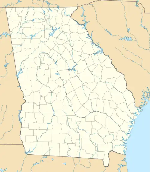
Empire is an unincorporated community and census-designated place in Dodge and Bleckley counties in the U.S. state of Georgia. As of the 2020 census, the CDP had a population of 319.
Empire, Georgia | |
|---|---|
 Empire | |
| Coordinates: 32°20′25″N 83°17′46″W | |
| Country | United States |
| State | Georgia |
| Counties | Bleckley, Dodge |
| Area | |
| • Total | 2.32 sq mi (6.00 km2) |
| • Land | 2.30 sq mi (5.96 km2) |
| • Water | 0.02 sq mi (0.04 km2) |
| Elevation | 386 ft (118 m) |
| Population (2020) | |
| • Total | 319 |
| • Density | 138.70/sq mi (53.54/km2) |
| Time zone | UTC-5 (Eastern (EST)) |
| • Summer (DST) | UTC-4 (EDT) |
| ZIP code | 31014 |
| Area code | 478 |
| FIPS code | 13-27512[2] |
| GNIS feature ID | 0313945[3] |
History
The Georgia General Assembly incorporated the place in 1911 as the "Town of Empire".[4] Founders of the community named it "Empire" in order to promote a sawmill established there.[5] The town's municipal charter was repealed in 1995.[5]
Geography
Empire is located primarily in Dodge County but extends west into Bleckley County as well. U.S. Route 23 passes through the CDP, leading north 4 miles (6 km) to Cochran, the Bleckley County seat, and south 12 miles (19 km) to Eastman, the Dodge County seat. Macon is 42 miles (68 km) to the north via US-23.
According to the United States Census Bureau, the CDP has a total area of 2.3 square miles (6.0 km2), of which 0.015 square miles (0.04 km2), or 0.72%, is water.[6]
References
- "2020 U.S. Gazetteer Files". United States Census Bureau. Retrieved December 18, 2021.
- "U.S. Census website". United States Census Bureau. Retrieved January 31, 2008.
- "US Board on Geographic Names". United States Geological Survey. October 25, 2007. Retrieved January 31, 2008.
- Acts Passed by the General Assembly of Georgia. J. Johnston. 1911. p. 1146.
- Krakow, Kenneth K. (1975). Georgia Place-Names: Their History and Origins (PDF). Macon, GA: Winship Press. p. 73. ISBN 0-915430-00-2.
- "Geographic Identifiers: 2010 Demographic Profile Data (G001): Empire CDP, Georgia". U.S. Census Bureau, American Factfinder. Archived from the original on February 12, 2020. Retrieved November 5, 2013.
- "Census of Population and Housing". Census.gov. Retrieved June 4, 2016.
Municipalities and communities of Bleckley County, Georgia, United States | ||
|---|---|---|
| Cities | 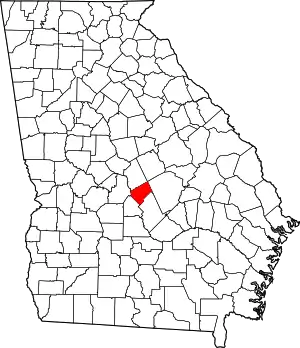 Map of Georgia highlighting Bleckley County | |
| CDP | ||
| Unincorporated communities | ||
| Footnotes | ‡This populated place also has portions in an adjacent county or counties | |
Municipalities and communities of Dodge County, Georgia, United States | ||
|---|---|---|
| City | 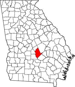 Map of Georgia highlighting Dodge County | |
| Towns | ||
| CDP | ||
| Other unincorporated communities | ||
| Footnotes | ‡This populated place also has portions in an adjacent county or counties | |