Epen
Epen (Dutch: [ˈeːpə(n)]; Limburgish: Ieëpe [ˈiəpə]) is a village in the southern part of the Dutch province of Limburg. It is a part of the municipality of Gulpen-Wittem, and lies about 15 km southwest of Kerkrade. Epen is known for its timber framed houses and is part of the sightseeing tour the Mergellandroute.
Epen
Ieëpe | |
|---|---|
Village | |
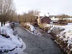
 Wingber mill, Epen | |
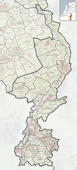
 Epen Location in the Netherlands  Epen Location in the province of Limburg in the Netherlands | |
| Coordinates: 50°47′N 5°55′E | |
| Country | |
| Province | |
| Municipality | |
| Area | |
| • Total | 7.42 km2 (2.86 sq mi) |
| Elevation | 130 m (430 ft) |
| Population (2021)[1] | |
| • Total | 1,025 |
| • Density | 140/km2 (360/sq mi) |
| Time zone | UTC+1 (CET) |
| • Summer (DST) | UTC+2 (CEST) |
| Postal code | 6285[1] |
| Dialing code | 043 |
The village was first mentioned in 1041 as "in villis ... Apine", and probably means "settlement near a river".[3] Epen developed in the Early Middle Ages.[4]
The Catholic St Paul Conversion Church is a single aisled church with a semi built-in tower with needle spire. The church was built between 1841 and 1842 and the tower was added between 1847 and 1848.[4]
Epen was home to 443 people in 1840. After World War II, it started to developed as a tourist area.[5]
Gallery
 Inn De Smidse
.jpg.webp) Het Patronaat
Het Patronaat.JPG.webp) St Paul Conversion Church
St Paul Conversion Church Hotel in Epen
References
- "Kerncijfers wijken en buurten 2021". Central Bureau of Statistics. Retrieved 24 April 2022.
- "Postcodetool for 6285AA". Actueel Hoogtebestand Nederland (in Dutch). Het Waterschapshuis. Retrieved 24 April 2022.
- "Epen - (geografische naam)". Etymologiebank (in Dutch). Retrieved 24 April 2022.
- Sabine Broekhoven, & Ronald Stenvert (2003). Epen (in Dutch). Zwolle: Waanders. ISBN 90 400 9623 6. Retrieved 24 April 2022.
- "Epen". Plaatsengids (in Dutch). Retrieved 24 April 2022.