Esenyurt
Esenyurt (Turkish: [e's̪ɛn̪juɾt]), formerly known as Ksenos, is a municipality and district of Istanbul Province, Turkey.[2] Its area is 43 km2,[3] and its population is 983,571 (2022).[1] Located in the European side of Istanbul, Esenyurt borders with Avcılar and Lake Küçükçekmece on the east, Büyükçekmece on the west, Başakşehir, Arnavutköy and TEM road on the north and Beylikdüzü and E-5 motorway on the south.
Esenyurt | |
|---|---|
District and municipality | |
 | |
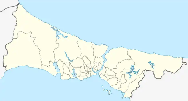
 Map showing Esenyurt District in Istanbul Province | |
 Esenyurt Location in Turkey  Esenyurt Esenyurt (Istanbul) | |
| Coordinates: 41°02′03″N 28°40′48″E | |
| Country | Turkey |
| Province | Istanbul |
| Government | |
| • Mayor | Kemal Deniz Bozkurt (CHP) |
| Area | 43 km2 (17 sq mi) |
| Population (2022)[1] | 983,571 |
| • Density | 23,000/km2 (59,000/sq mi) |
| Time zone | TRT (UTC+3) |
| Postal code | 34510 |
| Area code | 0212 |
| Website | www |
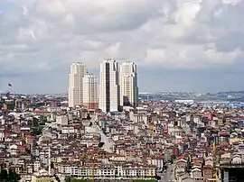
With the construction boom of large residential complexes in the area in the past few years, Esenyurt benefited from a major development. It now has four cultural centres, which are Esenyurt Cultural Centre, Saadetdere Cultural Centre, Yenikent Cultural Centre and Yunus Balta Cultural Centre. Four parks built in Esenyurt (Recep Tayyip Erdoğan Park, Şehitler Park, Gaziler Park and Kadir Topbaş Park) are also situated among the complexes.
History
The district is mainly built on the land owned by Ekrem Ömer Paşa in the 19th century. The name Esenyurt derives from one of the land owners Eşkinoz. Which in turn comes from the Greek Ksenos, meaning "foreigner".[4]
The area received migration from Romania and Bulgaria between 1920 and 1938, and had more recent migration mainly from Ardahan and Kars, as well as Erzurum and Artvin. In 1990s, Kurds evicted from their villages during the armed conflict between Turkey and the Kurdistan Workers' Party (PKK) were settled in the district.[5]
The municipality Esenyurt was established in 1989. In 2008 the district Esenyurt was created from part of the district Büyükçekmece.[6][7]
Esenyurt today
Esenyurt is a popular residential area due to the brand new properties and affordable property prices compared with Istanbul centre. Esenyurt is home to the Istanbul Esenyurt University, while being very close to Beykent University, Istanbul Arel University, Istanbul University and Istanbul Gelişim University. TUYAP Exhibition and Conference Centre is only 5km away from Esenyurt centre, while it is 26km away from the Istanbul Atatürk Airport. Shopping facilities are mainly gathered around shopping centres rather than individual shops along the streets. Esenyurt has three shopping centres, which are Eskule Shopping Centre, Torium Shopping Centre, City Center Shopping Centre and Akbatı AVM.
Composition
There are 43 neighbourhoods in Esenyurt District:[8]
- Akçaburgaz
- Akevler
- Akşemseddin
- Ardıçlı
- Aşık Veysel
- Atatürk
- Bağlarçeşme
- Balıkyolu
- Barbaros Hayrettin Paşa
- Battalgazi
- Çınar
- Cumhuriyet
- Esenkent
- Fatih
- Gökevler
- Güzelyurt
- Hürriyet
- İncirtepe
- İnönü
- İstiklal
- Koza
- Mehmet Akif Ersoy
- Mehterçeşme
- Mevlana
- Namık Kemal
- Necip Fazıl Kısakürek
- Orhan Gazi
- Örnek
- Osmangazi
- Pınar
- Piri Reis
- Saadetdere
- Şehitler
- Selahaddin Eyyubi
- Süleymaniye
- Sultaniye
- Talatpaşa
- Turgut Özal
- Üçevler
- Yenikent
- Yeşilkent
- Yunus Emre
- Zafer
Transportation
Public buses to/from Esenyurt
- 142E Esenyurt Incirtepe - Aksaray
- 142K Esenyurt Kiptaş 4. Etap- 5. Etap- Avcılar
- 142T Esenyurt Public Hospital - TUYAP Exhibition and Conference Centre
- 429 Kıraç - Yenibosna Metro
Metrobus lines to/from Esenyurt
- 34B Beylikdüzü - Avcılar
- 34BZ Beylikdüzü - Zincirlikuyu (night service)
- 34C Beylikdüzü - Cevizlibağ
- 34G Beylikdüzü - Söğütlüçeşme (night service)
Government
The mayor is Kemal Deniz Bozkurt of the center-left Republican People's Party (CHP).
Education
- Beykent University Hadımköy Campus
Sport
Süper Lig football club İstanbulspor plays their home matches at Esenyurt Necmi Kadıoğlu Stadium. [9]
Demographics
According to TURKSTAT, the population of Istanbul was 15 million 29 thousand 231 people in 2017, while the population increased by 38 thousand 493 in 2018 to 15 million 67 thousand 724 people. Istanbul's most populous districts are Esenyurt more than 891 thousand 120 people.[10]
Recreation
.jpg.webp)
In 2016, the municipality leased the Danamandıra Nature Park in Silivri district for 49 years in order to provide recreation area for the residents of the crowded district.[11]
Climate
Esenyurt experiences a relatively cool Mediterranean climate (Csa/Cs) according to both Köppen and Trewartha climate classifications, with cool winters and warm to hot summers.
Esenyurt is almost a degree colder than Bakırköy, this is despite the two districts' close proximity.[12] Nevertheless, it does conform to the general pattern of lower precipitation values, common in southern Istanbul. It is in USDA hardiness zone 9a and AHS heat zone 4.[13]
| Climate data for Esenyurt | |||||||||||||
|---|---|---|---|---|---|---|---|---|---|---|---|---|---|
| Month | Jan | Feb | Mar | Apr | May | Jun | Jul | Aug | Sep | Oct | Nov | Dec | Year |
| Average high °C (°F) | 8.3 (46.9) |
8.2 (46.8) |
10.3 (50.5) |
15.5 (59.9) |
20.6 (69.1) |
25.3 (77.5) |
27.7 (81.9) |
27.4 (81.3) |
24.1 (75.4) |
19.2 (66.6) |
14.5 (58.1) |
10.6 (51.1) |
17.6 (63.8) |
| Daily mean °C (°F) | 5.5 (41.9) |
5.3 (41.5) |
6.9 (44.4) |
11.3 (52.3) |
16.1 (61.0) |
20.5 (68.9) |
22.9 (73.2) |
22.9 (73.2) |
19.6 (67.3) |
15.4 (59.7) |
11.2 (52.2) |
7.8 (46.0) |
13.8 (56.8) |
| Average low °C (°F) | 2.7 (36.9) |
2.4 (36.3) |
3.4 (38.1) |
7.0 (44.6) |
11.5 (52.7) |
15.6 (60.1) |
18.1 (64.6) |
18.3 (64.9) |
15.1 (59.2) |
11.6 (52.9) |
7.9 (46.2) |
4.9 (40.8) |
9.9 (49.8) |
| Average precipitation mm (inches) | 90 (3.5) |
65 (2.6) |
67 (2.6) |
53 (2.1) |
33 (1.3) |
35 (1.4) |
22 (0.9) |
27 (1.1) |
43 (1.7) |
62 (2.4) |
84 (3.3) |
113 (4.4) |
694 (27.3) |
| Source: [14] | |||||||||||||
Gallery
 Haramidere Skyscrapers District
References
- "Address-based population registration system (ADNKS) results dated 31 December 2022, Favorite Reports" (XLS). TÜİK. Retrieved 12 July 2023.
- Büyükşehir İlçe Belediyesi, Turkey Civil Administration Departments Inventory. Retrieved 12 July 2023.
- "İl ve İlçe Yüz ölçümleri". General Directorate of Mapping. Retrieved 12 July 2023.
- Sevan Nişanyan. "Index Anatolicus - Nisanyan Map" (in Turkish). Retrieved 2023-03-30.
- Ahmetbeyzade, Cihan (2007-09-01). "Negotiating Silences in the So‐Called Low‐Intensity War: The Making of the Kurdish Diaspora in İstanbul". Signs: Journal of Women in Culture and Society. 33 (1): 160. doi:10.1086/518315. ISSN 0097-9740.
- Kanun No. 5747, Resmî Gazete, 22 March 2008.
- "İl İdaresi ve Mülki Bölümler Şube Müdürlüğü İstatistikleri - İl ve İlçe Kuruluş Tarihleri" (PDF) (in Turkish). p. 42. Retrieved 26 July 2023.
- Mahalle, Turkey Civil Administration Departments Inventory. Retrieved 12 July 2023.
- "İstanbulspor Necmi Kadıoğlu Stadyumu" (in Turkish). fbk. Retrieved 22 October 2021.
- "Turkey's Largest City in terms of Population: Istanbul". en.istanbul.gov.tr. Retrieved 2023-03-22.
- "Esenyurt Milli Parkı'nın İlk Konukları Anneler Oldu" [Mothers are the first guests of Esenyurt national park]. Milliyet (in Turkish). 15 May 2016. Retrieved 8 July 2020.
- "Normales et records climatologiques 1981-2010 à Istanbul / Ataturk - Infoclimat". www.infoclimat.fr. Retrieved 2021-06-01.
- "Bitki Soğuğa ve Sıcağa Dayanıklılık". www.mgm.gov.tr. Retrieved 2021-04-28.
- "Esenyurt - Weather History & Climate Data - Meteostat". meteostat.net. Retrieved 2021-06-03.
External links
- Esenyurt – the new city center with style
- Esenyurt Istanbul Archived 2017-03-24 at the Wayback Machine
- Municipality of Esenyurt (in Turkish)
