Flora, Louisiana
Flora is an unincorporated community in Natchitoches Parish, Louisiana, United States. It is located near the intersection of Louisiana highways 120 and 478, south of Natchitoches.
Flora | |
|---|---|
 Flora Location within the state of Louisiana | |
| Coordinates: 31°36′45″N 93°5′52″W | |
| Country | United States |
| State | Louisiana |
| Parish | Natchitoches |
| Elevation | 115 ft (35 m) |
| Time zone | UTC-6 (Central (CST)) |
| • Summer (DST) | UTC-5 (CDT) |
| ZIP code | 71428[2] |
| GNIS feature ID | 547366[1] |
The community is part of the Natchitoches Micropolitan Statistical Area.
References
- "Flora, Louisiana". Geographic Names Information System. United States Geological Survey, United States Department of the Interior.
- "Flora ZIP Code". zipdatamaps.com. 2022. Retrieved November 30, 2022.
Municipalities and communities of Natchitoches Parish, Louisiana, United States | ||
|---|---|---|
| City | 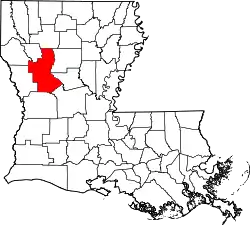 | |
| Town | ||
| Villages | ||
| CDPs | ||
| Other communities | ||
| Footnotes | ‡This populated place also has portions in an adjacent county or counties | |
This article is issued from Wikipedia. The text is licensed under Creative Commons - Attribution - Sharealike. Additional terms may apply for the media files.