Foudgum
Foudgum is a small village in Noardeast-Fryslân in the province of Friesland, Netherlands. It had a population of around 72 as of January 2017.[3] Before 2019, the village was part of the Dongeradeel municipality.[4]
Foudgum | |
|---|---|
Village | |
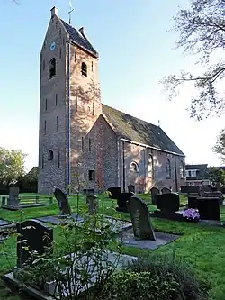
 St Mary's church | |
 Flag  Coat of arms | |
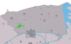
 Location in the former Dongeradeel municipality | |
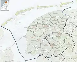
 Foudgum Location in the Netherlands  Foudgum Foudgum (Netherlands) | |
| Coordinates: 53°20′42″N 5°56′32″E | |
| Country | |
| Province | |
| Municipality | Noardeast-Fryslân |
| Area | |
| • Total | 3.39 km2 (1.31 sq mi) |
| Elevation | 0.3 m (1.0 ft) |
| Population (2021)[1] | |
| • Total | 75 |
| • Density | 22/km2 (57/sq mi) |
| Postal code | 9154[1] |
| Dialing code | 0519 |
The village was first mentioned in 944 as Fotdenheim. The etymology is unclear.[5] Foudgum is a terp (artificial living mound) village which is relatively in its original shape. There four paths leading to the church which is located on top of the mound. During the 19th century, part of the terp was excavated. The original church was demolished in the 19th century and replaced in 1808. It's currently in use a wedding location. In 1840, Foudgum was home to 112 people.[4]
Gallery
 Clergy house
 Farms around the terp
 View on Foudgum
References
- "Kerncijfers wijken en buurten 2021". Central Bureau of Statistics. Retrieved 31 March 2022.
- "Postcodetool for 9154AS". Actueel Hoogtebestand Nederland (in Dutch). Het Waterschapshuis. Retrieved 31 March 2022.
- Aantal inwoners per woonplaats in Dongeradeel op 1 januari 2017 Archived 2017-10-21 at the Wayback Machine - Dongeradeel
- "Foudgum". Plaatsengids (in Dutch). Retrieved 31 March 2022.
- "Foudgum - (geografische naam)". Etymologiebank (in Dutch). Retrieved 31 March 2022.
External links
![]() Media related to Foudgum at Wikimedia Commons
Media related to Foudgum at Wikimedia Commons
This article is issued from Wikipedia. The text is licensed under Creative Commons - Attribution - Sharealike. Additional terms may apply for the media files.