Fridaythorpe
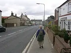
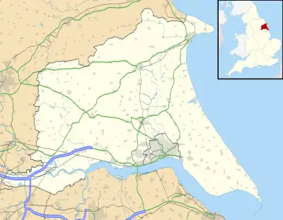
Fridaythorpe is a village and civil parish in the East Riding of Yorkshire, England. It is situated approximately 8 miles (13 km) north-east of Pocklington town centre and lies on the A166 road. It is 550 feet (170 m) above sea level, making it the highest village in the Yorkshire Wolds.

| Fridaythorpe | |
|---|---|
 Fridaythorpe | |
 Fridaythorpe Location within the East Riding of Yorkshire | |
| Population | 319 (2011 census)[1] |
| OS grid reference | SE875590 |
| • London | 170 mi (270 km) S |
| Civil parish |
|
| Unitary authority | |
| Ceremonial county | |
| Region | |
| Country | England |
| Sovereign state | United Kingdom |
| Post town | DRIFFIELD |
| Postcode district | YO25 |
| Dialling code | 01377 |
| Police | Humberside |
| Fire | Humberside |
| Ambulance | Yorkshire |
| UK Parliament | |
According to the 2011 UK census, Fridaythorpe parish had a population of 319,[1] an increase on the 2001 UK census figure of 183.[2]
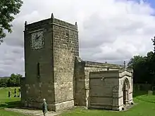
St Mary's Church, Fridaythorpe was restored in 1902–3 with the addition of a new north aisle designed by C. Hodgson Fowler and stained glass by Burlison and Grylls. In January 1967 the church was designated a Grade I listed building and is now recorded in the National Heritage List for England, maintained by Historic England.[3] It is on the Sykes Churches Trail devised by the East Yorkshire Churches Group.[4]
The Yorkshire Wolds Way National Trail, a long distance footpath passes through the village and the village is the midpoint of the trail.
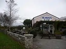
Village amenities include a Mace general shop and petrol filling station, an agricultural store, a vehicle mechanic business, and a cafe.[5]

In 1823 Fridaythorpe inhabitants numbered 275. Occupations included eleven farmers, three wheelwrights, two blacksmiths, two grocers, two shoemakers, three tailors, a tanner, and the landlords of the Cross Keys and Hare & Hounds public houses. Carriers operated between the village and Driffield every Thursday, and York every Saturday. In the village was a Methodist chapel.[6]
The village previously hosted the World Championship Flat Cap Throwing Competition at its summer fete. The championship was last contested in 2014.[7][8][9]
References
- UK Census (2011). "Local Area Report – Fridaythorpe Parish (1170211183)". Nomis. Office for National Statistics. Retrieved 18 February 2018.
- UK Census (2001). "Local Area Report – Fridaythorpe Parish (00FB054)". Nomis. Office for National Statistics. Retrieved 29 February 2020.
- Historic England. "Church of St Mary (1346479)". National Heritage List for England. Retrieved 27 June 2013.
- "Sykes Churches Trail Southern Route". Beverley, East Yorkshire: East Yorkshire Historic Churches Group.
- "Time called at Fridaythorpe's Farmers Arms". Driffield Post. Johnston Press Digital Publishing. 8 March 2008. Retrieved 15 January 2010.
- Baines, Edward (1823). History, Directory & Gazetteer of the County of York. p. 207. ISBN 1230139141.
- "World Flat Cap Throwing Championships". Driffield Times & Post. 11 July 2007. Retrieved 5 February 2013.
- "Flat cap throwing championships at Fridaythorpe". Beverley Guardian. 7 September 2014. Retrieved 1 February 2014 – via Brief Report.
- "World Championship: Flat Cap ThrowingHistory". Fridaythorpe Parish Council. Retrieved 1 February 2018.
- Gazetteer – A–Z of Towns Villages and Hamlets. East Riding of Yorkshire Council. 2006. p. 6.