Göztepe, Kadıköy
Göztepe is a neighbourhood in the municipality and district of Kadıköy, Istanbul Province, Turkey.[2] Its population is 40,858 (2022).[3] The name, literally meaning "eye hill" in English, was coined to honor Gözcü Baba ("Father Watchman"), the nickname of the watchman of a dervish lodge situated on a hill there.[4]
Göztepe | |
|---|---|
 Göztepe Location in Turkey 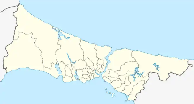 Göztepe Göztepe (Istanbul) | |
| Coordinates: 40.97694°N 29.06250°E | |
| Country | Turkey |
| Province | Istanbul |
| District | Kadıköy |
| Population (2022) | 40,858 |
| Time zone | TRT (UTC+3) |
| Postal code | 34730[1] |
| Area code | 0216 |
The neighborhood on the Asian part of Istanbul is bordered in the south by Sahilyolu (Coastline) and the Sea of Marmara, in the north by Merdivenköy, in the east by Erenköy and in the west by Çiftehavuzlar neighborhoods.
The notable high street of the Asian part of Istanbul, the Baghdad Avenue, runs through Göztepe. The city park of Göztepe is the largest green area along Baghdad Avenue covering 10,000 m2 (2.5 acres).[4]
History
The neighborhood developed in the late Ottoman times during the reign of Sultan Abdul Hamid II (1876-1909) as a residence area for high court officials. In the western part of the area, wealthy Levantines and other non-Muslims settled. Wooden mansions within lavish gardens were built in Göztepe and around. At the suburb, there were also farms and dairies, which supplied the court with their products as well.[5]
Göztepe railway station is the fourth stop from Haydarpaşa Terminal on the commuter line of Haydarpaşa-Gebze. Its opening followed the establishment of the Baghdad Railway, and contributed to further settlement in the area.[5]
In the first half of the 20th century, the area was populated as a summer resort mostly. While many of the historic wooden mansions made place for modern buildings following fires, a small number of them still exist.[5]
After the construction of the highway D.100 passing through north of Göztepe, the neighborhood grew into that direction in the meadows.[5]
Education
- Göztepe İhsan Kurşunoğlu Anadolu High School[6]
- Erenköy Girls High School
- Yeşilbahar Middle School (Closed)[7]
- Göztepe Elementary School[8]
- İlhami Ahmed Örnekal Elementary School[9]
- Fenerbahçe Anadolu High School[10]
- Kadıköy Göztepe Mesleki ve Teknik Anadolu High School[11]
- Faik Reşit Unat Middle School[12]
- Ali Haydar Ersoy Middle School[13]
- İstanbul Avni Akyol Fine Arts High School[14]
- Kadıköy Bilim ve Sanat Merkezi[15]
Places of interest
- Istanbul Toy Museum founded and run by poet and writer Sunay Akın.[4]
- Göztepe railway station
- Selamiçeşme Özgürlük Park[16]
- Göztepe Park
- Göztepe Marketplace (Göztepe Sabit Pazarı)
- Tütüncü Mehmet Efendi Mosque
- Caddebostan Synagogue[17]
- Göztepe Sports Facilities[18]
- Hilal S.K.
- Erenköy Fire station[19]
Transport
- M4 Kadıköy-Kartal (extension to Sabiha Gökçen International Airport is under construction)
References
- "Göztepe Posta Kodları" (in Turkish). Posta Kodları. Retrieved 2012-08-02.
- Mahalle, Turkey Civil Administration Departments Inventory. Retrieved 12 July 2023.
- "Address-based population registration system (ADNKS) results dated 31 December 2022, Favorite Reports" (XLS). TÜİK. Retrieved 12 July 2023.
- Biçer, Selin. "Geçmişin Modern Mimarlığı 2" (in Turkish). ODoğan. Archived from the original on 2012-10-19. Retrieved 2012-08-02.
- "Kadiköy'ün Tarihçesi" (in Turkish). Kadiköy Net. Archived from the original on 2012-10-28. Retrieved 2012-08-02.
- "Göztepe İhsan Kurşunoğlu Lisesi".
- "Gazete Kadıköy".
- "Göztepe İlkokulu".
- "İlhami Ahmed Örnekal İlkokulu".
- "Fenerbahçe Lisesi".
- "Göztepe Ticaret Meslek Lisesi".
- "Kadıköy Faik Reşit Unat Ortaokulu".
- "Çiftehavuzlar Ortaokulu".
- "İstanbul Avni Akyol Güzel Sanatlar Lisesi".
- "Alev Alatlı Bilim ve Sanat Merkezi".
- "Özgürlük Parkı".
- "Bet El Sinagogu".
- "Göztepe Spor Tesisleri".
- "Erenköy İtfaiye İstasyonu".
- "GZ1 Kadıköy-Göztepe Departure Times".
- "GZ2 Kadıköy-Göztepe Departure Times".