Kozyatağı
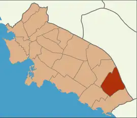
Kozyatağı is a neighbourhood in the municipality and district of Kadıköy, Istanbul Province, Turkey.[1] Its population is 37,743 (2022).[2] It is to the East of Göztepe, northwest of Bostancı, south of Ataşehir and north of the coastal neighbourhoods.
Kozyatağı | |
|---|---|
 Nidakule is one of the highest office buildings in Kozyatağı, Istanbul | |
 Location of Kozyatağı in Kadıköy | |
 Kozyatağı Location in Turkey  Kozyatağı Kozyatağı (Istanbul) | |
| Coordinates: 40.969°N 29.0865°E | |
| Country | Turkey |
| Province | Istanbul |
| District | Kadıköy |
| Population (2022) | 37,743 |
| Time zone | TRT (UTC+3) |
Transport
The M4 and the planned M8 metro lines run through Kozyatağı, along with many bus lines and minibuses. It is also easily accessible by the D-100 highway. Kozyatağı is landlocked, but ferries in Kadıköy and Bostancı can be reached easily.
Surroundings
The area consists of mainly residential apartments along with many commercial towers and plazas. High-rise buildings are not common in the Anatolian side except Kozyatağı, Ataşehir and a few more areas. There are also many parks and green areas along with a shopping mall.
References
- Mahalle, Turkey Civil Administration Departments Inventory. Retrieved 12 July 2023.
- "Address-based population registration system (ADNKS) results dated 31 December 2022, Favorite Reports" (XLS). TÜİK. Retrieved 12 July 2023.