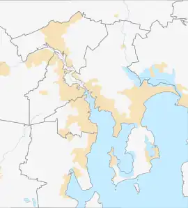
Gagebrook, Tasmania
Gagebrook is a residential locality in the local government area (LGA) of Brighton in the Hobart LGA region of Tasmania, Australia. The locality is about 9 kilometres (5.6 mi) south of the town of Brighton. The 2016 census recorded a population of 1440 for the state suburb of Gagebrook.[1] It is one of the northernmost suburbs of Hobart, located near the eastern shore of the Derwent River between the suburbs of Bridgewater and Old Beach.
| Gagebrook Hobart, Tasmania | |||||||||||||||
|---|---|---|---|---|---|---|---|---|---|---|---|---|---|---|---|
 Bridgewater (left) and Gagebrook (right) | |||||||||||||||
 Gagebrook | |||||||||||||||
| Coordinates | 42°44′40″S 147°16′01″E | ||||||||||||||
| Population | 1,440 (2016 census)[1] | ||||||||||||||
| Postcode(s) | 7030 | ||||||||||||||
| Location | 9 km (6 mi) S of Brighton | ||||||||||||||
| LGA(s) | Brighton | ||||||||||||||
| Region | Hobart | ||||||||||||||
| State electorate(s) | Lyons | ||||||||||||||
| Federal division(s) | Lyons | ||||||||||||||
| |||||||||||||||
History
Gagebrook was gazetted as a locality in 1977.[2] The suburb, like its adjacent suburb of Bridgewater (also built up of mass-public housing in the 1970s) has a reputation as a lower socio-economic area.[3][4][5] Like the rest of Hobart's public housing suburbs, many public housing stock have been sold privately.
Gagebrook has two primary schools: Herdman's Cove Primary School and Gagebrook Primary School[6] (both public).
Geography
The Jordan River forms the western and north-western boundaries.[7]
Road infrastructure
Route B32 (East Derwent Highway) passes to the south. From there, Gage Road and Tottenham Road provide access to the locality.[2][8]
References
- "2016 Census Quick Stats Gagebrook (Tas.)". quickstats.censusdata.abs.gov.au. Australian Bureau of Statistics. 23 October 2017. Retrieved 16 January 2021.
- "Placenames Tasmania – Gagebrook". Placenames Tasmania. Select "Search", enter "16959Y", click "Search", select row, map is displayed, click "Details". Retrieved 16 January 2021.
- "On the ground". Griffith Review. Retrieved 7 February 2012.
- Whelan, Jessica J (2001), The dynamics of community reputation : a case study, retrieved 9 March 2017
- Keen, Erica; Fusion Australia; Fusion Southern Tasmania (2006), Research into the community of Bridgewater & Gagebrook, Fusion Australia, retrieved 9 March 2017
- Tasmania. Parliament. Standing Committee on Public Works (1981), New Gagebrook Primary School, Bridgewater, Government Printer, ISBN 978-0-7246-1130-0
- Google (16 January 2021). "Gagebrook, Tasmania" (Map). Google Maps. Google. Retrieved 16 January 2021.
- "Tasmanian Road Route Codes" (PDF). Department of Primary Industries, Parks, Water & Environment. May 2017. Archived from the original (PDF) on 1 August 2017. Retrieved 16 January 2021.
