Gakenke District
Gakenke district is one among thirty district made of Rwanda. It's located in Northern Province of this country (Rwanda).This district has started implementing a building plan with demarcation for land usage and public facilities.[2]
Gakenke District | |
|---|---|
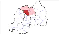 Shown within Northern Province and Rwanda | |
| Country | Rwanda |
| Province | Northern |
| Capital | Gakenke |
| Area | |
| • District | 703.9 km2 (271.8 sq mi) |
| Population (2022 census)[1] | |
| • District | 365,292 |
| • Density | 520/km2 (1,300/sq mi) |
| • Urban | 14,788 |
| • Rural | 350,504 |
Sectors
Gakenke district is divided into 19 sectors (imirenge): Busengo, Coko, Cyabingo, Gakenke, Gashenyi, Mugunga, Janja, Kamubuga, Karambo, Kivuruga, Mataba, Minazi, Muhondo, Muyongwe, Muzo, Nemba, Ruli, Rusasa and Rushashi.
References
- "Districts of Rwanda". Statoids.
- Inzego.doc — Province, District and Sector information from MINALOC, the Rwanda ministry of local government.
- Citypopulation.de Population of Gakenke District
- "Gakenke district gets new master plan". www.monpalais.com. Archived from the original on 10 July 2012. Retrieved 28 February 2012.
This article is issued from Wikipedia. The text is licensed under Creative Commons - Attribution - Sharealike. Additional terms may apply for the media files.