Gapinge
Gapinge is a village in the Dutch province of Zeeland. It is a part of the municipality of Veere, and lies about 6 km north of Middelburg.
Gapinge | |
|---|---|
Villages | |
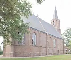
 Dutch Reformed Church | |
 Coat of arms | |
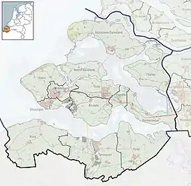
 Gapinge Location in the province of Zeeland in the Netherlands  Gapinge Gapinge (Netherlands) | |
| Coordinates: 51°32′38″N 3°37′28″E | |
| Country | Netherlands |
| Province | Zeeland |
| Municipality | Veere |
| Area | |
| • Total | 21.34 km2 (8.24 sq mi) |
| Elevation | 2.9 m (9.5 ft) |
| Population (2021)[1] | |
| • Total | 1,550 |
| • Density | 73/km2 (190/sq mi) |
| Time zone | UTC+1 (CET) |
| • Summer (DST) | UTC+2 (CEST) |
| Postal code | 4521[1] |
| Dialing code | 0115 |
History
The village was first mentioned in 1216 as Gapinge, and means "settlement near the widening of a creek".[3] Gapinge is an incomplete circular church village.[4]
The Dutch Reformed church is a single aisled church. The tower dates from the early 15th century. Between 1947 and 1949, the damage from the inundation of 1944 was repaired. The vliedberg is an artificial mound for a motte-and-bailey castle and was constructed between the 11th and 13th century.[4]
Gapinge was home to 203 people in 1840.[5] It was an independent municipality until 1857 when it was merged into Vrouwenpolder.[6] In 1966, it became part of the municipality of Veere.[5]
Gallery
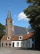
 Gapinge, Protestant church, Torenkerk
 Wind mill De Graanhalm
 Vliedberg
 Ponton bridge
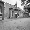
 School teacher's house
References
- "Kerncijfers wijken en buurten 2021". Central Bureau of Statistics. Retrieved 22 April 2022.
two entries
- "Postcodetool for 4521AA". Actueel Hoogtebestand Nederland (in Dutch). Het Waterschapshuis. Retrieved 22 April 2022.
- "Gapinge - (geografische naam)". Etymologiebank (in Dutch). Retrieved 22 April 2022.
- Piet van Cruyningen & Ronald Stenvert (2003). Gapinge (in Dutch). Zwolle: Waanders. ISBN 90 400 8830 6. Retrieved 22 April 2022.
- "Gapinge". Plaatsengids (in Dutch). Retrieved 22 April 2022.
- Ad van der Meer and Onno Boonstra, Repertorium van Nederlandse gemeenten, KNAW, 2011.