Gardabani Municipality
Gardabani (Georgian: გარდაბნის მუნიციპალიტეტი, Gardabnis Municiṕaliťeťi) is a municipality in Georgia's southern region Kvemo Kartli. It covers an area of 1,212.2 km2 (468 sq mi). As of 2021 it had a population of 80,329 people.[2] The city of Gardabani is its administrative centre.
Gardabani Municipality
გარდაბნის მუნიციპალიტეტი | |
|---|---|
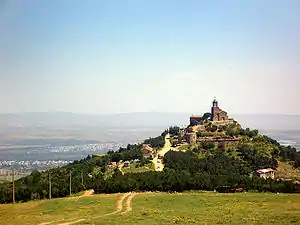 | |
 Flag  Seal | |
 | |
| Country | |
| Mkhare | Kvemo Kartli |
| Administrative centre | Gardabani |
| Government | |
| • Type | Mayor–Council |
| • Body | Gardabani Municipal Assembly |
| • Mayor | Davit Kargareteli (GD) |
| Area | |
| • Total | 1,212.2 km2 (468.0 sq mi) |
| Population (2021)[2] | |
| • Total | 80,329 |
| • Density | 66/km2 (170/sq mi) |
| Population by ethnicity[3] | |
| • Georgians | 54,2 % |
| • Azerbaijanis | 43,5 % |
| • Armenians | 0,7 % |
| • Russians | 0,5 % |
| • Assyrians | 0,3 % |
| Time zone | UTC+4 (Georgian Time) |
| Website | gardabani |
Modern History
After the annexation of the Kingdom of Kartli-Kakheti by the Russian Empire in 1801, the area of modern Gardabani administratively became part of the Tiflis Uyezd, which itself was part of the successive governates Georgia Governorate, Georgia-Imeretia Governorate and finally between 1846 and 1917 the Tiflis Governorate. Within the Tiflis Uyezd, present day Gardabani was located in the western half of the administrative uchastoks Karayaz (Караязский участок) and Sartachal (Сартачальский участок). The southern part (Karayaz) was mainly inhabited by Azerbaijanis, who at the time were referred to as Tatars like other Turkic-speaking ethnic groups.
In the 1918 elections in the Tiflis Mazra of the Democratic Republic of Georgia, Peri-Khan Sofiyeva from the village of Karajala (also known as Karajalari) was elected council member for the Karajaz district. According to historians, she was the first Muslim woman in the world to get elected through democratic elections, with universal suffrage.[4][5]
Karayaz was situated on one of the main routes of the Red Army from Azerbaijan during the Soviet invasion of Georgia in February 1921, mainly due to the Baku - Tiflis railway line through the district and the Soviet use of armored trains. The Soviets came out on top at the end of February, and annexed the fledgling republic as the Georgian SSR. The area of Gardabani initially remained in the Tiflis Okrug with the administrative reorganization of the Georgian SSR around 1930, but in 1938 the Karayaz Raion was separated from the Tiflis Okrug. The village of Karayaz(i) (Russian: Караязы; also Karatapa, Russian: Кара-тапа, Georgian: ყარატაფა, Azerbaijani: Qaratəpə) became the administrative center of the raion. Azerbaijanis were in the numerical majority in the new raion (68%).[6]
In 1947 the name of the raion and the administrative center was changed to Gardabani.[7] In 1969 the village of Gardabani received city status.[8] After the collapse of the Soviet Union and Georgia's independence, economic conditions declined in the country, but the municipality generally managed to escape the great wave of emigration of the 1990s, despite pockets of migration such as from Gardabani city. In 1995 the raion was assigned to the newly formed region (mchare) Kvemo Kartli, and was transformed into a municipality in 2006.
In 2006, the boundaries of the Tbilisi metropolitan region were significantly modified at the expense of the surrounding municipalities and in particular Gardabani, which lost roughly 92 km2 to the metropolitan region.[9][11] As for Gardabani, this mainly concerned the area on the northeast side of Tbilisi within the S9 Tbilisi Bypass, but also a large swath on the south side of Tbilisi. The municipality lost several settlements and many residents.
On August 8, 9, and 10, 2008, during the Russo-Georgian War, Russian planes bombed the Vaziani Air Force Base, located 20 kilometers east of Tbilisi in the municipality of Gardabani. Only the base was damaged and there were no casualties.[12][13][15]
Administrative divisions
Gardabani Municipality is administratively divided into 18 communities (თემი, temi) with 40 villages (სოფელი, sopeli). There is one city (ქალაქი, kalaki).[1]
Population
The population of Gardabani Municipality is 80,329 according to the 2021 estimate,[2] which is a 2% decrease from the last census of 2014. According to the 2014 census, the ethnic composition is 54.2% Georgians, 43.5% Azerbaijani. Small minority groups include Armenians (0.7%), Russians (0.5%) and Assyrians (0.3%). The population density is 66 people per square kilometer.
| Population Gardabani Municipality | ||||||||||||||||||
|---|---|---|---|---|---|---|---|---|---|---|---|---|---|---|---|---|---|---|
| 1897 | 1923 | 1939 | 1959 | 1970 | 1979 | 1989 | 2002[17] | 2014 | 2021 | |||||||||
| Gardabani Municipality | - | - | 17,770 | |||||||||||||||
| Gardabani [18] | - | 904 | - | |||||||||||||||
| Data: Population statistics Georgia 1897 to present.[19][20][6] Note:[17] | ||||||||||||||||||
Politics
Gardabani Municipal Assembly (Georgian: გარდაბნის საკრებულო) is the representative body in Gardabani Municipality, consisting of 36 members which are elected every four years. The last election was held in October 2021. Davit Kargareteli of Georgian Dream was elected as mayor.
| Party | 2017[22] | 2021[23] | Current Municipal Assembly | |||||||||||||||||||||||||||||||||||||||||||||
|---|---|---|---|---|---|---|---|---|---|---|---|---|---|---|---|---|---|---|---|---|---|---|---|---|---|---|---|---|---|---|---|---|---|---|---|---|---|---|---|---|---|---|---|---|---|---|---|---|
| Georgian Dream | 32 | 26 | ||||||||||||||||||||||||||||||||||||||||||||||
| United National Movement | 2 | 10 | ||||||||||||||||||||||||||||||||||||||||||||||
| European Georgia | 1 | |||||||||||||||||||||||||||||||||||||||||||||||
| Alliance of Patriots | 1 | |||||||||||||||||||||||||||||||||||||||||||||||
| Total | 36 | 36 | ||||||||||||||||||||||||||||||||||||||||||||||
Economy
The municipality's incomes comes from : Industry (mostly the Gardabani power plants), construction, services, agriculture and public services. The priority for the municipality is the development of agriculture and industry. The incomes of the population come mostly from agriculture and minor businesses (such as shops) and public services.
Gallery
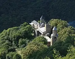
 Gardabani environs
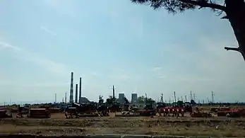 Power station Gardabani
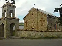 church of the virgin mary in Norio
References
- "Main Results of the 2014 Census (Publication)" (PDF). Census.ge, National Statistics Office of Georgia (Geostat) (in Georgian). 2016-04-28. pp. 323–327. Retrieved 2022-03-27.
- "Population and Demography - Population by cities and boroughs (daba), as of 1 January". National Statistics Office of Georgia, Geostat. 2021-01-01. Retrieved 2022-03-16.
- "Ethnic composition of Georgia 2014". mashke.org. Archived from the original on 2018-11-04.
- "The world's first democratically elected Muslim woman was from Georgia". Eurasianet. 2018-03-08. Retrieved 2022-03-29.
- "This is our history - Fari-Khanum Sofieva". Council of Europe - I Choose Equally. Retrieved 2022-03-29.
- "1939, Караязский район". Ethno Kavkaz (in Russian). Retrieved 2022-01-18.
- Melikishvili, Liana (2011). სოციალური უსაფრთხოების ეთნიკური ასპექტები პკოლიეთნიკურ საზობადოებაში (Ethnic Aspects of Social Security in a Polyethnic Community) (in Georgian) (1st ed.). Tbilisi: Mtsignobari Publishing House - Shota Rustaveli National Science Foundation. p. 89. ISBN 978-9941-424-18-2. Retrieved 2022-03-29.
- "Definition of "Gardabani"". Great Soviet Encyclopedia, 3rd edition 1969–1978 (in Russian). Retrieved 2022-03-29.
- "On Changing the Administrative Boundaries of Tbilisi, Gardabani Municipality and Mtskheta Municipality". Legislative Herald of Georgia (in Georgian). 2006-12-27. Retrieved 2022-03-29.
- "Results of the First National Census of Georgia in 2002, Volume II" (PDF). Census.ge, National Statistics Office of Georgia (Geostat) (in Georgian). 2003. pp. 201–203. Retrieved 2022-03-28.
- Surface area Gardabani in Census 2002: 1304.1 km²;[10] in Census 2014: 1212.2 km².[1]
- "Georgia Says Russian Jet Bombed Vaziani Base". Civil Georgia. 2008-08-08. Retrieved 2022-03-27.
- "Strategic Targets Bombed Across Georgia". Civil Georgia. 2008-08-09. Retrieved 2022-03-27.
- "Independent International fact-Finding Mission on the Conflict in Georgia Volume I-III". Max Planck Institute. 2009. Retrieved 2022-03-27.
- EU rapport, Volume II, page 216[14]
- due to the 2006 change of municipality boundary the daba Didi Lido and Kojori became part of the Tbilisi metropolitan region.
- The 2014 census found an inexplicable gap with the data from the national statistical office Geostat. UN-assisted research has found the 2002 census was inflated by about 8-9 percent. See,[21] "1. Introduction", Page 1.
- Until 1947 the city was called Karaya (Караязы).
- "Population divisions of Georgia". Population Statistics Eastern Europe and former USSR. Retrieved 2022-03-06.
- "Population cities & towns of Georgia". Population Statistics Eastern Europe and former USSR. Retrieved 2022-03-06.
- "Population Dynamics in Georgia - An Overview Based on the 2014 General Population Census Data" (PDF). National Statistics Office of Georgia, Geostat. 2017-11-29. Retrieved 2022-03-06.
- "Protocol elected municipal council members and mayors 2017" (PDF) (in Georgian). CESKO Central Election Commission. pp. 18–19. Retrieved 2022-03-03.
- "Protocol elected municipal council members and mayors 2021" (PDF) (in Georgian). CESKO Central Election Commission. pp. 23–25. Retrieved 2022-03-03.