Gemerek District
Gemerek District is a district of the Sivas Province of Turkey. Its seat is the town of Gemerek.[1] Its area is 1,131 km2,[2] and its population is 21,276 (2022).[3]
Gemerek District | |
|---|---|
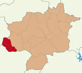 Map showing Gemerek District in Sivas Province | |
 Gemerek District Location in Turkey 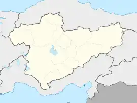 Gemerek District Gemerek District (Turkey Central Anatolia) | |
| Coordinates: 39°11′N 36°04′E | |
| Country | Turkey |
| Province | Sivas |
| Seat | Gemerek |
| Government | |
| • Kaymakam | Muhammed Taha Büyükserin |
| Area | 1,131 km2 (437 sq mi) |
| Population (2022) | 21,276 |
| • Density | 19/km2 (49/sq mi) |
| Time zone | TRT (UTC+3) |
| Website | www |
Composition
There are three municipalities in Gemerek District:[1][4]
There are 34 villages in Gemerek District:[5]
- Akçaşar
- Baştepe
- Bulhasan
- Burhanköy
- Çatköy
- Cesurlar
- Çiçekoğlu
- Dendil
- Durgunsu
- Eğerci
- Ekizce
- Eşikli
- Eskiçubuk
- Eskiyurt
- Hacıyusuf
- İnkışla
- Karaağıl
- Karaerkek
- Karagöl
- Kartalkaya
- Keklicek
- Kocaoğlu
- Köseli
- Küçüktuzhisar
- Kümeören
- Örenyurt
- Osmanuşağı
- Öziçi
- Seydinali
- Talazoğlu
- Tatlıpınar
- Tekmen
- Yeniköy
- Yeşilöz
References
- İlçe Belediyesi, Turkey Civil Administration Departments Inventory. Retrieved 22 May 2023.
- "İl ve İlçe Yüz ölçümleri". General Directorate of Mapping. Retrieved 22 May 2023.
- "Address-based population registration system (ADNKS) results dated 31 December 2022, Favorite Reports" (XLS). TÜİK. Retrieved 22 May 2023.
- Belde Belediyesi, Turkey Civil Administration Departments Inventory. Retrieved 22 May 2023.
- Köy, Turkey Civil Administration Departments Inventory. Retrieved 22 May 2023.
Gemerek District in Sivas Province of Turkey | |||||||||||||||||||||||||||
|---|---|---|---|---|---|---|---|---|---|---|---|---|---|---|---|---|---|---|---|---|---|---|---|---|---|---|---|
| Districts |  Districts of Sivas | ||||||||||||||||||||||||||
| |||||||||||||||||||||||||||
Metropolitan municipalities are bolded. | |||||||||||||||||||||||||||
| Municipalities | |
|---|---|
| Villages |
|
This article is issued from Wikipedia. The text is licensed under Creative Commons - Attribution - Sharealike. Additional terms may apply for the media files.