Geneva, Georgia
Geneva is a town in Talbot County, Georgia, United States. The population was 114 at the 2000 census.
Geneva, Georgia | |
|---|---|
 Geneva, Georgia (2012) | |
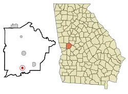 Location in Talbot County and the state of Georgia | |
| Coordinates: 32°34′46″N 84°33′2″W | |
| Country | United States |
| State | Georgia |
| County | Talbot |
| Area | |
| • Total | 0.79 sq mi (2.04 km2) |
| • Land | 0.79 sq mi (2.04 km2) |
| • Water | 0.00 sq mi (0.00 km2) |
| Elevation | 584 ft (178 m) |
| Population (2020) | |
| • Total | 75 |
| • Density | 95.30/sq mi (36.80/km2) |
| Time zone | UTC-5 (Eastern (EST)) |
| • Summer (DST) | UTC-4 (EDT) |
| ZIP code | 31810 |
| Area code | 706 |
| FIPS code | 13-32412[2] |
| GNIS feature ID | 0355991[3] |
History
The Georgia General Assembly incorporated the Town of Geneva in 1870.[4] The community's name is a transfer from Geneva, in Switzerland.[5]
Geography
Geneva is located at 32°34′46″N 84°33′2″W (32.579438, -84.550485).[6]
The town is located in the southern portion of the county along U.S. Route 80, which leads north 8 mi (13 km) to Talbotton, the county seat, and west 33 mi (53 km) to Columbus. The newly constructed Fall Line Freeway also runs through the town as well, leading east 6 mi (10 km) to Junction City, concurrent with Georgia State Route 96, which begins in the town. Georgia State Route 41 also runs through the town, following U.S. Route 80 to Talbotton and leading south 20 mi (32 km) to Buena Vista.
According to the United States Census Bureau, the town has a total area of 0.8 square miles (2.1 km2), all land.
Demographics
| Census | Pop. | Note | %± |
|---|---|---|---|
| 1880 | 254 | — | |
| 1900 | 264 | — | |
| 1910 | 210 | −20.5% | |
| 1920 | 210 | 0.0% | |
| 1930 | 179 | −14.8% | |
| 1940 | 203 | 13.4% | |
| 1950 | 209 | 3.0% | |
| 1960 | 262 | 25.4% | |
| 1970 | 250 | −4.6% | |
| 1980 | 232 | −7.2% | |
| 1990 | 182 | −21.6% | |
| 2000 | 114 | −37.4% | |
| 2010 | 105 | −7.9% | |
| 2020 | 75 | −28.6% | |
| U.S. Decennial Census[7] | |||
2020 census
| Race / Ethnicity | Pop 2010[8] | Pop 2020[9] | % 2010 | % 2020 |
|---|---|---|---|---|
| White alone (NH) | 32 | 28 | 30.48% | 37.33% |
| Black or African American alone (NH) | 72 | 39 | 68.57% | 52.00% |
| Native American or Alaska Native alone (NH) | 1 | 0 | 0.85% | 0.00% |
| Asian alone (NH) | 0 | 0 | 0.00% | 0.00% |
| Pacific Islander alone (NH) | 0 | 0 | 0.00% | 0.00% |
| Some Other Race alone (NH) | 0 | 0 | 0.00% | 0.00% |
| Mixed Race/Multi-Racial (NH) | 0 | 2 | 0.00% | 2.67% |
| Hispanic or Latino (any race) | 0 | 6 | 0.00% | 8.00% |
| Total | 105 | 75 | 100.00% | 100.00% |
As of the census[2] of 2000, there were 114 people, 52 households, and 34 families residing in the town. The population density was 144.9 inhabitants per square mile (55.9/km2). There were 59 housing units at an average density of 75.0 per square mile (29.0/km2). The racial makeup of the town was 45.61% White, 52.63% African American, and 1.75% from two or more races.
There were 52 households, out of which 23.1% had children under the age of 18 living with them, 50.0% were married couples living together, 7.7% had a female householder with no husband present, and 34.6% were non-families. 28.8% of all households were made up of individuals, and 13.5% had someone living alone who was 65 years of age or older. The average household size was 2.19 and the average family size was 2.74.
In the town, the population was spread out, with 16.7% under the age of 18, 7.0% from 18 to 24, 29.8% from 25 to 44, 31.6% from 45 to 64, and 14.9% who were 65 years of age or older. The median age was 44 years. For every 100 females, there were 103.6 males. For every 100 females age 18 and over, there were 106.5 males.
The median income for a household in the town was $18,750, and the median income for a family was $27,750. Males had a median income of $13,750 versus $18,125 for females. The per capita income for the town was $14,839. There were no families and 14.9% of the population living below the poverty line, including no under eighteens and 15.0% of those over 64.
References
- "2020 U.S. Gazetteer Files". United States Census Bureau. Retrieved December 18, 2021.
- "U.S. Census website". United States Census Bureau. Retrieved January 31, 2008.
- "US Board on Geographic Names". United States Geological Survey. October 25, 2007. Retrieved January 31, 2008.
- Acts and Resolutions of the General Assembly of the State of Georgia. Clark & Hines, State Printers. 1870. p. 191.
- Krakow, Kenneth K. (1975). Georgia Place-Names: Their History and Origins (PDF). Macon, GA: Winship Press. p. 92. ISBN 0-915430-00-2.
- "US Gazetteer files: 2010, 2000, and 1990". United States Census Bureau. February 12, 2011. Retrieved April 23, 2011.
- "Census of Population and Housing". Census.gov. Retrieved June 4, 2015.
- "P2 HISPANIC OR LATINO, AND NOT HISPANIC OR LATINO BY RACE – 2010: DEC Redistricting Data (PL 94-171) – Geneva town, Georgia". United States Census Bureau.
- "P2 HISPANIC OR LATINO, AND NOT HISPANIC OR LATINO BY RACE - 2020: DEC Redistricting Data (PL 94-171) - Geneva town, Georgia". United States Census Bureau.
Municipalities and communities of Talbot County, Georgia, United States | ||
|---|---|---|
| Cities | 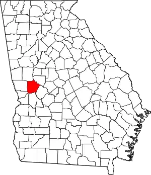 Map of Georgia highlighting Talbot County | |
| Towns | ||
| CDP | ||
| Other unincorporated communities | ||
| Footnotes | ‡This populated place also has portions in an adjacent county or counties | |