Gezawa
Gezawa is a Local Government Area in Kano State, Nigeria. Gezawa Local Government Area administrative headquarters is in the town of Gezawa with its area council made up of Jogana, Gawo, Zango, Tumbau, Wangara, Sarain-Gezawa, Babawa, Ketatwa and Tsamiya-Dabba. It has an area of 340 km2 and a population of 282,069 at the 2006 census.
Gezawa | |
|---|---|
LGA and town | |
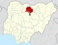
 Gezawa Location in Nigeria | |
| Coordinates: 12.1°N 8.7°E | |
| Country | |
| State | Kano State |
| Area | |
| • Total | 340 km2 (130 sq mi) |
| Population (2006 census) | |
| • Total | 282,069 |
| Time zone | UTC+1 (WAT) |
| 3-digit postal code prefix | 702 |
| ISO 3166 code | NG.KN.GE |

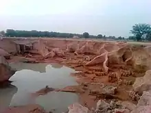
Traditional mudbrick making in Gezawa village.
The Gezawa government councils heads the public administrations in Gezawa government area which is made up of eleven wards represented by eleven councilors inclusive of the chairman who heads the executive arm of the local government.[1]
The postal code of the area is 702.[2]
References
- "Gezawa Local Government Area". www.finelib.com. Retrieved 2023-06-22.
- "Post Offices- with map of LGA". NIPOST. Archived from the original on 2012-11-26. Retrieved 2009-10-20.
This article is issued from Wikipedia. The text is licensed under Creative Commons - Attribution - Sharealike. Additional terms may apply for the media files.
