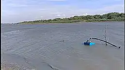
Ghodasgaon, Jalgaon
Ghodasgaon is a village in Muktainagar taluka of Jalgaon district in Maharashtra. It is located near the Purna River in Muktainagar.[1][2]
Ghodasgaon | |
|---|---|
Village | |
 Ghodasgaon Map showing Ghodasgaon in Maharashtra  Ghodasgaon Ghodasgaon (India) .svg.png.webp) Ghodasgaon Ghodasgaon (Earth) | |
| Coordinates: 21°01′22″N 76°08′55″E | |
| Country | India |
| State | Maharashtra |
| District | Jalgaon |
| Taluka | Muktainagar |
| Founded by | Government of Maharashtra |
| Seat | Grampanchayat |
| Ward (electoral subdivision) | Six |
| Government | |
| • Sarpanch | Pratibha P. Kolhe |
| Area | |
| • Total | 2,226 ha (5,501 acres) |
| [1] | |
| Dimensions | |
| • Length | 0.955 km (0.593 mi) |
| • Width | 0.879 km (0.546 mi) |
| Elevation | 245 m (804 ft) |
| Lowest elevation (Shop's street) | 234 m (768 ft) |
| Population (2011)[1] | |
| • Total | 3,287 |
| Time zone | UTC+5:30 (IST) |
| Postal Index Number | 425306 |
| Telephone code | 02583 |
| Vehicle registration | MH 19 |
History
Ghodasgaon was part of Khandesh district until 1906 when the district was split to form two new districts: East Khandesh and West Khandesh. From the second half of the 19th century to 1954 the village was in Bombay Presidency. Ghodasgaon became part of East Khandesh district kn 1906. East Khandesh district was renamed to the current name Jalgaon district on 10 October 1960.[1][3][4][5]
In 1954, Ghodasgaon became part of the East Khandesh district and was part of Edlabad.[6][7][8] A 1911 British survey of mammals near Ghodasgaon found a prevalence of wild pigs and monkeys.[9] In 1956, Ghodasgaon became part of the newly formed Bombay State.[10] More, recently, Edlabad was renamed to Muktainagar.[5][3][11][12]
The village was previously situated on the banks of Purna River at 21°02′39″N 76°08′01″E, but was relocated to the current site by the district government to avoid persistent flooding during the rainy season. In the early 1990s the local government started to make roads for the new village.[13]
Geography


Purna river flows to the north of Ghodasgaon. Muktainagar is 10 kilometres (6.2 mi) from the village, it is headquarter of Muktainagar taluka. Ghodasgaon is situated near National Highway 53, and is located near to the villages of Taroda, Ruikheda, Pimpri Akaraut, Dolarkheda, and Dui. The nearest airports are Aurangabad Airport and Jalgaon Airport, while the closest railway station is Bhusaval Junction railway station. The Satpura Range is around 5 kilometres (3.1 mi) away from the village.[14] Ghodasgaon has two Aanganwadi centers and Marathi primary schools and one high school, but does not have any colleges, with the nearest being in Muktainagar. One agriculture credit society is also available there. The village has asphalt roads, and is well-connected to the Indian National Highway system. Ghodasgaon has 46 hectares (110 acres) of land under non-agriculture uses, 280 hectares (690 acres) of forest, 27 hectares (67 acres) of irrigated land and 1,425 hectares (3,520 acres) of unirrigated land. The most important industrial produce of the village is sugar. The nearest hospital is 10 kilometres (6.2 mi) away from Ghodasgaon.[1]
Population
As of the 2011 Indian census, Ghodasgaon had 3,287 people, of which 1,697 were male and 1,590 were female. The village had 757 households. The population in children under the age of seven was 406, with 226 being male and 180 being female.[12] 2,321 people were literate.[15]
| Year | Population | Citation |
|---|---|---|
| 1951 | 1495 | [3] |
| 1961 | 2158 | [3] |
| 1971 | 2255 | [5] |
| 1981 | 2114 | [4] |
| 1991 | 2508 | [4] |
| 2001 | 2934 | [10] |
| 2011 | 3,287 | [12] |
References
- District census handbook Jalgaon (PDF). Mumbai: Directorate of census operations Maharashtra. 2014. Retrieved 5 September 2023.
- "Ghodasgaon, Muktainagar Village information Soki.In". soki.in. Retrieved 7 March 2021.
- District census handbook Jalgaon (Year 1961) (PDF). Bombay: The Maharashtra census office Bombay. 1966. p. 51.
- District Census Handbook, Jalgaon. 1981. Retrieved 13 March 2021.
- District census handbook Jalgaon (PDF). Bombay: The Maharashtra census office Bombay. 1973. p. 5.
- Reed, Sir Stanley (1954). The Times of India Directory and Year Book Including Who's Who. Times of India Press. p. 801.
- Assembly, Maharashtra (India) Legislature Legislative (1963). Debates; Official Report.
- Campbell, James M. (December 1880). "Gazetteer of the Bombay Presidency: Khandesh, Volume XII". Gazetteer of Bombay Presidency. 12: 1 – via Google books.
- Journal of the Bombay Natural History Society. Bombay Natural History Society. 1911.
- "District Census Handbook, Jalgaon, Part A, Part-XII-A & B, Series-28" (PDF). 2011.
- District census handbook Jalgaon (PDF). Mumbai: Directorate of census operations Maharashtra. 1992.
- Singh Deol, Ranjit (31 May 2014). "Census of India 2011". District Census Handbook Jalgaon of 2011. XII–B: 178 – via CenusIndia.gov.in.
- "नकली हि-यांचे गाव, त्याचे नाव घोडसगाव". Lokmat (in Marathi). मुक्ताईनगर. 6 April 2017. Retrieved 13 March 2021.
- "Ghodasgaon, Muktainagar Village information | Soki.In". soki.in. Retrieved 3 March 2021.
- Singh Deol, Ranjit (31 May 2014). "District census handbook Jalgaon" (PDF). XII–B: 179 – via censusindia.gov.in.
{{cite journal}}: Cite journal requires|journal=(help)CS1 maint: date and year (link)