Gladstone, New Mexico
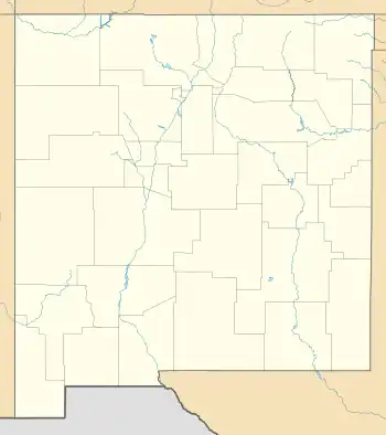
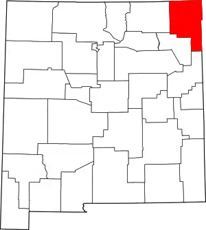
Gladstone is an unincorporated layover in Union County, New Mexico, United States, founded in 1880.[1] It lies at the intersection of US Route 56 and Union County Road C001. The post office, which opened in 1888, closed in 2010, leaving only a general store with gas service, and two houses, located there. The rest of the community has reverted to private ranch land.
Gladstone | |
|---|---|
 Gladstone Location within the state of New Mexico  Gladstone Gladstone (the United States) | |
| Coordinates: 36°18′16″N 103°58′23″W | |
| Country | United States |
| State | New Mexico |
| County | Union |
| Elevation | 5,882 ft (1,793 m) |
| Time zone | UTC-7 (Mountain (MST)) |
| • Summer (DST) | UTC-6 (MDT) |
| ZIP codes | 88422 |
| Area code | 575 |
| GNIS feature ID | 898549 |
History
Gladstone was founded in 1880 by William H. Harris, an Englishman, who hoped to set up a Utopian religious community called "Gladstone Colony".[2] He named it in honor of William Ewart Gladstone, a Liberal politician and the British Prime Minister at the time. A fair number of settlers came to Gladstone, but many left disillusioned shortly thereafter.[1]
Climate
According to the Köppen Climate Classification system, Gladstone has a semi-arid climate, abbreviated "BSk" on climate maps. The hottest temperature recorded in Gladstone was 104 °F (40.0 °C) on June 29, 1957, while the coldest temperature recorded was −26 °F (−32.2 °C) on January 13, 1963.[3]
| Climate data for Pasamonte, New Mexico, 1991–2020 normals, extremes 1925–present | |||||||||||||
|---|---|---|---|---|---|---|---|---|---|---|---|---|---|
| Month | Jan | Feb | Mar | Apr | May | Jun | Jul | Aug | Sep | Oct | Nov | Dec | Year |
| Record high °F (°C) | 77 (25) |
80 (27) |
83 (28) |
90 (32) |
97 (36) |
104 (40) |
103 (39) |
101 (38) |
99 (37) |
89 (32) |
84 (29) |
78 (26) |
104 (40) |
| Mean maximum °F (°C) | 67.2 (19.6) |
69.0 (20.6) |
77.0 (25.0) |
80.9 (27.2) |
88.3 (31.3) |
95.5 (35.3) |
96.7 (35.9) |
93.7 (34.3) |
90.5 (32.5) |
84.2 (29.0) |
75.1 (23.9) |
67.9 (19.9) |
98.2 (36.8) |
| Average high °F (°C) | 47.0 (8.3) |
50.0 (10.0) |
57.7 (14.3) |
65.1 (18.4) |
74.0 (23.3) |
84.0 (28.9) |
87.4 (30.8) |
87.6 (30.9) |
78.3 (25.7) |
67.5 (19.7) |
55.8 (13.2) |
46.7 (8.2) |
66.8 (19.3) |
| Daily mean °F (°C) | 31.9 (−0.1) |
34.2 (1.2) |
41.8 (5.4) |
48.5 (9.2) |
58.2 (14.6) |
67.9 (19.9) |
71.9 (22.2) |
70.0 (21.1) |
63.1 (17.3) |
51.6 (10.9) |
40.0 (4.4) |
31.9 (−0.1) |
50.9 (10.5) |
| Average low °F (°C) | 16.9 (−8.4) |
18.5 (−7.5) |
25.3 (−3.7) |
32.0 (0.0) |
42.4 (5.8) |
51.8 (11.0) |
56.4 (13.6) |
55.5 (13.1) |
48.0 (8.9) |
35.7 (2.1) |
24.1 (−4.4) |
17.0 (−8.3) |
35.3 (1.9) |
| Mean minimum °F (°C) | 2.4 (−16.4) |
3.2 (−16.0) |
9.9 (−12.3) |
19.1 (−7.2) |
30.0 (−1.1) |
42.8 (6.0) |
50.8 (10.4) |
49.6 (9.8) |
35.8 (2.1) |
19.8 (−6.8) |
9.4 (−12.6) |
1.1 (−17.2) |
−3.5 (−19.7) |
| Record low °F (°C) | −26 (−32) |
−19 (−28) |
−11 (−24) |
5 (−15) |
16 (−9) |
32 (0) |
39 (4) |
35 (2) |
25 (−4) |
0 (−18) |
−15 (−26) |
−23 (−31) |
−26 (−32) |
| Average precipitation inches (mm) | 0.30 (7.6) |
0.27 (6.9) |
0.68 (17) |
0.90 (23) |
1.81 (46) |
1.65 (42) |
2.97 (75) |
3.20 (81) |
1.73 (44) |
0.96 (24) |
0.36 (9.1) |
0.41 (10) |
15.24 (385.6) |
| Average snowfall inches (cm) | 4.1 (10) |
3.1 (7.9) |
4.0 (10) |
1.6 (4.1) |
0.3 (0.76) |
0.0 (0.0) |
0.0 (0.0) |
0.0 (0.0) |
0.0 (0.0) |
1.2 (3.0) |
2.8 (7.1) |
3.4 (8.6) |
20.5 (51.46) |
| Average precipitation days (≥ 0.01 in) | 2.0 | 1.9 | 4.0 | 4.5 | 6.4 | 7.2 | 9.7 | 9.6 | 5.3 | 3.5 | 2.6 | 2.7 | 59.4 |
| Average snowy days (≥ 0.1 in) | 1.7 | 1.7 | 1.8 | 0.8 | 0.1 | 0.0 | 0.0 | 0.0 | 0.0 | 0.4 | 1.3 | 2.0 | 9.8 |
| Source 1: NOAA[4] | |||||||||||||
| Source 2: National Weather Service[3] | |||||||||||||
References
- Julyan, Robert (1998) "Gladstone" Place Names of New Mexico (2nd ed.) University of New Mexico Press, Albuquerque, New Mexico, page 148, ISBN 0-8263-1689-1
- Not to be confused with the Australian venture, see: Hogan, James Francis (1898) The Gladstone Colony: An Unwritten Chapter of Australian History Unwin, London, OCLC 458041251
- "NOAA Online Weather Data – NWS Albuquerque". National Weather Service. Retrieved August 9, 2023.
- "U.S. Climate Normals Quick Access – Station: Pasamonte, NM". National Oceanic and Atmospheric Administration. Retrieved August 9, 2023.
