Gloster, Louisiana
Gloster is an unincorporated community and census-designated place (CDP) in DeSoto Parish, Louisiana, United States. As of the 2010 census it had a population of 94.[2]
Gloster, Louisiana | |
|---|---|
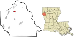 Location in De Soto Parish and the state of Louisiana. | |
| Coordinates: 32°11′28″N 93°48′54″W | |
| Country | |
| State | |
| Parish | DeSoto |
| Area | |
| • Total | 1.27 sq mi (3.30 km2) |
| • Land | 1.26 sq mi (3.26 km2) |
| • Water | 0.01 sq mi (0.03 km2) |
| Elevation | 241 ft (73 m) |
| Population (2020) | |
| • Total | 53 |
| • Density | 42.06/sq mi (16.24/km2) |
| Time zone | UTC-6 (Central (CST)) |
| • Summer (DST) | UTC-5 (CDT) |
| ZIP code | 71030 |
| FIPS code | 22-29395 |
| GNIS feature ID | 535251 |
Gloster is located 1.5 miles (2.4 km) east of U.S. Route 171, 17 miles (27 km) north of Mansfield, the DeSoto Parish seat, and 30 miles (48 km) south of Shreveport.
It is the nearest community to three places listed on the U.S. National Register of Historic Places:
References
- "2020 U.S. Gazetteer Files". United States Census Bureau. Retrieved March 20, 2022.
- "Geographic Identifiers: 2010 Demographic Profile Data (G001): Gloster CDP, Louisiana". U.S. Census Bureau, American Factfinder. Retrieved October 28, 2015.
- "Census of Population and Housing". Census.gov. Retrieved June 4, 2016.
Municipalities and communities of DeSoto Parish, Louisiana, United States | ||
|---|---|---|
| City | 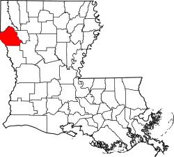 | |
| Towns | ||
| Villages | ||
| CDPs | ||
| Other unincorporated communities | ||
This article is issued from Wikipedia. The text is licensed under Creative Commons - Attribution - Sharealike. Additional terms may apply for the media files.