Gmina Ożarów Mazowiecki
Gmina Ożarów Mazowiecki is an urban-rural gmina (administrative district) in Warsaw West County, Masovian Voivodeship, in east-central Poland. Its seat is the town of Ożarów Mazowiecki, which lies approximately 14 kilometres (9 mi) west of Warsaw.
Gmina Ożarów Mazowiecki
Ożarów Mazowiecki Commune | |
|---|---|
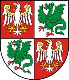
 Flag  Coat of arms | |
| Coordinates (Ożarów Mazowiecki): 52°13′N 20°48′E | |
| Country | |
| Voivodeship | Masovian |
| County | Warsaw West |
| Seat | Ożarów Mazowiecki |
| Area | |
| • Total | 71.34 km2 (27.54 sq mi) |
| Population (2013[1]) | |
| • Total | 22,444 |
| • Density | 310/km2 (810/sq mi) |
| • Urban | 10,561 |
| • Rural | 11,883 |
| Website | http://www.ozarow-mazowiecki.pl |
The gmina covers an area of 71.34 square kilometres (27.5 sq mi), and as of 2006 its total population is 20,788 (out of which the population of Ożarów Mazowiecki amounts to 8,237, and the population of the rural part of the gmina is 12,551).
Villages
Apart from the town of Ożarów Mazowiecki, Gmina Ożarów Mazowiecki contains the villages and settlements of Bronisze, Duchnice, Gołaszew, Jawczyce, Kaputy, Konotopa, Koprki, Kręczki, Macierzysz, Michałówek, Mory, Myszczyn, Ołtarzew, Orły, Orły-Kolonia, Ożarów, Pilaszków, Piotrkówek Duży, Piotrkówek Mały, Płochocin, Pogroszew, Pogroszew-Kolonia, Strzykuły, Święcice, Szeligi, Umiastów, Wieruchów, Wolica and Wolskie.
Neighbouring gminas
Gmina Ożarów Mazowiecki is bordered by Warsaw, by the town of Piastów, and by the gminas of Błonie, Brwinów, Leszno and Stare Babice.
