Gomotartsi Knoll
Gomotartsi Knoll (Bulgarian: Гомотарска могила, ‘Gomotarska Mogila’ \go-mo-'tar-ska mo-'gi-la\) is the rocky, mostly ice-covered peak of elevation 942 m[1] in the south part of Widmark Ice Piedmont on Stresher Peninsula, Loubet Coast in Graham Land, Antarctica. It is named after the settlement of Gomotartsi in Northwestern Bulgaria.
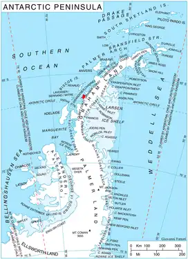
Location of Stresher Peninsula on Graham Land, Antarctic Peninsula.
Location
Gomotartsi Knoll is located at 66°20′36″S 65°30′10″W, which is 17.7 km east-southeast of Cape Bellue, 6.3 km west-southwest of Rugg Peak and 7.78 km northwest of Mount Lyttleton. British mapping in 1976.
Maps
- Antarctic Digital Database (ADD). Scale 1:250000 topographic map of Antarctica. Scientific Committee on Antarctic Research (SCAR). Since 1993, regularly upgraded and updated.
- British Antarctic Territory. Scale 1:200000 topographic map. DOS 610 Series, Sheet W 66 64. Directorate of Overseas Surveys, Tolworth, UK, 1976.
Notes
- Reference Elevation Model of Antarctica. Polar Geospatial Center. University of Minnesota, 2019
References
- Bulgarian Antarctic Gazetteer. Antarctic Place-names Commission. (details in Bulgarian, basic data in English)
- Gomotartsi Knoll. SCAR Composite Antarctic Gazetteer.
External links
- Gomotartsi Knoll. Copernix satellite image
This article includes information from the Antarctic Place-names Commission of Bulgaria which is used with permission.
This article is issued from Wikipedia. The text is licensed under Creative Commons - Attribution - Sharealike. Additional terms may apply for the media files.