Gorczyce, Ełk County
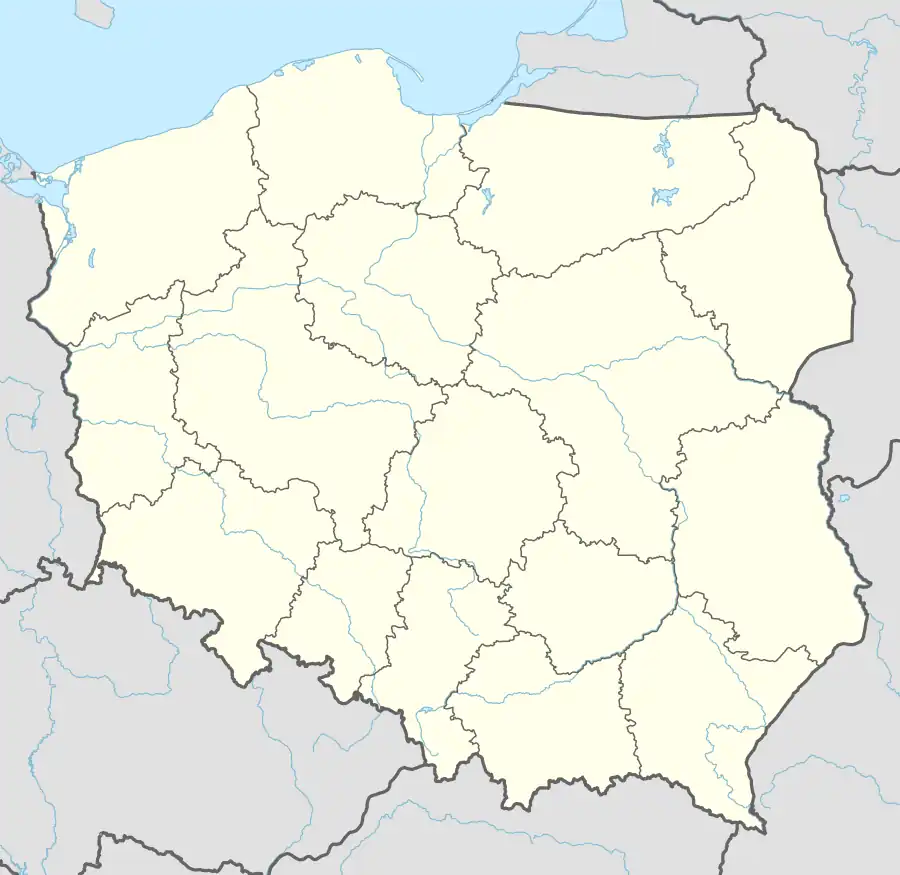
Gorczyce [ɡɔrˈt͡ʂɨt͡sɛ] (German: Gorczitzen; 1928–1945: Deumenrode) is a village in the administrative district of Gmina Prostki, within Ełk County, Warmian-Masurian Voivodeship, in northern Poland.[1] It lies approximately 6 kilometres (4 mi) south-west of Prostki, 18 km (11 mi) south of Ełk, and 124 km (77 mi) east of the regional capital Olsztyn. It is a sołectwo of Prostki.[2]
Gorczyce | |
|---|---|
Village | |
 Gorczyce | |
| Coordinates: 53°40′N 22°22′E | |
| Country | |
| Voivodeship | Warmian-Masurian |
| County | Ełk |
| Gmina | Prostki |
| Population (approx.) | 110 |
History
Before 1945 the area was part of East Prussia. The village was historically called Gorczitzen, written Gortzitzen in the 1881 Geographical Dictionary of the Kingdom of Poland,[3] and is recorded as Gramatzken in a 1484 document.[4] In 1928 it was renamed to Deumenrode.[5][6]
Under Prussian administration, it was administered with Borki (Borken), their combined population being 286 in 1885.[7] Its population was 205 in 1933, 186 in 1939.[8] With the defeat of Germany in World War II, it became part of Poland and was renamed to Gorczyce.
Transport
Gorczyce is on route 1680N, which links Prostki with Biała Piska.
References
- "Central Statistical Office (GUS) - TERYT (National Register of Territorial Land Apportionment Journal)" (in Polish). 2008-06-01.
- "Sołectwa - Sołtysi" (in Polish). Gmina Prostki. Archived from the original on 2016-12-10.
- Słownik geograficzny Królestwa Polskiego i innych krajów słowiańskich (in Polish). Filipa Sulimierskiego i Władsława Walewskiewgo. 1881. p. 703.
- Weber, Reinhold (1988). Die Landgemeinden des Grenzkreises Lyck (in German). Hohenwestedt/Holstein: Broschat. p. 84. ISBN 9783924256302.
[dem] ehrbaren Hans Deumenroder zwanzig Huben zu Gramaczken gelegen im Gebiete Licke
. - Kaemmerer, Margarete (2004). Ortsnamenverzeichnis der Ortschaften jenseits von Oder und Neiße (in German). ISBN 3-7921-0368-0.
- Gause, Fritz (1935). Neue Ortsnamen in Ostpreußen seit 1800: Verzeichnis der Änderungen im Ortsnamenbestand der Provinz Ostpreußen (alten Umfanges) seit dem Beginn des 19. Jahrhunderts. Einzelschriften der Historischen Kommission für ost- und westpreußische Landesforschung 6 (in German). Königsberg: Gräfe & Unzer. pp. 20, 37. OCLC 166049680.
- Gemeindelexikon für das Königreich Preußen: auf Grund der Materialien der Volkszählung vom 1. Dezember 1885 und anderer amtlicher Quellen (in German). Vol. 1 Provinz Ostpreußen. Berlin: Verlag des Königlichen Statistischen Bureaus. 1888. pp. 348–49. OCLC 749455982.
- Rademacher, Michael. "Landkreis Lyck (Lyk, poln. Elk)". Deutsche Verwaltungsgeschichte (in German). Archived from the original on 2009-04-18.