Podolia Governorate
The Podolia Governorate,[lower-alpha 1] also known as the Podillia Governorate,[1] was a province (guberniya) of the Southwestern Krai of the Russian Empire. The Podolia Governorate bordered the Volhynian Governorate to the north, the Kiev Governorate to the east, the Kherson Governorate to the southeast, the Bessarabia Governorate to the south, and Austria to the west. Its administrative centre was Kamenets-Podolsky (Kamianets-Podilskyi), which later moved to Vinnitsa (Vinnytsia). The governorate covered areas of Ukraine's partially Khmelnytskyi and most of Vinnytsia Oblasts, along with the fractionally recognised state of Transnistria.
Podolia Governorate
Подольская губернія | |
|---|---|
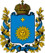 Coat of arms | |
.svg.png.webp) Location in the Russian Empire | |
| Country | Russian Empire |
| Krai | Southwestern |
| Established | 1793 |
| Abolished | 1925 |
| Capital |
|
| Area | |
| • Total | 42,017 km2 (16,223 sq mi) |
| Population (1897) | |
| • Total | 3,018,299 |
| • Density | 72/km2 (190/sq mi) |
| • Urban | 7.35% |
| • Rural | 92.65% |
It was created from the Second Partition of Poland, which was formed from the former Polish Bracław and Podole voivodeships, which are part of the Southwestern Krai along with Volhynia and Kiev. Its capital was located in Kamianets-Podilskyi, which later moved to Vinnytsia. The governorate still existed until the administrative reforms of the Ukrainian SSR, which dissolved it into five okruhas.
History
The Government of Podolia was established right after the Second Partition of Poland in place of the former Podole and Bracław Voivodeships in 1793.
Location
The Podolia Governorate occupied the southwestern frontier of the former Russian empire, bordering Austria-Hungary, and had an area of about 42,000 km2. The administrative centre was Kamenets-Podolskiy until 1914 when it moved to Vinnytsia.
Podolia Governorate was one of the three governorates of the Southwestern Krai administration. In 1917 it was recognized by the Russian Provisional Government to be governed by the General Secretariat of Ukraine as the representative of the Russian Provisional Government in the region.
Administrative division
Uyezd subdivision
Until 1918 the governorate consisted of 12 uyezds (counties):
| County | County Town | Arms of County Town | Area | Population (1897 census) | |
|---|---|---|---|---|---|
| Transliteration name | Russian Cyrillic | ||||
| Baltsky | Балтский | Balta | 7,766.25 km2 (2,998.57 sq mi) | 391,018 | |
| Bratslavsky | Брацлавский | Bratslav | 3,079.93 km2 (1,189.17 sq mi) | 241,868 | |
| Vinnitsky | Винницкий | Vinnitsa | 2,980.92 km2 (1,150.94 sq mi) | 248,314 | |
| Gaysinsky | Гайсинский | Gaysin | 3,383.11 km2 (1,306.23 sq mi) | 248,142 | |
| Kamenets-Podolsky | Каменец-Подольский | Kamenets-Podolsky | 2,884.19 km2 (1,113.59 sq mi) | 266,350 | |
| Letichevsky | Летичевский | Letichev | 2,699.14 km2 (1,042.14 sq mi) | 184,477 | |
| Litinsky | Литинский | Litin | 3,322 km2 (1,283 sq mi) | 210,502 | |
| Mogilyovsky | Могилёвский | Mogilyov | 2,746.14 km2 (1,060.29 sq mi) | 227,672 | |
| Novoushitsky | Новоушицкий | Novaya Ushitsa | 2,840.26 km2 (1,096.63 sq mi) | 223,312 | |
| Olgopolsky | Ольгопольский | Olgopol | 4,008.14 km2 (1,547.55 sq mi) | 284,253 | |
| Proskurovsky | Проскуровский | Proskurov | 2,691.06 km2 (1,039.02 sq mi) | 226,091 | |
| Yampolsky | Ямпольский | Yampol | 3,618.01 km2 (1,396.92 sq mi) | 266,300 | |
Okruha subdivision
On 12 April 1923 all uyezds (counties) were transformed into okruhas (counties), while volosts (districts) – into raions (districts). Okruhas served as a subdivision of government until it was abolished on 1 August 1925. Together with the government of Podilia, the Haisyn okruha was dissolved as well. Some territory of Tulchyn okruha were included into the newly formed Moldavian Autonomous Soviet Socialist Republic.
- Vinnytsia
- Haisyn
- Kamianets
- Mohyliv
- Proskuriv
- Tulchyn
Principal cities
Russian Census of 1897:
- Kamenets/Podolsky – 35 934 (Jewish – 16 112, Ukrainian – 9 755, Russian – 7 420)
- Vinnitsa – 30 563 (Jewish – 11 456, Ukrainian – 10 862, Russian – 5 206)
- Balta – 23 363 (Jewish – 13 164, Russian – 5 385, Ukrainian – 4 124)
- Proskurov – 22 855 (Jewish – 11 369, Ukrainian – 4 425, Russian – 3 483)
- Mogilev/Dnestr – 22 315 (Jewish – 12 188, Ukrainian – 6 512, Russian – 2 668)
- Zhmerinka – 12 908
- Khmelnik – 11 657 (Jewish – 5 979, Ukrainian – 5 375, Polish – 150)
Smaller cities
- Bar – 9 982 (Jewish – 5 764, Ukrainian – 3 332, Russian – 485)
- Lityn – 9 420 (Jewish – 3 828, Ukrainian – 3 047, Russian – 2 126)
- Gaysin – 9 374 (Jewish – 4 322, Ukrainian – 3 946, Russian – 884)
- Olgopol – 8 134 (Ukrainian – 4 837, Jewish – 2 465, Russian – 625)
- Bratslav – 7 863 (Jewish – 3 275, Ukrainian – 2 608, Russian – 1 782)
- Letichev – 7 248 (Jewish – 4 105, Ukrainian – 1 719, Polish – 741)
- Yampol – 6 605 (Ukrainian – 3 282, Jewish – 2 819, Russian – 275)
- Novaya Ushytsa – 6 371 (Jewish – 2 214, Russian – 2 120, Ukrainian – 1 836)
- Staraya Ushytsa – 4 176 (Ukrainian – 2 488, Jewish – 1 584, Polish – 57)
- Salnitsa – 3 699 (Ukrainian – 2 758, Jewish – 899, Polish – 19)
- Verbovets – 2 311 (Ukrainian – 1 282, Jewish – 661, Polish – 326)
Language
According to the Russian Empire Census on 28 January [O.S. 15 January] 1897, the Podolia Governorate had a population of 3,018,299, including 1,505,940 men and 1,512,359 women. The majority of the population indicated Little Russian[lower-alpha 2] to be their mother tongue, with a significant Jewish speaking minority.[2]
| Language | Native speakers | Percentage |
|---|---|---|
| Little Russian[lower-alpha 2] | 2,442,819 | 80.93 |
| Jewish | 369,306 | 12.24 |
| Great Russian[lower-alpha 2] | 98,984 | 3.28 |
| Polish | 69,156 | 2.29 |
| Romanian | 26,764 | 0.89 |
| German | 4,069 | 0.13 |
| Tatar | 2,296 | 0.08 |
| Bashkir | 1,113 | 0.04 |
| Czech | 886 | 0.03 |
| White Russian[lower-alpha 2] | 834 | 0.03 |
| Roma | 510 | 0.02 |
| Votyak | 254 | 0.01 |
| French | 245 | 0.01 |
| Chuvash | 137 | 0.00 |
| Mordovian | 136 | 0.00 |
| Latvian | 112 | 0.00 |
| Cheremis | 101 | 0.00 |
| Other languages | 577 | 0.02 |
| TOTAL | 3,018,299 | 100.00 |
| Faith | Male | Female | Both | |
|---|---|---|---|---|
| Number | Percentage | |||
| Eastern Orthodox | 1,180,148 | 1,178,349 | 2,358,497 | 78.14 |
| Judaism | 179,612 | 191,000 | 370,612 | 12.28 |
| Roman Catholic | 131,145 | 131,593 | 262,738 | 8.70 |
| Old Believer | 9,357 | 9,492 | 18,849 | 0.62 |
| Lutheran | 2,020 | 1,795 | 3,815 | 0.13 |
| Islam | 3,427 | 33 | 3,460 | 0.11 |
| Armenian Apostolic | 65 | 29 | 94 | 0.00 |
| Reformed | 30 | 26 | 56 | 0.00 |
| Armenian Catholic | 23 | 14 | 37 | 0.00 |
| Karaite | 11 | 13 | 24 | 0.00 |
| Anglican | 3 | 4 | 7 | 0.00 |
| Mennonite | 2 | 1 | 3 | 0.00 |
| Baptist | 1 | 1 | 2 | 0.00 |
| Other Christian denomination | 12 | 9 | 21 | 0.00 |
| Other non-Christian denomination | 84 | 0 | 84 | 0.00 |
| Total | 1,505,940 | 1,512,359 | 3,018,299 | 100.00 |
- Religious structures
- Churches
- Eastern Orthodox 1645
- Roman Catholic (kosciol) 202
- Lutheran 4
- Monasteries
- Eastern Orthodox 7 (male), 4 (female)
- Synagogues 89
- other Shul(s) 438
- Mosque(s) 1
See also
Notes
- Prior to 1918, the Imperial Russian government classified Russians as the Great Russians, Ukrainians as the Little Russians, and Belarusians as the White Russians. After the creation of the Ukrainian People's Republic in 1918, the Little Russians identified themselves as "Ukrainian".[3] Also, the Belarusian Democratic Republic which the White Russians identified themselves as "Belarusian".[4]
References
- Mikhail Levchenko. Hanshchyna (Ганьщина Україна). Opyt russko-ukrainskago slovari︠a︡. Tip. Gubernskago upravlenii︠a︡, 1874.
- "Demoscope Weekly – Annex. Statistical indicators reference". demoscape.ru. Retrieved 19 March 2023.
- Hamm, Michael F. (2014). Kiev: A Portrait, 1800–1917. Princeton University Press. p. 83. ISBN 978-1-4008-5151-5.
- Fortson IV, Benjamin W. (2011). Indo-European Language and Culture: An Introduction. John Wiley & Sons. p. 429. ISBN 978-1-4443-5968-8.
- Демоскоп Weekly - Приложение. Справочник статистических показателей.. demoscope.ru (in Russian). Retrieved 3 May 2023.