Gowdall
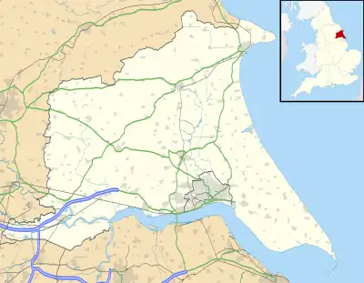
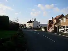
Gowdall is a village and civil parish in the East Riding of Yorkshire, England. It is situated approximately 1 mile (1.6 km) west of the town of Snaith, 1 mile to the north of the M62 motorway and the A645 road, and just south of the River Aire.
| Gowdall | |
|---|---|
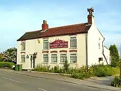
 Boot & Shoe Inn, Gowdall | |
 Gowdall Location within the East Riding of Yorkshire | |
| Population | 356 (2011 census)[1] |
| OS grid reference | SE622223 |
| • London | 155 mi (249 km) SSE |
| Civil parish |
|
| Unitary authority | |
| Ceremonial county | |
| Region | |
| Country | England |
| Sovereign state | United Kingdom |
| Post town | GOOLE |
| Postcode district | DN14 |
| Dialling code | 01405 |
| Police | Humberside |
| Fire | Humberside |
| Ambulance | Yorkshire |
| UK Parliament | |
According to the 2011 UK Census, Gowdall parish had a population of 356,[1] an increase on the 2001 UK Census figure of 318.[2]
Toponymy
The name "Gowdall" originates from Old English. It translates as "Nook of land where marigolds grow", and is composed of the elements golde ("marigold") and halh ("nook of land").[3] The village was not mentioned in the Domesday Book but was recorded as Goldale sometime in the 12th century.[4]
History

The parish was part of the Goole Rural District in the West Riding of Yorkshire from 1894 to 1974, then in Boothferry district of Humberside until 1996.[5]
In 2000 the village was severely flooded, and made national news.[6] In February 2020, Gowdall along with other villages surrounding Snaith suffered from further flooding after the River Aire "over-topped".[7]
Each October, before 2017 when the annual festival permanently ceased to occur, Gowdall residents hosted a 'Scarecrow and Pumpkin Festival'.[8]
The village formerly had a public house called The Boot and Shoe Inn. It has been closed since 2018.
References
- UK Census (2011). "Local Area Report – Gowdall Parish (1170211190)". Nomis. Office for National Statistics. Retrieved 18 February 2018.
- UK Census (2001). "Local Area Report – Gowdall Parish (00FB061)". Nomis. Office for National Statistics. Retrieved 27 February 2020.
- Mills, Anthony David (2011) [2003]. A Dictionary of British Place Names (revised ed.). Oxford University Press. p. 211. ISBN 978-0199609086.
- Ekwall, Eilert (1960). The concise Oxford dictionary of English place-names (4 ed.). Oxford: Clarendon Press. p. 202. ISBN 0-19-869103-3.
- "History of Gowdall, in East Riding of Yorkshire and West Riding | Map and description". www.visionofbritain.org.uk. Retrieved 25 November 2020.
- Wainwright, Martin (23 November 2000). "Wet and forlorn, a village's misery continues". The Guardian. Guardian News and Media Limited. Retrieved 19 January 2010.
- "Flooding Update – Snaith, Gowdall and East Cowick". East Riding of Yorkshire Council. Retrieved 28 February 2020.
- "Fantastic day out". Goole Courier. Johnston Press Digital Publishing. 1 November 2007. Archived from the original on 6 July 2008. Retrieved 8 February 2010.
- Gazetteer – A–Z of Towns Villages and Hamlets. East Riding of Yorkshire Council. 2006. p. 6.