Grand Bahama
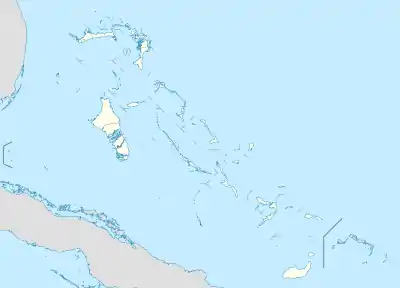
Grand Bahama is the northernmost of the islands of the Bahamas, with the town of West End located 56 nautical miles (64 mi; 104 km) east of Palm Beach, Florida.[2] It is the third largest island in the Bahamas island chain of approximately 700 islands and 2,400 cays. The island is roughly 530 square miles (1,400 km2) in area and approximately 153 kilometres (95 mi) long west to east and 24 kilometres (15 mi) at its widest point north to south. Administratively, the island consists of the Freeport Bonded Area and the districts of East Grand Bahama and West Grand Bahama.[3] Nearly half of the homes on the island were damaged or destroyed in early September 2019 by Hurricane Dorian.[4][5]
Native name: Grand Bahamian | |
|---|---|
 Western and central Grand Bahama seen from space, looking southwest | |
 Grand
Bahama | |
| Geography | |
| Location | Atlantic Ocean |
| Coordinates | 26°39′N 78°19′W |
| Archipelago | Bahamas |
| Area | 1,373 km2 (530 sq mi) |
| Highest elevation | 40 ft (12 m) |
| Administration | |
| Largest settlement | Freeport |
| Demographics | |
| Population | 47,475[1] (2022) |
| Pop. density | 34.75/km2 (90/sq mi) |
| Additional information | |
| Time zone | |
| • Summer (DST) | |
| ISO code | BS-EG BS-FP BS-WG |
Climate
Grand Bahama Island has a tropical monsoon climate, with a hot and wet season from May through October, and warm and dry season from November through April.
In Freeport the summer high temperatures average 31 °C (88 °F), with average lows of 26 °C (79 °F). During the winter, the average high temperature is 28 °C (82 °F), and the average low is 19 °C (66 °F).[6] The rainy season in the Bahamas is from May to October. The hurricane season runs from June through November, with the greatest risk in the months of August, September, and October.[7]
History
Early Spanish contact
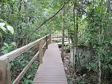
The indigenous Lucayan people's name for the island was Bahama ('large upper middle island').[8][9] Grand Bahama's existence for almost two centuries was largely governed by the nature of the treacherous coral reefs surrounding the island, which repelled its Spanish claimants (who largely left it alone apart from infrequent en route stops by ships for provisions) while attracting pirates, who would lure ships onto the reefs where they would run aground and be plundered. The Spaniards took little interest in the island after enslaving the native Lucayan inhabitants.
British rule
In 1670, Charles II of England issued a land patent, granting the Bahamas to the eight Lords Proprietors of the Carolinas.[10] By 1828, Grand Bahama remained almost unpopulated.[11]
A brief smuggling boom occurred during the years of prohibition in the United States, when West End, Grand Bahama, and Bimini served as waystations for illicit imports of liquor to the U.S.[12]
The major settlement that developed on the island was Freeport-Lucaya, but other hamlets and settlements emerged, including Russell Town, Williams Town, Smith's Point, Mather Town, Pinder's Point, Lewis Yard, Hunter's, and Mack Town.[13]
Hawksbill Creek Agreement era
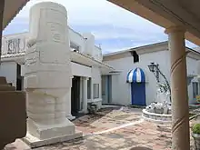
By the mid-20th century, Grand Bahama's population numbered around 500 and the island was one of the least developed of the Bahamas' islands. However it finally gained a stable source of income when in 1955 a Virginian financier named Wallace Groves began redevelopment with the Bahamian government to build the city of Freeport under the Hawksbill Creek Agreement and create the Grand Bahama Port Authority. Soon after, the ambitious Edward St. George, with the financial help of Sir Jack Hayward, took the company to new frontiers. Seeing the success of Cuba as a tourist destination for wealthy Americans, St. George was eager to develop Grand Bahama in a similar vein. The city grew rapidly, with St. George adding a harbour, an airport soon after the city was founded, and the tourist center of Port Lucaya in 1962. Grand Bahama became the second most populous island in the Bahamas (over 50,000 in 2004).[14]
Hurricane Dorian effects
On September 1, 2019, Hurricane Dorian struck the island as a Category 5 hurricane and caused catastrophic destruction.
Economy
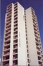
One aspect that contributes to the economy of the Bahamas is what they directly export and import. The Bahamas ranks as the 137th largest exporter and 117th largest importer in the world. Some of the major trading partners include the United States, France, and Finland. Top exports include; passenger cargo ships, special purpose ships, and refined petroleum.[15] Freeport, a city in Grand Bahama has some industries that also contribute to the economy. These major industries are pharmaceutical plants, Fragrance of The Bahamas perfume factory, an oil transshipment company, and an immunology research center.[16] Despite the Bahamas being big exporters and importers, their agriculture and fisheries also help with the economy. They produce agriculture ranging from crops, poultry, livestock, to dairy. On commercial farms in Grand Bahama, vegetable and citrus production are produced and exported to other countries. For their fisheries, Crayfish and conch are their top exports.[17] Even though the economy is based heavily on what the Bahamas produces and sells, tourism is the mainstay of the island's economy. The resort area at Port Lucaya and visits by cruise ships provide the bulk of this activity. Grand Bahama's tourism sector is complemented by the BORCO oil bunkering facility owned by Buckeye,[18] the South Riding Point oil storage and transhipment terminal owned by Statoil,[19] and a transshipment/container port partly owned by Hong Kong conglomerate Hutchison Whampoa and the Grand Bahama Port Authority. There are also quarrying operations on the island and a large shipyard.
There are two airports on the island: Grand Bahama International Airport in Freeport, and West End Airport in West End. Grand Bahama International Airport is the larger of the two, and West End Airport is open sporadically for private aircraft only.
Administrative regions
Grand Bahama is divided into three districts and seven town areas for administrative purposes. Each district is run by a chief councilor, and each town area or township is run by a chairperson. As of 1996 Grand Bahama has three districts.[20]
Elections are held every 5 years in the Bahamas. The two principal parties are the Progressive Liberal Party and the Free National Movement.. Grand Bahama also is a part of the islands outside of New Providence and operate under Local Government; this allows for a greater allowance for people to have a more direct rule. The intention of Local government is to not have direct connections to any political party.
Main settlements
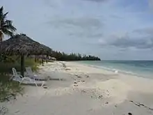
- Freeport is the main city of Grand Bahama. It holds the commercial ship harbour and the main airport.
- Lucaya is a tourist destination on the island, with beaches and hotels.
- West End is the capital of Grand Bahama. It first achieved notoriety as a rum-running port during the Prohibition.
- In the 1950s, West End became home to the Jack Tar marina and club. However, over the years the marina fell into disrepair, and the whole city of West End was of little economic import to Grand Bahama. In 2001, the resort was reopened as Old Bahama Bay Resort & Yacht Harbour.[21]
- Eight Mile Rock stretches out over eight miles of rocky shore, hence its name. It is home to Bahamian NBA and WNBA players, Buddy Hield and Jonquel Jones.
- McLean's Town is the easternmost settlement of Grand Bahama. It is within a 30-minute ferry ride of the northernmost settlement, the neighboring island of Abaco.
Flora and fauna
Grand Bahama Island is populated with a variety of plants, birds, mammals and fish.
The Bahamas is home to many different species of bats, including the buffy flower bat, whose hair is white and brown. As the name suggests, it has a flowery nose that helps pollinate flowers and is usually found in dark caves or abandoned homes.[22]
The Bahama woodstar is a non-migratory hummingbird found in brushy habitats, including forest and undergrowth, areas of low-growing, and scrubby vegetation.[23]
The Bahama swallow is a medium-sized bird native to the Bahamas. This endangered bird breeds in the islands' pine woodland, but is threatened due to human development. This swallow has a green head and back, blue wings with a black tail, and a white belly and chin.[24]
The tiger shark is a species that gets its name from the vertical stripes that line its body. They are often found near canals, harbours and shallow reefs of Grand Bahama Island.[25]
The yellow elder is a shrub native to the Bahamas. It is densely branched with bright green leaves and yellow flowers that usually attract butterflies, bees, and hummingbirds.
The casuarina is an invasive species to the Bahamas. It is a flowering shrub or tree with fine leaves that can grow to a height of 65 feet. The casuarina is common along the islands' shorelines, due to its salt-tolerance and ability to thrive in sandy soils.[26]
References
- "Census population and housing" (PDF). Bahamas Gov. Retrieved 17 April 2023.
- "West End". Retrieved February 2, 2021.
- "Grand Bahama Island | island and district, The Bahamas". Encyclopedia Britannica. Retrieved 2018-10-28.
- Ramon Espinosa; Danica Coto; Michael Weissenstein (September 3, 2019). "'Total devastation': Hurricane slams parts of the Bahamas". Associated Press. Retrieved September 3, 2019.
- Andone, Dakin (2019-09-05). "The airport on the island of Grand Bahama is 'a debris field' after Hurricane Dorian". CNN.com. Retrieved 2019-09-05.
- "Weather in the Bahamas". The Islands of the Bahamas. Retrieved June 6, 2014.
- "Best Times to Visit Bahamas". U.S News and Daily Report. Archived from the original on 2011-04-18.
- Ahrens, Wolfgang P. (2016). "Naming the Bahamas Islands: History and Folk Etymology". In Hough, Carole; Izdebska, Daria (eds.). 'Names and Their Environment': Proceedings of the 25th International Congress of Onomastic Sciences: Glasgow, 25-29 August 2014, Volume 1: Keynote Lectures: Toponomastics I (PDF). University of Glasgow. p. 47. ISBN 978-0-85261-947-6.
- Granberry, Julian; Vescelius, Gary (2004). Languages of the Pre-Columbian Antilles. University of Alabama Press. p. 85. ISBN 0-8173-1416-4.
- Stephanie Hackert, Urban Bahamian Creole: System and Variation (John Benjamins Publishing Co.: 2004), p. 35.
- Michael Craton & Gail Saunders, A History of the Bahamian People (Vol. 1: From Aboriginal Times to the End of Slavery: University of Georgia Press, 1992: 1998 paperback ed.), p. 383.
- Michael Craton & Gail Saunders, A History of the Bahamian People (Vol. 2: From the Ending of Slavery to the Twenty-first Century: University of Georgia Press, 1998), p. 237.
- Michael Craton & Gail Saunders, A History of the Bahamian People (Vol. 2: From the Ending of Slavery to the Twenty-first Century: University of Georgia Press, 1998), p. 333.
- In 1955, the second most populated city of The Bahamas was little more than a pine forest http://www.grandbahamavacations.com/about-the-island/history-of-grand-bahama-island/ Over 30 years later, the result is a community completely tailored to the getaway tourist, a premeditated paradise offering almost every kind of vacation activity imaginable.
- "- Bahamas (BHS) Exports, Imports, and Trade Partners". atlas.media.mit.edu. Retrieved 2018-10-28.
- Ellicott, Karen (2002). Cities of the World 6th ed. Detroit, Michigan: Gale Research Co. ISBN 978-0-7876-3912-9.
- Hill, Melissa Sue (2017). Worldmark Encyclopedia of the Nations. Farmington Hills, MI: Gale. ISBN 978-1-4103-3898-3.
- Buckeye Partners, L.P. "BORCO". Retrieved 2013-02-21.
- Statoil ASA. "Bahamas - South Riding Point". Retrieved 2013-02-21.
- "The Government of Bahamas - Landing Page".
- "Hotel Online Report". Archived from the original on 2017-06-29. Retrieved 2008-02-12.
- "Common Bats of the Bahamas" (PDF).
- "Bahama Woodstars | Beauty of Birds". www.beautyofbirds.com. Retrieved 2018-10-22.
- "Bahama Swallow". neotropical.birds.cornell.edu. doi:10.2173/bow.bahswa.01. S2CID 216419425. Retrieved 2018-10-24.
- "Tiger Sharks, Galeocerdo cuvier". MarineBio.org. Retrieved 2018-10-22.
- "Invasive Species of the Bahamas – Casuarina | CIASNET.ORG". www.ciasnet.org. Retrieved 2019-09-03.
External links
- Official Tourism Site of The Islands of the Bahamas
- Official Site of the Grand Bahama Island Tourism Board
- https://bs.usembassy.gov/hurricane-season-alert/
- https://www.thebahamasguide.com/business-investment/agriculture/
- http://legacy.iica.int/Eng/regiones/caribe/bahamas/Lists/News%20%20IICA%20Bahamas/Attachments/16/The%20Top%2030%20Crops%20L.%20Minns.pdf