Greenhithe, New Zealand
Greenhithe is a northwestern suburb of Auckland, New Zealand, located on the North Shore.
Greenhithe | |
|---|---|
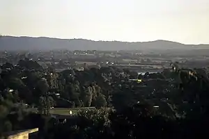 Greenhithe looking towards the Waitākere Ranges. | |
| Coordinates: 36°46′S 174°41′E | |
| Country | New Zealand |
| City | Auckland |
| Local authority | Auckland Council |
| Electoral ward | Albany ward |
| Local board | Upper Harbour Local Board |
| Area | |
| • Land | 780 ha (1,930 acres) |
| Population (June 2022)[2] | |
| • Total | 8,710 |
| Postcode(s) | 0632 |
| Paremoremo | Schnapper Rock | Unsworth Heights |
| Herald Island |
|
Bayview |
| Hobsonville | (Waitematā Harbour) | Beach Haven |
Greenhithe was so named after a village on the River Thames, in Kent, named by Henry James Blyth, who settled there in 1882 and came from the original Greenhithe in England. Greenhithe comes from the Old English word 'hithe' or 'hythe', meaning wharf.[3] The name is appropriate, since Greenhithe has a wharf onto Lucas Creek that leads into the estuaries of Auckland's Waitematā Harbour.
In 2001 Greenhithe had a population of 4,170 according to the census. It showed dramatic growth after the North Shore City Council determined that it was to be a major growth area.[4] Where once the typical section size was a quarter to half an acre, the newer subdivisions of Wainoni, Admiral's Court and others have reduced that to around 600m2 (with a quarter acre being a shade over 1000m2). Since 1 November 2010, Greenhithe has been under the governance of Auckland Council.
Greenhithe includes the Wainoni area around Wainoni Park.[5]
Historically, Greenhithe extended from the Upper Harbour Bridge through to Wainoni Park in the north. New subdivisions have extended the urban boundaries through to "Greenhithe North", including the northern part of Kyle Rd and Schnapper Rock. Until a proposed bridge is built to join the two Kyle Rds, these areas may have more community affiliation with Albany.
Greenhithe is bordered by Lucas Creek in the north and Oruamo or Hellyers Creek in the south. New Zealand Transport Agency completed the Upper Harbour Motorway through Greenhithe, in late 2007.
Demographics
Greenhithe covers 7.80 km2 (3.01 sq mi)[1] and had an estimated population of 8,710 as of June 2022,[2] with a population density of 1,117 people per km2.
| Year | Pop. | ±% p.a. |
|---|---|---|
| 2006 | 5,901 | — |
| 2013 | 7,683 | +3.84% |
| 2018 | 8,592 | +2.26% |
| Source: [6] | ||
Greenhithe had a population of 8,592 at the 2018 New Zealand census, an increase of 909 people (11.8%) since the 2013 census, and an increase of 2,691 people (45.6%) since the 2006 census. There were 2,613 households, comprising 4,263 males and 4,329 females, giving a sex ratio of 0.98 males per female, with 1,821 people (21.2%) aged under 15 years, 1,758 (20.5%) aged 15 to 29, 4,245 (49.4%) aged 30 to 64, and 768 (8.9%) aged 65 or older.
Ethnicities were 71.1% European/Pākehā, 4.6% Māori, 2.0% Pacific peoples, 26.1% Asian, and 3.1% other ethnicities. People may identify with more than one ethnicity.
The percentage of people born overseas was 41.4, compared with 27.1% nationally.
Although some people chose not to answer the census's question about religious affiliation, 58.3% had no religion, 31.1% were Christian, 0.1% had Māori religious beliefs, 1.8% were Hindu, 0.9% were Muslim, 0.9% were Buddhist and 1.5% had other religions.
Of those at least 15 years old, 2,334 (34.5%) people had a bachelor's or higher degree, and 543 (8.0%) people had no formal qualifications. 2,022 people (29.9%) earned over $70,000 compared to 17.2% nationally. The employment status of those at least 15 was that 3,699 (54.6%) people were employed full-time, 1,062 (15.7%) were part-time, and 192 (2.8%) were unemployed.[6]
| Name | Area (km2) | Population | Density (per km2) | Households | Median age | Median income |
|---|---|---|---|---|---|---|
| Greenhithe West | 2.72 | 3,501 | 1,287 | 1,101 | 41.9 years | $44,700[7] |
| Greenhithe East | 1.44 | 3,093 | 2,148 | 912 | 34.5 years | $42,000[8] |
| Greenhithe South | 3.64 | 1,998 | 549 | 600 | 36.9 years | $42,500[9] |
| New Zealand | 37.4 years | $31,800 |
Education
Greenhithe School is a coeducational contributing primary (years 1-6) school with a roll of 476 students as at April 2023.[10][11] The school opened as a small rural school in 1893.[12]
Upper Harbour Primary School is a coeducational contributing primary school (years 1-6), with a roll of 408 students as at April 2023.[10][13] The school opened in February 2006.[14]
References
- "ArcGIS Web Application". statsnz.maps.arcgis.com. Retrieved 16 June 2022.
- "Population estimate tables - NZ.Stat". Statistics New Zealand. Retrieved 25 October 2022.
- "Greenhithe | NZHistory, New Zealand history online". nzhistory.govt.nz. Retrieved 31 January 2022.
- Council, Auckland. "North Shore district plan text". Auckland Council. Retrieved 12 December 2021.
- Gregory's Auckland & Surrounds Street Directory (3rd ed.). 2008. map 55. ISBN 978-0-7319-2048-8.
- "Statistical area 1 dataset for 2018 Census". Statistics New Zealand. March 2020. Greenhithe West (118900), Greenhithe East (119100) and Greenhithe South (119400).
- 2018 Census place summary: Greenhithe West
- 2018 Census place summary: Greenhithe East
- 2018 Census place summary: Greenhithe South
- "New Zealand Schools Directory". New Zealand Ministry of Education. Retrieved 12 December 2022.
- Education Counts: Greenhithe School
- Lutz, Heike; Chan, Theresa (2011). "Albany and East Coast Bays" (PDF). North Shore Heritage: Thematic Review Report. Vol. 2. p. 409. Retrieved 14 April 2016.
- Education Counts: Upper Harbour Primary School
- "Welcome to Upper Harbour School". Retrieved 20 April 2009.
External links
- Greenhithe Residents Association
- Greenhithe School
- Photographs of Greenhithe held in Auckland Libraries' heritage collections.