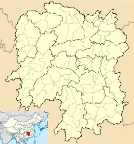
Guanqiao, Liuyang
Guanqiao Town (simplified Chinese: 官桥镇; traditional Chinese: 官橋鎮; pinyin: Guānqiáo Zhèn) is a rural town in Liuyang City, Hunan Province, People's Republic of China.[1] As of the 2015 census it had a population of 26,600 and an area of 87.9-square-kilometre (33.9 sq mi).[2] The town is bordered to the north and northwest by Zhentou Town, to the east by Puji Town, and to the south by Lusong District of Zhuzhou.
Guanqiao Town
官桥镇 | |
|---|---|
 Guanqiao Town Location in Hunan | |
| Coordinates: 27°55′52″N 113°21′16″E | |
| Country | People's Republic of China |
| Province | Hunan |
| Prefecture-level city | Changsha |
| County-level city | Liuyang |
| Area | |
| • Total | 87.9 km2 (33.9 sq mi) |
| Population (2015) | 26,600 |
| Time zone | UTC+8 (China Standard) |
| Postal code | 410181 |
| Area code | 0731 |
Administrative division
The town is divided into four villages and one community, the following areas:
- Jizhen Community (集镇社区)
- Sugu Village (苏故村)
- Yijiang Village (一江村)
- Bajiaoting Village (八角亭村)
- Shihuizui Village (石灰嘴村)
Economy
The main industries in and around the town are forestry and farming.
Geography
Liuyang River, also known as the mother river, flows through the town.
Xiashan Reservoir (峡山水库) is the largest body of water and the largest reservoir in the town.
Mount Daniuling (打牛岭) is a mountain in the town. The peak is 270 metres (890 ft) in elevation.
Education
- Guanqiao Middle School
Transportation
Railway
The Shanghai–Kunming railway passes across the town north to south.[3]
The Hangzhou–Changsha high-speed railway, which connects Hangzhou and Changsha, running through the town north to south.[3]
Religion
Zhong Kui Temple (钟馗庙) is a Taoist temple in the town for worship of Zhong Kui.
References
- 全国最大茶叶专业合作社联盟落户湖南浏阳 (in Chinese). Xinhuanet. Archived from the original on August 28, 2013. Retrieved 2013-08-06.
- 浏阳市乡镇区划调整改革结果公示. sohu (in Chinese). 2016-04-15.
- Zhang Hong, ed. (2018). "Liuyang" 《浏阳市》. 《中国分省系列地图册:湖南》 [Maps of Provinces in China: Hunan] (in Chinese). Xicheng District, Beijing: SinoMaps Press. pp. 32–33. ISBN 978-7-5031-8949-4.