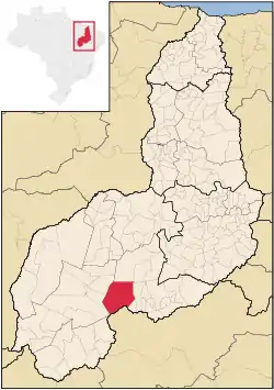
Guaribas
Guaribas is a municipality in the state of Piauí in the Northeast region of Brazil.[2][3][4][5] Described as a "farming outpost five hours from the nearest paved, two-lane highway", Guaribas is considered one of the poorest municipalities in the country.[6]
Guaribas | |
|---|---|
Municipality | |
 Location in Piauí | |
| Country | |
| Region | Nordeste |
| State | Piauí |
| Mesoregion | Sudoeste Piauiense |
| Government | |
| • Mayor | Joércio Matias de Andrade (MDB) |
| Population (2020 [1]) | |
| • Total | 4,568 |
| Time zone | UTC−3 (BRT) |
Geography
The municipality contains part of the 823,843 hectares (2,035,760 acres) Serra das Confusões National Park, created in 1998, which protects an area of the Caatinga biome.[7] The municipality is in the Capivara-Confusões Ecological Corridor, created in 2006 to link the Serra da Capivara National Park to the Serra das Confusões National Park.[8]
Demographics
Living standards in Gauribas have been compared to that of low-income African countries by O Estado de S. Paulo. In 2003, the city was the testing ground for the Bolsa Família social program.[9]
Politics
In the 2022 Brazilian general election, Guaribas gave Workers' Party candidate Luiz Inácio Lula da Silva his highest share of the vote in the country, with Lula receiving 93% of the vote in the municipality.[10]
The current mayor of Guaribas is Joércio Matias de Andrade, a member of the Brazilian Democratic Movement (MDB).[11]
See also
References
- IBGE 2020
- "Divisão Territorial do Brasil" (in Portuguese). Divisão Territorial do Brasil e Limites Territoriais, Instituto Brasileiro de Geografia e Estatística (IBGE). July 1, 2008. Retrieved December 17, 2009.
- "Estimativas da população para 1º de julho de 2009" (PDF) (in Portuguese). Estimativas de População, Instituto Brasileiro de Geografia e Estatística (IBGE). August 14, 2009. Retrieved December 17, 2009.
- "Ranking decrescente do IDH-M dos municípios do Brasil" (in Portuguese). Atlas do Desenvolvimento Humano, Programa das Nações Unidas para o Desenvolvimento (PNUD). 2000. Archived from the original on October 3, 2009. Retrieved December 17, 2009.
- "Produto Interno Bruto dos Municípios 2002-2005" (PDF) (in Portuguese). Instituto Brasileiro de Geografia e Estatística (IBGE). December 19, 2007. Archived from the original (PDF) on October 2, 2008. Retrieved December 17, 2009.
- Clendenning, Alan (May 25, 2003). "Revolution's Slow Start in Brazil". Washington Post. Retrieved November 9, 2022.
- Unidade de Conservação: Parque Nacional Serra das Confusões (in Portuguese), MMA: Ministério do Meio Ambiente, retrieved 2016-06-09
- Operação combate caça em corredor ecológico no Piauí (in Portuguese), ICMBio, 25 July 2012, retrieved 2016-11-04
- Conconi, Augusto; do Lago, Cecília do Lago; Shalders, André (2022-09-17). "Berço do Bolsa Família é esquecido pelo Congresso". Estadão (in Brazilian Portuguese). Retrieved 2022-11-07.
- Marreiros, Lucas (2022-10-31). "Município símbolo do Fome Zero, Guaribas, no PI, comemora vitória de Lula com a maior votação do país: 93%". G1 (in Brazilian Portuguese). Retrieved 2022-11-07.
- "No Piauí, prefeito é investigado após furar fila da vacina e postar nas redes". Época (in Brazilian Portuguese). 2021-02-01. Retrieved 2022-11-10.
