Ali Kunsha Airport
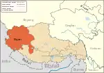
Ali Kunsha Airport, also called Ngari Günsa Airport, (IATA: NGQ, ICAO: ZUAL), also known as Shiquanhe Airport is a dual-use military and civil airport serving the town of Shiquanhe in Ngari Prefecture, between Gar Chongsar and Sogmai, Günsa Township, Ngari Prefecture, Tibet Autonomous Region. It started operations on 1 July 2010, becoming the fourth civil airport in Tibet after Lhasa, Nyingchi, and Qamdo airports.[2]
Ali Kunsha Airport 阿里昆莎机场 Ālǐ Kūnshā Jīchǎng | |||||||||||
|---|---|---|---|---|---|---|---|---|---|---|---|
| Summary | |||||||||||
| Airport type | Military/Public | ||||||||||
| Serves | Shiquanhe | ||||||||||
| Location | Gar Chongsar, Günsa Township, Ngari Prefecture, Tibet | ||||||||||
| Elevation AMSL | 4,274 m / 14,022 ft | ||||||||||
| Coordinates | 32°06′31″N 80°03′10″E | ||||||||||
| Map | |||||||||||
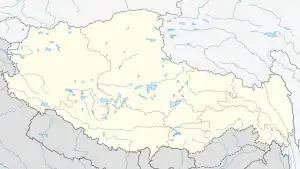
 NGQ Location of airport in Tibet | |||||||||||
| Runways | |||||||||||
| |||||||||||
| Statistics (2021) | |||||||||||
| |||||||||||
Source:[1] | |||||||||||
| Ali Kunsha Airport | |||||||
|---|---|---|---|---|---|---|---|
| Simplified Chinese | 阿里昆莎机场 | ||||||
| |||||||
Situated at 4,274 m (14,022 ft) above sea level, Gunsa Airport is the fourth highest airport in the world after Daocheng Yading Airport, Qamdo Bamda Airport, and Kangding Airport.[3][4] Gunsa airport has a 4,500-meter runway. It is expected to handle 120,000 passengers by 2020. Construction began in May 2007 and cost an estimated 1.65 billion yuan (241.22 million U.S. dollars).[2]
As Shiquanhe (Ali) is only a one-day bus drive (about 330 km) from the settlement of Darchen situated just north of Lake Manasarovar, facing Mount Kailash,[5] it is expected to benefit pilgrims to these two sites, which are considered sacred by Hindus,[6] Buddhists, Bonpa and Jains.[7][8] With the opening of Shigatse Peace Airport in October 2010, the five airports, coupled with the Qinghai–Tibet railway and a network of roads, are expected to increase tourism to scenic and holy sites in Tibet.[6]
Military buildup
Since the last major standoff between China and India at Doklam in 2017 military presence at the Ngari Gunsa Airport has been expanded with Shenyang J-16s and J-11s fighter jets stationed. The airport is 200 kilometres from Pangong Tso, Ladakh.[9][10]
Airlines and destinations
| Airlines | Destinations |
|---|---|
| China Eastern Airlines | Kashgar, Xi'an |
| Lucky Air | Kashgar, Ürümqi |
| Tibet Airlines | Hotan,[11] Lhasa, Shache,[11] Xi'an, Xining[11] |
See also
Footnotes
- 阿里昆莎机场 Archived 2012-04-04 at the Wayback Machine
- Tibet's fourth civil airport opens Archived 2010-12-14 at the Wayback Machine
- The world’s third highest airport opens with milestone Airbus A319 flight Archived 2014-12-04 at the Wayback Machine
- 西藏阿里昆莎机场迎来首航 为世界海拔第三高
- Mayhew and Kohn (2005), p. 209.
- "Pilgrims to benefit from new Tibet Airport near Mt Kailash."
- Albinia (2008), p. 288,
- Gyurme (199), p. 36.
- Chan, Minnie (2020-06-04). "China flexing military muscle in border dispute with India". South China Morning Post. Retrieved 2020-06-04.
- "China starts construction activities near Pangong Lake amid border tensions with India". Business Today. 27 May 2020. Retrieved 2020-06-05.
- "最新!2023年夏航季西宁机场航班时刻表发布!". Retrieved 11 May 2023.
References
- Albinia, Alice. (2008) Empires of the Indus: The Story of a River. First American Edition (2010) W. W. Norton & Company, New York. ISBN 978-0-393-33860-7.
- Dorje, Gyurme. (2009) Tibet Handbook. Footprint Handbooks, Bath, England. ISBN 978-1-906098-32-2.
- Mayhew, Bradley and Kohn, Michael. (2005) Tibet. 6th Edition. ISBN 1-74059-523-8.
