Rutog Town
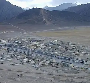
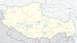
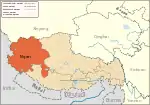
The Rutog Town[1][2] (Tibetan: རུ་ཐོང་གྲོང་རྡལ, ZYPY: Rutog Chongdai),[3] called Rituzhen in Chinese (Chinese: 日土镇 ;pinyin: Rìtǔ zhèn),[3] is a town and the seat of Rutog County in the far western Tibet Autonomous Region. It is also a major military base for China near the disputed border with India allowing it to press its claims militarily.[4][5]
Rutog Town / Rituzhen
རུ་ཐོང་གྲོང་རྡལ / 日土镇 Derub, Gyelgosang | |
|---|---|
 | |
 Rutog Town / Rituzhen | |
| Coordinates: 33°23′6″N 79°43′48″E | |
| Country | People's Republic of China |
| Province | Tibet Autonomous Region |
| Prefecture | Ngari Prefecture |
| County | Rutog County |
| Elevation | 4,280 m (14,040 ft) |
| Population | |
| • Total | 1,000 |
| Time zone | UTC+8 (CST) |
The town was built around in 1999 by the Chinese administration of Tibet on the China National Highway 219.[6] Prior to that, the seat of the county was at Rudok or Rutog Dzong, about 10 km northwest, which had been its capital for more than a thousand years.[7][8]
The new Rutog Town is located 120 kilometres by road northwest of Shiquanhe (also called Ali or Ngari) and 10 kilometres south of Lake Pangong.[9] The town has a population of about 1000 people.
Town and garrison
Prior to the construction of the town around 1999, the location contained a small Gyelgosang community (Tibetan: རྒྱལ་སྒོ་བསངས, Wylie: rgyal sgo bsangs, THL: gyel go sang, ZYPY: Gyaigosang; Chinese: 杰果桑社区; pinyin: Jié guǒ sāng shèqū) of the Derub village (33.3718°N 79.6961°E).[3][lower-alpha 1] Lacking a river of its own, it is watered by a canal dug from the Maga Tsangpo river at Derub.
Tibetologist Gyurme Dorje states that the newly built town is basically a Chinese military garrison,[10] as does the Lonely Planet guide.[11] The town serves as a base for China's military operations against India along the disputed Sino-Indian border in Ladakh and the associated "salami tactics".[12]
Normally able to accommodate 5,000 troops, the camp's capacity was expanded to house 15,000 to 18,000 troops by 2021.[13] Satellite imagery indicated that China broke ground in August 2019,[4] and started extending the facilities in the waterless valley to the northeast of the town. New garrison facilities, radar stations, surface-to-air missile sites, heliports and tank drills have been constructed.[5]
Township
The extended township of Rutog contains the Old Rudok town and the valley of Shaldat and Spanggur lakes towards the Ladakh border. It is bounded in the north by the Pangong lake and in the south by the Maga Tsangpo basin.[14] The valley contains villages such as Chulung 'Ogma (33.3795°N 79.5308°E), Recho (or Retso; 33.4087°N 79.1977°E) and Shingzhang (33.4973°N 79.0387°E) at the southeastern end of Spanggur Lake.
Transportation
The China National Highway 219 (G219) connects Rutog to Shiquanhe, the capital of the Ngari Prefecture, Gar Günsa, the home of Ngari Gunsa Airport, and other venues to the southeast. In the north, the highway passes through the disputed Aksai Chin region and goes to Kashgar.[15] The Lonely Planet guide mentioned in 1999 that the visitors coming from Kashgar were required to have a permit to enter Rutog.[6]
At Derub, a road called Musi Xian branches off from G219 towards the Spanggur Lake near the Indian border.[16] Yeban Xian branches off from Musi Xian near Shaldat Lake and heads to the Indus Valley and, via Demchok, into the Tsamda County.[17] At the northeastern end of the Pangong Lake, another offshoot of G219 called Banying Xian heads to the Chinese military base at Kongka La.[18]
In addition, China has recently started constructing a bridge over the Pangong Lake near the Khurnak Plain. This is intended to link up Musi Xian and Banying Xian, so that China can move troops and resources speedily across the two sides of the Pangong Lake.[19]
See also
Notes
References
-
Webster's 21st Century World Atlas. Barnes & Noble Books. 1999. p. 94 – via archive.org.
Rutog
-
Complete Atlas Of The World (3 ed.). Penguin Random House. 2016. p. 238 – via archive.org.
Rutog
- Tibet Autonomous Region (China): Ngari Prefecture, KNAB place name database.
- Sushant Singh, From Ladakh to Eastern Sector, Latest Satellite Images Show Additional Chinese Pressure on India, India Cable, 21 December 2021.
- Saikiran Kannan, China consolidates Rutog base near Pangong Tso to house disengaged PLA troops, India Today, 22 February 2021.
- Lonely Planet 1999, p. 264: "Further south the road skirts around the eastern end of Lake Palgon [Pangong] and soon after arrives at new Rutok Xian, where a permit checkpoint awaits the unwary. The old town of Rutok, overlooked by a ruined hilltop dzong (fort) and a recently restored monastery, is about 10 km west of the road and a few kilometres to the south of the new town."
- Wakefield, E. B. (1961), "A Journey to Western Tibet, 1929" (PDF), The Alpine Journal: 118–133
- Chan, Victor (1994), Tibet Handbook, Chico, CA: Moon Publications, p. 980, ISBN 9780918373908 – via archive.org: "After 3 1/2 hr (147 km) [from Ali] reach a road junction. The left fork goes to Rutok Xian, the right to Yecheng."
- Lonely Planet 1999, p. 279.
- Dorje, Footprint Tibet (2004), p. 394: "Today the newly built town of Rutok is basically a Chinese military garrison of harsh concrete buildings and satellite dishes.".
- Lonely Planet 1999, p. 279: "It's a checkpoint on this important road and a busy army post with a number of new buildings in the bizarre modern Chinese architecture popping up all over Tibet."
- Brahma Chellaney, China’s Himalayan Salami Tactics, Project Syndicate, 9 March 2021.
- Rajesh Roy, China, India Move Tens of Thousands of Troops to the Border in Largest Buildup in Decades, The Wall Street Journal, 2 July 2021. ProQuest 2547411498
- Rutog Township, OpenStreetMap, retrieved 20 October 2022.
- Lonely Planet 1999, pp. 279, 280.
- Musi Xian S301, OpenStreetMap, retrieved 20 October 2022.
- 303 Highway (including Yeban Xian), OpenStreetMap, 20 October 2022.
- Banying Xian, OpenStreetMap, retrieved 20 October 2022.
- Tarushi Aswani, China’s Bridge Over the Pangong Tso in Ladakh, The Diplomat, 16 January 2022.
Bibliography
- Dorje, Gyurme (2004), Footprint Tibet Handbook with Bhutan (3rd ed.), Bath: Footprint Handbooks, ISBN 1-903471-30-3 – via archive.org
- Mayhew, Bradley; Bellezza, John Vincent; Wheeler, Tony; Taylor, Chris (1999), Tibet, Lonely Planet, ISBN 9780864426376 – via archive.org
