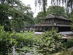
Gusu District
Gusu District (simplified Chinese: 姑苏区; traditional Chinese: 姑蘇區; pinyin: Gūsū Qū) is one of five urban districts and the main district of Suzhou, Jiangsu province, China. It was created on 1 September 2012 by the merger of the three former districts of Canglang, Pingjiang, and Jinchang.[1]
Gusu
姑苏区 | |
|---|---|
 | |
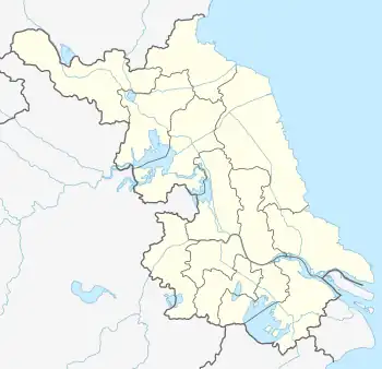
 Gusu Location in Jiangsu | |
| Coordinates: 31°19′09″N 120°35′30″E | |
| Country | People's Republic of China |
| Province | Jiangsu |
| Prefecture-level city | Suzhou |
| Formed | 1 September 2012 |
| Area | |
| • Total | 85.1 km2 (32.9 sq mi) |
| Population (2020) | |
| • Total | 958,000 |
| • Density | 11,000/km2 (29,000/sq mi) |
| Time zone | UTC+8 (China Standard) |
| Postal code | 215008 |
Administrative divisions
As of 2020, Gusu District has the following 8 subdistricts:[2]
- Baiyangwan Subdistrict
- Pingjiang Subdistrict
- Jinchang Subdistrict
- Canglang Subdistrict
- Shuangta Subdistrict
- Huqiu Subdistrict
- Sujin Subdistrict
- Wumenqiao Subdistrict
Historical divisions
As of 2011, the three districts which formed Gusu District had 17 subdistricts and 3 towns.[3]
| Former Canglang District[4] | Former Jinchang District[5] | Former Pingjiang District[6] |
|---|---|---|
| Shuangta Subdistrict (双塔街道) | Shilu Subdistrict (石路街道) | Guanqian Subdistrict (观前街道) |
| Nanmen Subdistrict (南门街道) | Caixiang Subdistrict (彩香街道) | Pingjiang Road Subdistrict (平江路街道) |
| Xujiang Subdistrict (胥江街道) | Liuyuan Subdistrict (留园街道) | Sujin Subdistrict (苏锦街道) |
| Wumenqiao Subdistrict (吴门桥街道) | Huqiu Subdistrict (虎丘街道) | Loumen Subdistrict (娄门街道) |
| Fengmen Subdistrict (葑门街道) | Baiyangwan Subdistrict (白洋湾街道) | Chengbei Subdistrict (城北街道) |
| Youxin Subdistrict (友新街道) | Taohuawu Subdistrict (桃花坞街道) | |
| Loufeng (娄葑镇) | ||
| Weiting (唯亭镇) | ||
| Shengpu (胜浦镇) | ||
References
- 苏州行政区划重大调整:古城合并新设姑苏区 吴江撤市设区. Xinhua (in Chinese). 2012-09-01. Archived from the original on September 4, 2012. Retrieved 2012-09-05.
- 2020年统计用区划代码(姑苏区) [2020 Statistical Division Codes (Gusu District)] (in Chinese). National Bureau of Statistics of China. 2020. Archived from the original on 2021-03-15. Retrieved 2021-03-05.
- "苏州市-行政区划网 www.xzqh.org" (in Chinese). XZQH. Retrieved 2012-05-24.
- 2011年统计用区划代码和城乡划分代码(沧浪区) [2011 Statistical Division Codes and Urban-rural Division Codes (Canglang District)] (in Chinese). National Bureau of Statistics of China. 2011. Archived from the original on 2021-03-15. Retrieved 2021-03-15.
- 2011年统计用区划代码和城乡划分代码(金阊区) [2011 Statistical Division Codes and Urban-rural Division Codes (Jinchang District)] (in Chinese). National Bureau of Statistics of China. 2011. Archived from the original on 2021-03-15. Retrieved 2021-03-15.
- 2011年统计用区划代码和城乡划分代码(平江区) [2011 Statistical Division Codes and Urban-rural Division Codes (Pingjiang District)] (in Chinese). National Bureau of Statistics of China. 2011. Archived from the original on 2021-03-15. Retrieved 2021-03-15.
This article is issued from Wikipedia. The text is licensed under Creative Commons - Attribution - Sharealike. Additional terms may apply for the media files.