Hadab al-Fawwar
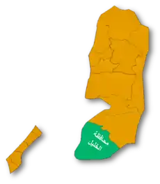
Hadab al-Fawwar (Arabic: حدب الفوّار, lit. Sparkling Slope) is a Palestinian village located seven kilometers southwest of Hebron. The village is in the Hebron Governorate Southern West Bank. According to the Palestinian Central Bureau of Statistics, the village had a population of 2,354 in 2017.[1] The primary health care facilities for the village are designated by the Ministry of Health as level 2.[3]
Hadab al-Fawwar | |
|---|---|
| Arabic transcription(s) | |
| • Arabic | حدب الفوّار |
 Hadab al-Fawwar Location of Hadab al-Fawwar within Palestine | |
| Coordinates: 31°28′36″N 35°03′20″E | |
| Palestine grid | 155/098 |
| State | State of Palestine |
| Governorate | Hebron |
| Government | |
| • Type | Village council |
| Population (2017)[1] | |
| • Total | 2,354 |
| Name meaning | The hummock[2] |
History
Ceramics from the Byzantine era have been found here.[4]
Ottoman era
In 1883 the PEF's Survey of Western Palestine (SWP) found here "Walls, a deep cistern, and a large tomb, sequently used as a stable."[5]
Footnotes
- Preliminary Results of the Population, Housing and Establishments Census, 2017 (PDF). Palestinian Central Bureau of Statistics (PCBS) (Report). State of Palestine. February 2018. pp. 64–82. Retrieved 2023-10-24.
- Palmer, 1881, p. 393
- West Bank Health care
- Dauphin, 1998, p. 962
- Conder and Kitchener, 1883, SWP III, p. 329
Bibliography
- Conder, C.R.; Kitchener, H.H. (1883). The Survey of Western Palestine: Memoirs of the Topography, Orography, Hydrography, and Archaeology. Vol. 3. London: Committee of the Palestine Exploration Fund.
- Dauphin, C. (1998). La Palestine byzantine, Peuplement et Populations. BAR International Series 726 (in French). Vol. III : Catalogue. Oxford: Archeopress. ISBN 0-860549-05-4.
- Palmer, E.H. (1881). The Survey of Western Palestine: Arabic and English Name Lists Collected During the Survey by Lieutenants Conder and Kitchener, R. E. Transliterated and Explained by E.H. Palmer. Committee of the Palestine Exploration Fund.
External links
- Survey of Western Palestine, Map 21: IAA, Wikimedia commons
- Hadab Al Fawwar Village (fact sheet), Applied Research Institute–Jerusalem (ARIJ)
- Hadab Al Fawwar Village profile, ARIJ
- Hadab Al Fawwar Village aerial photo, ARIJ
- The priorities and needs for development in Hadab al Fawwar village based on the community and local authorities' assessment, ARIJ
This article is issued from Wikipedia. The text is licensed under Creative Commons - Attribution - Sharealike. Additional terms may apply for the media files.
