Hamswehrum
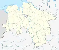
Hamswehrum is a village in the region of East Frisia, in Lower Saxony, Germany. It is part of the municipality of Krummhörn. The village is located between Upleward and Groothusen.
Hamswehrum | |
|---|---|
 | |
 Coat of arms | |
Location of Hamswehrum | |
 Hamswehrum  Hamswehrum | |
| Coordinates: 53.43077°N 7.04963°E | |
| Country | Germany |
| State | Lower Saxony |
| District | Aurich |
| Municipality | Krummhörn |
| Area | |
| • Metro | 6.46 km2 (2.49 sq mi) |
| Elevation | 5 m (16 ft) |
| Population | |
| • Metro | 469 |
| Time zone | UTC+01:00 (CET) |
| • Summer (DST) | UTC+02:00 (CEST) |
| Postal codes | 26736 |
| Dialling codes | 04923 |
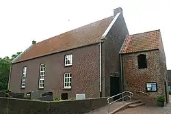
The village is first mentioned in a written source in 1375 and was probably founded by the inhabitants of a disappeared place (Hamswehr or Hayenswehr). Buildings such as the Geele Börg ('Yellow Castle') appear again and again in the history of the place. Nowadays, only a farm named after this castle remains a reminder of this. The 15th-century church was demolished in 1967 and replaced by a new church the following year: the current St. Maria's Church.[1]
References
- "Hamswehrum". Greetsiel-Krummhoern.de (in German). Retrieved 17 October 2023.
External links
![]() Media related to Hamswehrum at Wikimedia Commons
Media related to Hamswehrum at Wikimedia Commons
This article is issued from Wikipedia. The text is licensed under Creative Commons - Attribution - Sharealike. Additional terms may apply for the media files.