Hartford Municipal Airport
Hartford Municipal Airport (ICAO: KHXF, FAA LID: HXF) is a public use airport in Washington County, Wisconsin, United States.[1] The airport is owned by and located two nautical miles (4 km) northwest of the central business district of the city of Hartford.[1] It is included in the Federal Aviation Administration (FAA) National Plan of Integrated Airport Systems for 2021–2025, in which it is categorized as a local general aviation facility.[2]
Hartford Municipal Airport | |||||||||||||||
|---|---|---|---|---|---|---|---|---|---|---|---|---|---|---|---|
| Summary | |||||||||||||||
| Airport type | Public | ||||||||||||||
| Owner | City of Hartford | ||||||||||||||
| Serves | Hartford, Wisconsin | ||||||||||||||
| Elevation AMSL | 1,069 ft / 326 m | ||||||||||||||
| Coordinates | 43°20′57″N 088°23′29″W | ||||||||||||||
| Map | |||||||||||||||
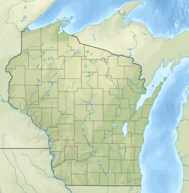 HXF Location of airport in Wisconsin  HXF HXF (the United States) | |||||||||||||||
| Runways | |||||||||||||||
| |||||||||||||||
| Statistics | |||||||||||||||
| |||||||||||||||
Although many U.S. airports use the same three-letter location identifier for the FAA and IATA, this facility is assigned HXF by the FAA but has no designation from the IATA.[3]
Facilities and aircraft
Hartford Municipal Airport covers an area of 378 acres (153 ha) at an elevation of 1,069 feet (326 m) above mean sea level. It has two runways: 9/27 is 3,401 by 75 feet (1,037 x 23 m) with an asphalt surface and approved GPS approaches, and runway 18/36 is 2,231 by 196 feet (680 x 60 m) with a turf surface.[1]
For the 12-month period ending August 10, 2022, the airport had 15,500 aircraft operations, an average of 42 per day: 97% general aviation, 3% air taxi and less than 1% military. In October 2023, there were 91 aircraft based at this airport: 75 single-engine, 1 multi-engine, 1 jet, 3 helicopter and 11 glider.[1]
See also
References
- FAA Airport Form 5010 for HXF PDF. Federal Aviation Administration. effective October 5, 2023.
- "NPIAS Report 2019-2023 Appendix A" (PDF). Federal Aviation Administration. October 3, 2018. Retrieved October 12, 2018.
- "Hartford Municipal Airport (ICAO: KHXF, FAA: HXF)". Great Circle Mapper. Retrieved May 16, 2013.
External links
- Airport page at City of Hartford website
- "Hartford Municipal (HXF)" (PDF). Archived from the original (PDF) on 2013-03-15. at Wisconsin DOT Airport Directory
- FAA Terminal Procedures for HXF, effective October 5, 2023
- Resources for this airport:
- FAA airport information for HXF
- AirNav airport information for HXF
- FlightAware airport information and live flight tracker
- SkyVector aeronautical chart for HXF
Civil aviation in Wisconsin | ||
|---|---|---|
| Primary airports | ||
| Airlines | ||
| Museums | ||
| Aviation related | ||
| People | ||