Henry Inlet
Henry Inlet is a narrow, ice-filled inlet about 12 nautical miles (22 km) long, indenting the north coast of Thurston Island, Antarctica, immediately east of Hughes Peninsula. The inlet was first plotted from air photos taken by U.S. Navy Operation Highjump, 1946–47, and was named by the Advisory Committee on Antarctic Names for Robert Henry, a photographer's mate with the U.S. Navy Bellingshausen Sea Expedition, who in February 1960 recorded features along Eights Coast from helicopters.[1]

Henry Inlet
Location of Henry Inlet in Antarctica
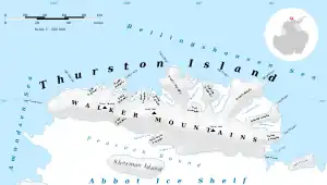
Map of Thurston Island.
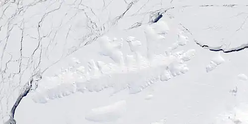
Satellite image of Thurston Island.
Maps
- Thurston Island – Jones Mountains. 1:500000 Antarctica Sketch Map. US Geological Survey, 1967.
- Antarctic Digital Database (ADD). Scale 1:250000 topographic map of Antarctica. Scientific Committee on Antarctic Research (SCAR), 1993–2016.
References
- "Henry Inlet". Geographic Names Information System. United States Geological Survey, United States Department of the Interior. Retrieved 13 June 2012.
![]() This article incorporates public domain material from "Henry Inlet". Geographic Names Information System. United States Geological Survey.
This article incorporates public domain material from "Henry Inlet". Geographic Names Information System. United States Geological Survey.
This article is issued from Wikipedia. The text is licensed under Creative Commons - Attribution - Sharealike. Additional terms may apply for the media files.