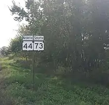
Wisconsin Highway 73
State Trunk Highway 73 (often called Highway 73, STH-73 or WIS 73) is a 265.84-mile (427.83 km) state highway in the central part of the US state of Wisconsin that runs mostly north–south from Ingram to near Edgerton. The exception is in Wood and Adams counties, where this highway runs east–west. It is one of the longer Wisconsin state highways.
State Trunk Highway 73 | ||||
|---|---|---|---|---|
WIS 73 highlighted in red | ||||
| Route information | ||||
| Maintained by WisDOT | ||||
| Length | 265.84 mi[1] (427.83 km) | |||
| Major junctions | ||||
| South end | ||||
| North end | ||||
| Location | ||||
| Country | United States | |||
| State | Wisconsin | |||
| Counties | Dane, Columbia, Dodge, Green Lake, Marquette, Waushara, Adams, Portage, Wood, Clark, Taylor, Rusk | |||
| Highway system | ||||
| ||||
Route description

WIS 73 starts in Dane County at an interchange with Interstate 39 (I-39), I-90 (exit 160), US Highway 51 (US 51) north of the city of Edgerton. Also near this junction, WIS 106 meets WIS 73 east of Albion. WIS 73 heads north nine miles (14 km) where it meets US 12 and US 18. WIS 73 continues north and heads one mile (1.6 km) to Deerfield. About four miles (6.4 km) north of Deerfield, it meets I-94 at exit 250, and continues north another four miles to Marshall where it has a brief overlap with WIS 19.
It continues north about 10 miles (16 km) to the city of Columbus. Just before it goes under an overpass of US 151, it crosses into Columbia County. WIS 73 crosses US 151, WIS 89, WIS 16, WIS 60 and US 151 again, in that order, as it travels northeast through Columbus on Park Avenue and Ludington Street. It also crosses into Dodge County just after WIS 16/WIS 60.
WIS 73 then continues north for 13 miles (21 km) to Randolph. Just north of town, it crosses WIS 33. WIS 73 will continue to go back and forth between both sides of Columbia–Dodge county line until it crosses into Green Lake County at County Highway AW, five miles (8.0 km) north of WIS 33. WIS 73 continues to head north for four miles to a junction with WIS 44. The two routes head west, forming a wrong-way concurrency through the unincorporated town of Manchester for two miles (3.2 km) before WIS 44 splits off to head to Kingston.
WIS 73 heads north another 10 miles to a junction with WIS 23, three miles (4.8 km) east of Princeton. WIS 23/WIS 73 overlaps to Princeton using Fulton Street and Main Street before WIS 23 splits southwest to Montello. WIS 73 then heads north-northwest, crossing into Marquette County at Eagle Road, to Neshkoro. WIS 73 will then cross into Waushara County just north of County Highway E, north of Neshkoro. WIS 73 continues north-northwest six miles (9.7 km) to Wautoma, where it meets WIS 21. WIS 21/WIS 73 runs concurrently through downtown before WIS 21 splits off to head to Necedah.

WIS 73 heads northwest for about 15 miles (24 km) to Plainfield where WIS 73 crosses I-39 (exit 136) and US 51 west of town. It continues heading west, crossing into Adams County at County Highway D. WIS 73 straddles the Adams-Portage county line for about four miles. It then enters Wood County before WIS 73 continues west-northwest to WIS 13, where it has a brief overlap with WIS 13. WIS 73 continues west for four miles to the Wisconsin River where it enters the city of Nekoosa. In Nekoosa, WIS 73 has a junction with WIS 173. WIS 73 follows roughly along the west bank of the Wisconsin River into Port Edwards, where it meets with WIS 54. WIS 54 is cosigned with WIS 73 along the west bank of the Wisconsin River as they enter Wisconsin Rapids's southwest side.
At Riverview Expressway, they meet with WIS 13. WIS 54 heads to Plover while WIS 73 and WIS 13 are cosigned briefly before they split at WIS 34 (4th Avenue) and Grand Avenue. WIS 73 heads west-northwest out of town. It crosses WIS 186. WIS 73 meets WIS 80 in Pittsville where WIS 73/WIS 80 overlap for about two miles before WI 80 heads north to Marshfield.
WIS 73 heads west seven miles (11 km) to where it crosses into Clark County. It continues west about 17 miles (27 km) to WIS 95 before it turns north and enters Neillsville where it has a one-block overlap with US 10 before heading north out of town. WIS 73 heads north to Greenwood and Withee. Just before Withee, WIS 73 meets with the WIS 29 expressway, overlaps with it for about 10 miles to Thorp, where WIS 73 exits and heads north once again. It crosses into Taylor County about five miles (8.0 km) north of WIS 29.
It goes north another seven miles to WIS 64. They are cosigned heading north before WIS 64 splits just east of Gilman. WIS 73 continues north to Jump River before entering Rusk County. It continues north for nine miles (14 km) to Ingram, where WIS 73 ends at US 8.
Major intersections
| County | Location | mi | km | Destinations | Notes |
|---|---|---|---|---|---|
| Dane | Edgerton | 0.0 | 0.0 | Southern terminus; road continues south as US 51 | |
| Albion | 0.8 | 1.3 | Western terminus of WIS 106 | ||
| Deerfield | 11.1 | 17.9 | Interchange | ||
| 17.2 | 27.7 | ||||
| Marshall | 21.5 | 34.6 | Western end of WIS 19 concurrency | ||
| 21.6 | 34.8 | Eastern end of WIS 19 concurrency | |||
| Columbia | Columbus | 34.5 | 55.5 | Diamond interchange | |
| 36.6 | 58.9 | ||||
| Dodge | 38.3 | 61.6 | Diamond interchange | ||
| Columbia | Randolph | 52.8 | 85.0 | ||
| Green Lake | Manchester | 62.6 | 100.7 | Eastern end of WIS 44 concurrency | |
| 64.1 | 103.2 | Western end of WIS 44 concurrency | |||
| Princeton | 74.0 | 119.1 | Eastern end of WIS 23 concurrency | ||
| 77.3 | 124.4 | Western end of WIS 23 concurrency | |||
| Waushara | Wautoma | 94.2 | 151.6 | Eastern end of WIS 21 concurrency | |
| 95.9 | 154.3 | ||||
| 96.7 | 155.6 | Eastern end of WIS 22 concurrency | |||
| 96.8 | 155.8 | Western end of WIS 21/WIS 22 concurrency. | |||
| Plainfield | 113.9 | 183.3 | Diamond interchange | ||
| Wood | Nekoosa | 130.8 | 210.5 | ||
| 135.0 | 217.3 | ||||
| 137.1 | 220.6 | Western end of WIS 54 concurrency | |||
| Wisconsin Rapids | 141.9 | 228.4 | Eastern end of WIS 54 concurrency; southern end of WIS 13 concurrency | ||
| 142.7 | 229.7 | Northern end of WIS 13 concurrency; southern terminus of WIS 34 | |||
| Vesper | 150.4 | 242.0 | Southern terminus of WIS 186 | ||
| Pittsville | 158.8 | 255.6 | Eastern end of WIS 80 concurrency | ||
| 161.2 | 259.4 | Western end of WIS 80 concurrency | |||
| Clark | Neillsville | 185.0 | 297.7 | Southern end of WIS 95 concurrency | |
| 188.0 | 302.6 | Northern end and terminus of WIS 95; western terminus of US 10 concurrency. US 10 concurrency goes east for 0.1 miles | |||
| Greenwood | 201.9 | 324.9 | Western terminus of WIS 98 | ||
| Withee | 216.8 | 348.9 | Interchange; eastern end of WIS 29 concurrency | ||
| Thorp | 226.8 | 365.0 | Interchange; western end of WIS 29 concurrency | ||
| Taylor | Lublin | 239.8 | 385.9 | Southern end of WIS 64 concurrency | |
| Gilman | 243.1 | 391.2 | Northern end of WIS 64 concurrency | ||
| Rusk | Ingram | 265.84 | 427.83 | Northern terminus | |
1.000 mi = 1.609 km; 1.000 km = 0.621 mi
| |||||
References
- Bessert, Chris. "Wisconsin Highways: Highways 70-79 (Highway 73)". Wisconsin Highways. Retrieved 2007-03-20.
External links
 Media related to Wisconsin Highway 73 at Wikimedia Commons
