Hillcrest, KwaZulu-Natal
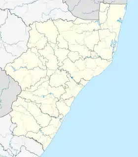
Hillcrest is a town in the KwaZulu-Natal province of South Africa that forms part of the eThekwini Metropolitan Municipality and is situated approximately 32 km (20 mi) north-west of Durban and 53 km (33 mi) south-east of Pietermaritzburg.
Hillcrest | |
|---|---|
 Hillcrest 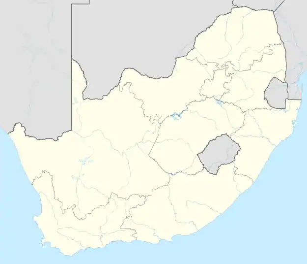 Hillcrest | |
| Coordinates: 29°46′48″S 30°45′46″E | |
| Country | South Africa |
| Province | KwaZulu-Natal |
| Municipality | eThekwini |
| Established | 22 January 1895 |
| Government | |
| • Ward Councillor | Rick Crouch[1][2][3] (Democratic Alliance) |
| Area | |
| • Total | 21.44 km2 (8.28 sq mi) |
| Population (2011)[4] | |
| • Total | 13,329 |
| • Density | 620/km2 (1,600/sq mi) |
| Racial makeup (2011) | |
| • Black African | 11.4% |
| • Coloured | 0.8% |
| • Indian/Asian | 3.0% |
| • White | 84.3% |
| • Other | 0.6% |
| First languages (2011) | |
| • English | 82.7% |
| • Afrikaans | 7.6% |
| • Zulu | 6.9% |
| • Other | 2.9% |
| Time zone | UTC+2 (SAST) |
| Postal code (street) | 3610 |
| PO box | 3650 |
| Area code | 031 |
Vehicle registrations in Hillcrest start with NU - N for Natal, U for Upper Highway which covers suburbs within the Upper Highway Area such as Kloof, Gillitts, Botha's Hill, Assagay, Waterfall and Everton as well as New Germany and Queensburgh just outside the Upper Highway.
History
Hillcrest was formerly a sleepy village, governed by its own Town Board[5] on the outskirts of Durban that has now become a booming suburb incorporated into the eThekwini Metropolitan Municipality. Hill Crest (as the town's name was variously spelt until 1969) was founded on a rise in the main road from Durban to Pietermaritzburg in 1895 as a farming or "weekend" village, then a good distance from what was the emerging port of Port Natal. The village was laid out as leasehold sites on a portion of the farm Albinia owned by William Gillitt, one of the main pioneer families of the area and after which the nearby suburb of Gillitts is named.
One of the other early families to set up in the area was the Acutts who had already established the well known in Durban estate agents firm of that name. In 1903 the first school in the village was established in a wood and iron cottage in Hospital Road leased to a Mrs McMillian, the principal of the first Highbury School, by Horace Acutt.
When the first Hillcrest Health Committee was established in 1943, the total all-race population was 1135 persons and only the Main Road was hardened. Nkutu Road was hardened with klinker in 1947 and this was followed in 1951 with the hardening of the first portion of Inanda Road. In 1962 blacktopping of selected roads in the central area began, followed by further roads in 1965. By 1971, when Town Board status was obtained, the total population had grown to 2799 persons.
The Hillcrest Waste Water Treatment Plant was established in the 1990s, then serving only the central commercial area of the village with phased extensions planned in time, with other areas continuing on septic tanks.
Hillcrest today
Hillcrest lost its independent Town Board status in 1996 and was made subject to administration by the Outer West Local Council - a substructure council of the then Durban Unicity. In 2000, the Outer West Local Council, along with other local councils, was disestablished and were replaced by the single eThekwini Municipality encompassing the entire Durban metropolitan area.
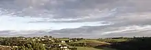
The suburb of Hillcrest experienced a building boom in the late 1990s and 2000s with the construction of many gated communities and shopping centres.[6] With rural origins, Hillcrest has been swept up in Durban's urban sprawl in recent years and is today being redeveloped as a residential suburb on the outer western outskirts of the Durban metropole. Hillcrest also serves as a commuter town with much of its working population travelling to Durban and Pinetown to work or study.
Contrary to its reputation for urban sprawl, Hillcrest's location 30+ kilometres from the coastal city of Durban means that the town is still situated far enough from the city life and therefore has managed to retain its country atmosphere, appealing to those who sought to have the convenience of living a peri-urban lifestyle close enough to the city and its amenities.
Geography
Hillcrest lies among the suburbs of Gillitts and Everton to the east, Waterfall to the north-east as well as Botha's Hill and Assagay to the west which together with Kloof (lies further east) and Hillcrest have all slowly grown together to form the Upper Highway Area, named after its location above Pinetown on the M13 highway.
Hillcrest lies on the rural-urban fringe where the suburban area dissolves into sugarcane fields and farmlands to the south and into traditional rural villages to the north.
Suburban areas[7]
- Albany (Residential)
- Albina (Residential)
- Belvedere (Residential)
- Belvedere Ext 1 (Residential)
- Cotswold Downs Golf and Country Estate (Residential)
- Hilldene (Residential)
- Plantations (Residential)
- West Riding (Residential)
Economy
Residential development
In recent years, Hillcrest has experienced increasing interest in the residential estates sector and as a result, upmarket luxury lifestyle estates such as Cotswold Downs Golf & Country Estate and Plantations Estate are a fast growing part of the local landscape of the town. The increasing popularity of properties in Hillcrest can be attributed to the town's balance between an edgy, semi-urban lifestyle, coupled with the nostalgia of country living.[8][9]
Retail
While largely a residential area, Hillcrest does feature a distinct and small commercial centre lined with shopping centres, shops, cafés and restaurants along the main high street of Old Main Road.
Hillcrest is mainly served by the Hillcrest Corner Shopping Centre located in the town centre and is anchored by Checkers, Woolworths, Virgin Active, Dis-Chem and Clicks. Many other smaller suburban shopping complexes in Hillcrest are within easy access, such as Christians Village, The Colony, Hillgate, Hillcrest Centre, Lillies Quarter Lifestyle Centre and Oxford Village Centre.[10][11]
Infrastructure
Education
A public school system is provided in Hillcrest including Hillcrest High School and Hillcrest Primary School,[12][13] with Winston Park Primary School in nearby Winston Park.
Private schools include Highbury Preparatory School, Curro: HCA and Waterfall Schools with Kearsney College and the Roseway Waldorf School in nearby Botha's Hill and Alverstone respectively.
Healthcare
Hillcrest is served by two hospitals, namely the Hillcrest Hospital, a specialised public hospital for chronically ill patients and the Busamed Hillcrest Private Hospital, owned by major South African private health group, Busamed, located just outside Hillcrest.[14][15]
Road Transport
Hillcrest lies directly on the M13 freeway, which bypasses the town to the south, connecting it with Durban to the south-east (via Gillitts, Kloof, Pinetown and Westville) and Pietermaritzburg to the north-west (via the N3) as King Cetshwayo Highway and is the untolled alternative route to the N3 (tolled in Pinetown). The N3 freeway bypasses Hillcrest further south, connecting it with Durban to the south-east and Pietermaritzburg to the north-west. The older section of the N3, now renumbered as the R103 (passes through the town centre) connects Hillcrest with Botha’s Hill and Inchanga to the north-west as Old Main Road, running somewhat parallel to the N3.
Smaller local routes in Hillcrest include the M33 route (Inanda Road), leading north from the R103 to Waterfall and east to Kloof and the M46 route (Kassier Road) leading south from the R103 to Assagay and Shongweni and south-west to Mpumalanga.
Notable residents
- Dale Benkenstein, Nashua Dolphins cricket player
- Wayne Fyvie, former Sharks and SA national rugby player
- Ian McIntosh, former Rhodesian, Sharks and SA national rugby coach
- Shaun Pollock, former Dolphins and SA national cricket player and captain
- Terence Parkin, Olympic medalist
- Heather Hamilton, Miss South Africa 1999,[16] Miss Universe top 10 1999, Miss World contestant 2000
- Megan Coleman, Miss South Africa 2006, Miss Universe 2007, Miss World contestant 2007
- Harold 'Tiger' Wright, South African Champion Jockey
- Sir Liege Hulett, Founder of Kearsney College, founder of Hulett's Sugar.[17]
- Horace Smethurst, Springbok Soccer Captain, Australia New Zealand Tour 1947, soccer player
References
- "Councillor ready to tackle problems hands-on". Retrieved 2011-07-09.
- Independent Electoral Commission - 2011 Election Results
- Ward 10 - Official Ward 10 Councillor Web Site
- "Main Place Hillcrest". Census 2011.
- Mullany, David (2007). "Hillcrest of a wave". The Property Magazine. Archived from the original on 2009-05-22.
- "Census 2011: Main Place: Hillcrest". census2011.adrianfrith.com. Retrieved 2023-03-10.
- "Home • Plantations Estate". Plantations Estate. Retrieved 2023-08-29.
- Downs, Cotswold. "Cotswold Downs, Hillcrest Golf Course, Luxury Estate". cotswolddowns.co.za. Retrieved 2023-08-29.
- "Home - Lillies Quarter". 2020-05-04. Retrieved 2023-04-17.
- "Hillcrest Corner | Simply Essential". Retrieved 2023-04-17.
- "Hillcrest Primary School Website". HCPS. Retrieved 23 October 2014.
- "KZN primary school gets top marks for technology adoption". www.itweb.co.za. IT Web. 14 November 2012. Retrieved 5 November 2014.
- "Busamed Hillcrest". Busamed Hillcrest. Retrieved 2023-03-10.
- "Hillcrest Hospital". www.kznhealth.gov.za. Retrieved 2023-03-10.
- "Heather Hamilton: Who's Who SA". Who's Who SA. Archived from the original on 2014-11-05. Retrieved 2014-11-05.
- Tongaat Hulletts history
Sources
- Lest We Forget - The Story of Hillcrest 1895 - 1995, Elizabeth Camp, c. 1996
- Hillcrest Gillitts Activity Corridor Local Development Plan - Outer West Local Council, 2000
- The Highway Mail, 1 June 2011.
- The Hilltop, 2 June 2011.
- Independent Electoral Commission (South Africa), 9 June 2011.
.svg.png.webp)