Umbogintwini
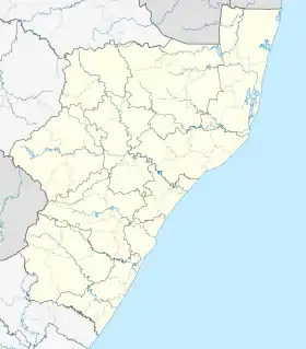
Umbogintwini (a corruption of eZimbokodweni)[2] is a suburb located approximately 23 km (14 mi) south-west of Durban, in the KwaZulu-Natal province of South Africa and forms part of the eThekwini Metropolitan Municipality.
Umbogintwini | |
|---|---|
 Umbogintwini  Umbogintwini | |
| Coordinates: 30°01′S 30°53′E | |
| Country | South Africa |
| Province | KwaZulu-Natal |
| Municipality | eThekwini |
| Main Place | Durban |
| • Councillor | (African National Congress) |
| Area | |
| • Total | 5.47 km2 (2.11 sq mi) |
| Population (2011)[1] | |
| • Total | 105 |
| • Density | 19/km2 (50/sq mi) |
| Racial makeup (2011) | |
| • Black African | 33.0% |
| • Coloured | 5.7% |
| • Indian/Asian | 15.1% |
| • White | 42.5% |
| • Other | 3.8% |
| First languages (2011) | |
| • English | 43.3% |
| • Afrikaans | 21.2% |
| • Zulu | 20.2% |
| • Tsonga | 5.8% |
| • Other | 9.6% |
| Time zone | UTC+2 (SAST) |
| Postal code (street) | 4120 |
| PO box | 4120 |
| Area code | 905 |
History
In the early 1900s, Mr Arthur Chamberlain (uncle of British Prime Minister Neville Chamberlain) saw an opportunity to supply explosives to the gold mines in South Africa at a cheaper rate than he could supply from the Kynochs factory in Arklow, Ireland. In 1907, the Natal Colony (prior to the Union of South Africa in 1910) granted Kynochs Ltd a lease on 1,400 acres (566 hectares) of land south of the uMbokodweni River which was originally part of a reserve.
Mr Warner, a land surveyor from Brisbane in Australia was contracted to lay out the factory and village of Umbogintwini. A house had been built for him in the village before he moved 11 km south-west of the village on the farm which is today known as the seaside resort of Warner Beach.
The first road constructed in the village was Highbury Road which became the focus of the earliest amenities buildings and residences before the village expanded and Chamberlain Road became the next point for development in the village.
23 men and their families from the Kynochs factory in Arklow, Ireland, moved to the area from 1908 to assist with the construction of the Twini factory with the men living outside of Umbogintwini until the first houses in the village were built.
The factory officially opened for production in 1908 as Kynochs Ltd and was set up to produce explosives as well as chemicals including nitric and sulphuric acid needed in the production of the explosives. The name of the factory later changed to African Explosives and Industries (which later further changed to African Explosives and Chemical Industries) in 1924 before the ramping up of the production of explosives during World War 2. During World War 2, the Royal Navy maintained a presence when purpose-built double storey houses for the officers were constructed, on Highbury Road.
In the late 1950s and 1960s, the "new village", an extension of Umbogintwini, was developed north of Dickens Road.
Umbogintwini's post office received the corrected name in 1997.
The village did not develop much until December 2004 when 90 hectares comprising the village and golf course was sold to Keystone Investments for their Arbour Town Development and in 2006 Volvo opened its GTO plant in Umbogintwini.
Today, Highbury Road and Cocking Road do not exist due to the Arbour Town development however Chamberlain Road, Prince Street, Rees Road and Oppenheimer Road still exist today. Oppenheimer Road used to extend through the village, however today the section between Dickens Road and Junction 2 no longer exists as it now forms part of the Arbour Town development and Chamberlain Road now forms part of the Arbour Village housing complex.
Etymology
"Umbogintwini'' is the corrupted version of the Zulu word Mbokodweni or eZimbokodweni meaning “river where round stones are collected” which is named after the uMbokodweni River on which it lies on. The name "Umbogintwini'' itself is too long for many residents and thus today the suburb is commonly referred to as the shortened version of the name which is "Twini '' or even sometimes ''MBog".[3][4]
Overview
Umbogintwini is a mixed-use area featuring three distinct areas: the industrial complex, the village and the Arbour Town-Galleria precinct.
Much of Umbogintwini comprises the industrial complex which lies to the west of the railway. The well-developed industrial complex is widely known as a major chemical and manufacturing hub in KwaZulu-Natal hosting the manufacturing plants of several major corporations such as Volvo, Toyota Boshoku, Toyota Tsusho, Yara South Africa, Dulux, BASF, Anchor Yeast, Dyefin Textiles, Acacia, Progas, The Beverage Company, Chemical Initiatives, Sammar and APM Terminals amongst others.[5][6][7]
The small residential section of Umbogintwini known as "the village" lies to the north of the suburb between the railway and the N2 freeway and consists of a post office, primary school and a park.
The official boundaries of Umbogintwini also include the Arbour Town-Galleria precinct situated in the south of Umbogintwini between the railway and the N2. The precinct is host to two shopping centres namely the Galleria Mall, the largest shopping centre south of Durban and the Arbour Crossing Shopping Centre. Arbour Town which includes Arbour Crossing is a mixed-use development situated along Arbour Road and has seen steady growth with the development of a Makro outlet and the addition of a number of auto sales facilities and drive-thru restaurants.[8]
Geography
Umbogintwini is situated on the southern bank of the uMbokodweni River approximately 8 kilometres (5 miles) north-west of the Amanzimtoti CBD. Umbogintwini forms the southernmost part of the South Durban Basin, a heavily industrialised region to the south of Durban.[9] Umbogintwini is bordered by Lotus Park to the north, Athlone Park to the east, Amanzimtoti to the south, and eZimbokodweni to the west.
Transport
Rail
Situated between Arbour Town and the industrial complex, the Umbogintwini railway station lies on the South Coast Line, the main commuter line between Durban and Kelso on the South Coast. Metrorail operates commuter rail services to various stations between Durban and Kelso such as Isipingo and Rossburgh to the north as well as Amanzimtoti, Kingsburgh, Umgababa, Umkomaas and Scottburgh to the south.
Road
The main road through Umbogintwini is Dickens Road which connects the suburb withAthlone Park and provides direct access to the N2 freeway via exit 144.
Umbogintwini is bounded by the N2 freeway to the east, leading north–south from Durban towards Amanzimtoti and Port Shepstone and Mfundi Mngandi Drive to the west, leading east–west from Isipingo to the neighbouring townships of eZimbokodweni and KwaMakhutha. McGowan Place is another significant local route through Umbogintwini, providing access to the Arbour Town/Galleria retail complex.
References
- "Sub Place Umbogintwini". Census 2011.
- Jenkins, Elwyn (2007), Falling into place: the story of modern South African place names, David Philip Publishers, p. 76
- "Umbogintwini - Some history and memories of a boy from Umbogintwini". Retrieved 14 May 2022.
- Jenkins, Elwyn R. (January 1991). "Linguistic and sociolinguistic issues in South African place names". English Usage in Southern Africa. 22 (1): 23–33. doi:10.1080/10228199108566057. ISSN 0256-5986.
- "DURBAN". www.volvogroup.com. Retrieved 14 May 2022.
- "TBEU". www.toyota-boshoku.be. Retrieved 14 May 2022.
- "TOYOTA TSUSHO AFRICA (PTY) LTD | Umbogintwini Amanzimtoti Kwazulu-Natal South Africa | Search in Africa". south-africa.searchinafrica.com. Retrieved 14 May 2022.
- "Home". Retrieved 14 May 2022.
- "Map of South Africa showing KwaZulu-Natal Province and South Durban Basin". ResearchGate. Retrieved 1 May 2022.
.svg.png.webp)