Hindlip
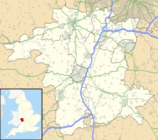
Hindlip or Hinlip[1] is a village and civil parish 3 miles (4.8 km) north east of Worcester,[2] in the Wychavon district, in the county of Worcestershire, England. In 2011 the parish had a population of 180.[3] The parish touches Tibberton, Martin Hussingtree, Salwarpe, Oddingley, Warndon and North Claines.[4]
| Hindlip | |
|---|---|
 | |
 Hindlip Location within Worcestershire | |
| Area | 4.4011 km2 (1.6993 sq mi) |
| Population | 180 (2011 census) |
| • Density | 41/km2 (110/sq mi) |
| OS grid reference | SO879586 |
| Civil parish |
|
| District | |
| Shire county | |
| Region | |
| Country | England |
| Sovereign state | United Kingdom |
| Post town | Worcester |
| Postcode district | WR3 |
| UK Parliament | |
Features
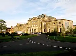
There are 15 listed buildings in Hindlip.[5] Hindlip Hall, a stately home originally built in 1563, rebuilt in 1820 following its destruction by fire is the headquarters of the West Mercia Police.[6] St James's Church is a 15th-century parish church[7] which is no longer supported by the Church of England (since 1997), but is now the church for the constabulary.[8]
History
The name "Hindlip" means 'Hind leap'.[9] Hindlip was recorded in the Domesday Book as Hindelep.[10] Hindlip was "Hindehlep" in the 10th century, "Hundeslep" in the 12th century, "Hindelupe" in the 13h century and Henlipp in the 16th century.[11] On the 22nd of December 1886 Upper and Lower Smite Houses, a part of Warndon parish was transferred to the parish. The transferred area contained 5 houses in 1891. On the 1st of April 1952 18 acres were transferred to the parish from North Claines and 5 acres were transferred to Warndon.[12] The parish was historically in the Oswaldslow hundred.[13] Hindlip was possibly a deserted medieval village.[14]
References
- "History of Hindlip, in Wychavon and Worcestershire Place names". A Vision of Britain through Time. Retrieved 29 May 2019.
- "Distance from Hindlip [52.225468, -2.17856]". GENUKI. Retrieved 29 May 2019.
- UK Census (2011). "Local Area Report – Hindlip Parish (E04010403)". Nomis. Office for National Statistics. Retrieved 29 May 2019.
- "Hindlip". Ordnance Survey. Retrieved 29 May 2019.
- "Listed Buildings in Hindlip, Wychavon, Worcestershire". British Listed Buildings. Retrieved 29 May 2019.
- Historic England, "Hindlip Hall (116050)", Research records (formerly PastScape), retrieved 29 May 2019
- Historic England, "St James's Church (116047)", Research records (formerly PastScape), retrieved 29 May 2019
- Genealogy and Heraldry Archived 2009-09-30 at the Wayback Machine accessed 7 July 2008
- "Hindlip Key to English Place-names". The University of Nottingham. Retrieved 29 May 2019.
- "Worcestershire E-L". The Domesday Book Online. Retrieved 29 May 2019.
- "Parishes: Hindlip". British History Online. Retrieved 29 May 2019.
- "Relationships and Changes Hindlip Ch/AP/CP through time". A Vision of Britain through Time. Retrieved 29 May 2019.
- "Hindlip". GENUKI. Retrieved 29 May 2019.
- Historic England, "Hindlip (116067)", Research records (formerly PastScape), retrieved 29 May 2019