Hkamti District
Hkamti District or Khamti District (sometimes Naga Hills District[1]) is a district in northern Sagaing Division of Burma (Myanmar). Its administrative center is the town of Singkaling Hkamti.
Khamti District
ခန္တီးခရိုင် | |
|---|---|
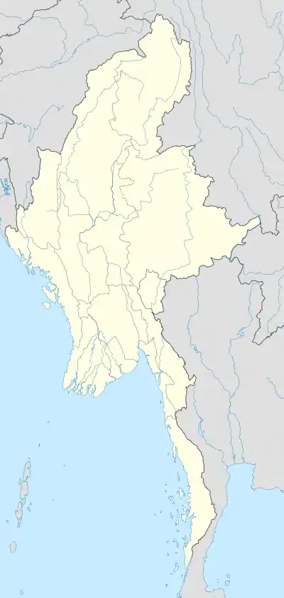 Khamti District Location in Burma | |
| Coordinates: 26°00′N 95°41′E | |
| Country | Burma |
| Region | Sagaing Region |
| No. of Townships | 3 |
| Capital | Singkaling Hkamti |
| Time zone | UTC+6.30 (MST) |
Townships
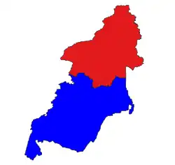
The district consists of the two townships:
Prior to 2010,[2] it additionally controlled Lahe, Lay Shi (Lashe), and Nanyun townships, which were transferred under the 2008 Constitution[3] to the Naga Self-Administered Zone. The revised smaller district still has a significant minority Naga population.
Borders
Hkamti District is bordered[4] by:
- India to the west
- Naga Self-Administered Zone to the west and north,
- Myitkyina District and Mohnyin District of Kachin State to the east.
- Katha District to the southeast, and
- Mawlaik District and Tamu District to the south,
Economy
Most people in Hkamti District practice subsistence farming. There is also a jade mine,[5] although most of the jade mining is nearby in Mohnyin District.[6]
Demographics
The district is inhabited by the Khamti, Duleng (Kachin) and Nung Rawang people.
Notes
- "Naga Hills District" Geonames
- "တိုင်းခုနစ်တိုင်းကို တိုင်းဒေသကြီးများအဖြစ် လည်းကောင်း၊ ကိုယ်ပိုင်အုပ်ချုပ်ခွင့်ရ တိုင်းနှင့် ကိုယ်ပိုင်အုပ်ချုပ်ခွင့်ရ ဒေသများ ရုံးစိုက်ရာ မြို့များကို လည်းကောင်း ပြည်ထောင်စုနယ်မြေတွင် ခရိုင်နှင့်မြို့နယ်များကို လည်းကောင်း သတ်မှတ်ကြေညာ". Weekly Eleven News (in Burmese). 2010-08-20. Retrieved 2010-08-23.
- ပြည်ထောင်စုသမ္မတမြန်မာနိုင်ငံတော် ဖွဲ့စည်းပုံအခြေခံဥပဒေ (၂၀၀၈ ခုနှစ်) (in Burmese) [0]=1|2008 Constitution PDF Archived 2011-05-01 at the Wayback Machine
- "Myanmar States/Divisions & Townships Overview Map" Archived 2010-12-03 at the Wayback Machine Myanmar Information Management Unit (MIMU)
- "2001 Gem News Archive: Oct. 29, 2001: New Burma Jade Mine" Archived 2009-06-08 at the Wayback Machine Gem News Pala International
- Hughes, Richard W. (2000) "Burmese Jade: The Inscrutable Gem, Part I: Burma's Jade Mines" Pala International
External links
.svg.png.webp)
