Hudson, Wisconsin
Hudson is a city in St. Croix County, Wisconsin, United States. As of the 2020 United States census, its population was 14,755.[2] It is part of the Minneapolis–St. Paul Metropolitan Statistical Area (MSA). The village of North Hudson is directly north of Hudson.
Hudson | |
|---|---|
City | |
| Hudson | |
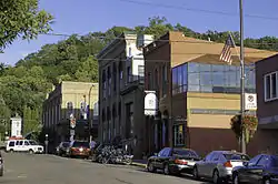
 Historic architecture in downtown Hudson, September 2010 | |
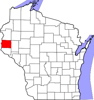
 Location of Hudson in St. Croix County, Wisconsin. | |
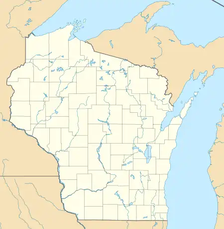
 Hudson Location within the state of Wisconsin  Hudson Hudson (the United States) | |
| Coordinates: 44°58′19″N 92°44′42″W | |
| Country | United States |
| State | Wisconsin |
| County | St. Croix |
| Government | |
| • Type | Mayor - Council |
| • Mayor | Rich O’Connor |
| Area | |
| • City | 7.65 sq mi (19.80 km2) |
| • Land | 6.77 sq mi (17.52 km2) |
| • Water | 0.88 sq mi (2.28 km2) |
| Population | |
| • City | 14,755 |
| • Density | 2,180.8/sq mi (842.0/km2) |
| • Metro | 3,690,261 (16th) |
| • Demonym | Hudsonite |
| Time zone | UTC−6 (Central (CST)) |
| • Summer (DST) | UTC−5 (CDT) |
| ZIP codes | 54016, 54017 |
| Area code(s) | 715 & 534 (715 |
| FIPS code | 55-36250 |
| Website | www.ci.hudson.wi.us |
History

Hudson was settled in 1840 by Louis Massey and his brother in-law, Peter Bouchea. William Streets arrived at about the same time.[3] Later that year, Joseph Sauperson (commonly known as Joe LaGrue) took up residence. These four are considered Hudson's original inhabitants. Massey and Bouchea settled at the mouth of the Willow River, near the present-day First and St. Croix Streets. They had been part of a group that lived for some time along the river below Fort Snelling, which appears on some old maps as "Massey's Landing".
Hudson was originally called Willow River. It was later named Buena Vista by Judge Joel Foster, founder of River Falls, after returning from the Mexican War where he fought in the Battle of Buena Vista. In 1852, Alfred D. Gray, Hudson's first mayor, petitioned to change the city's name to Hudson, because the bluffs along the St. Croix River reminded him of the Hudson River in his native New York.[4]
A large number of settlers arrived in the 1850s and 1860s, many of whom were ancestors of today's residents. The lumber industry was the area's prime attraction, and over time sawmills were established throughout the St. Croix Valley.
The Chicago, St. Paul, Minneapolis and Omaha Railway was formed in 1881 from other railroads building between the Twin Cities and Chicago.[5] The shops and headquarters of the Omaha Road were in Hudson. This route is now part of the Union Pacific Railroad.
On August 30, 1917, a violent mob of 1,000 held a night rally in front of the armory protesting the pacifist People's Council of America's attempt to hold a conference in Hudson's prizefighting arena. The crowd then moved on the four organizers in the lobby of their hotel and threatened to hang them. Only after the pleadings of county attorney N. O. Varnum were the four allowed to leave town at once and unharmed.[6]
U.S. Highway 12 once crossed the St. Croix River on a toll bridge between Wisconsin and Minnesota, which provided revenue for the town. With the construction of Interstate 94, the toll bridge was removed, though the long causeway extending to the former bridge location is now open to the public as a pedestrian walkway, known as "The Dike".

Geography
According to the United States Census Bureau, the city has an area of 7.41 square miles (19.19 km2), of which 6.53 square miles (16.91 km2) is land and 0.88 square miles (2.28 km2) is water.[7]
Interstate Highway 94, U.S. Route 12 and Wisconsin Highway 35 are three of the main routes in the community.
Climate
| ||||||||||||||||||||||||||||||||||||||||||||||||||||||||||||||||||||||||||||||||||||||||||||||||||||||||||||||||||||||||||||
Demographics
| Census | Pop. | Note | %± |
|---|---|---|---|
| 1860 | 1,570 | — | |
| 1870 | 1,748 | 11.3% | |
| 1880 | 2,298 | 31.5% | |
| 1890 | 2,885 | 25.5% | |
| 1900 | 3,259 | 13.0% | |
| 1910 | 2,810 | −13.8% | |
| 1920 | 3,014 | 7.3% | |
| 1930 | 2,725 | −9.6% | |
| 1940 | 2,987 | 9.6% | |
| 1950 | 3,435 | 15.0% | |
| 1960 | 4,325 | 25.9% | |
| 1970 | 5,049 | 16.7% | |
| 1980 | 5,434 | 7.6% | |
| 1990 | 6,378 | 17.4% | |
| 2000 | 8,775 | 37.6% | |
| 2010 | 12,719 | 44.9% | |
| 2020 | 14,755 | 16.0% | |
| U.S. Decennial Census[9] | |||
2020 census
As of the census of 2020,[2] the population was 14,755. The population density was 2,180.8 inhabitants per square mile (842.0/km2). There were 6,510 housing units at an average density of 962.2 per square mile (371.5/km2). Ethnically, the population was 4.4% Hispanic or Latino of any race. When counting both Hispanic and non-Hispanic people together by race, the city was 89.5% White, 1.4% Asian, 1.3% Black or African American, 0.4% Native American, 0.1% Pacific Islander, 1.6% from other races, and 5.7% from two or more races.
According to the American Community Survey estimates for 2016-2020, the median income for a household in the city was $74,207, and the median income for a family was $94,292. Male full-time workers had a median income of $61,412 versus $49,663 for female workers. The per capita income for the city was $38,400. About 4.9% of families and 6.8% of the population were below the poverty line, including 12.0% of those under age 18 and 5.6% of those age 65 or over.[10] Of the population age 25 and over, 95.0% were high school graduates or higher and 42.5% had a bachelor's degree or higher.[11]
2010 census
As of the census[12] of 2010, there were 12,719 people, 5,287 households, and 3,324 families living in the city. The population density was 1,947.8 inhabitants per square mile (752.0/km2). There were 5,642 housing units at an average density of 864.0 per square mile (333.6/km2). The racial makeup of the city was 94.8% White, 0.9% African American, 0.3% Native American, 1.4% Asian, 0.7% from other races, and 1.8% from two or more races. Hispanic or Latino of any race were 2.7% of the population.
There were 5,287 households, of which 32.6% had children under the age of 18 living with them, 49.0% were married couples living together, 9.9% had a female householder with no husband present, 4.0% had a male householder with no wife present, and 37.1% were non-families. 29.6% of all households were made up of individuals, and 10.4% had someone living alone who was 65 years of age or older. The average household size was 2.36 and the average family size was 2.95.
The median age in the city was 35.4 years. 25.3% of residents were under the age of 18; 6.7% were between the ages of 18 and 24; 32% were from 25 to 44; 23.4% were from 45 to 64; and 12.3% were 65 years of age or older. The gender makeup of the city was 48.5% male and 51.5% female.
Economy
Hudson has grown as a tourist destination and restaurants on the St. Croix in its historic downtown, along with hotels and other businesses that serve traffic on Interstate Highway 94.
The former greyhound racing track, St. Croix Meadows, is being redeveloped to include a hotel, dining, commercial office space, residential condos, a baseball field, an 18-hole mini golf course, and an indoor sports complex with two hockey rinks and a soccer arena.[13]
Two made-for-TV movies were filmed in the city in 2021.[14]
Arts and culture
Hudson is home of the Phipps Center for the Arts, a regional performing arts center. It is the headquarters of Little Free Libraries and was the site of the first Little Free Library.[15]
Public safety
Hudson is served by the Hudson Police Department, the Hudson Fire Department, and Lakeview EMS. These agencies respond to about 400 fire calls, 2000 EMS and rescue calls, and 5000 police calls annually.
Transportation
Hudson has no public airports, though residents have access to the New Richmond Regional Airport and the St. Paul Downtown Airport for general aviation, and the Minneapolis–Saint Paul International Airport (MSP) for commercial and international flights. There is an airport shuttle from Hudson to MSP.
Education
Hudson is served by the Hudson School District. Public schools in the city include E. P. Rock Elementary School, Hudson Prairie Elementary School, North Hudson Elementary School, Willow River Elementary School, Houlton Elementary School, River Crest Elementary School, Hudson Middle School, and Hudson High School.
St Patrick's School, a Catholic parochial school, is also in Hudson. The Trinity Academy of Hudson, a Lutheran private school, offers preschool through eighth grade.
In 2010, the University of Wisconsin–River Falls opened a satellite campus in Hudson with a focus on undergraduate and graduate degrees for adult students.
Notable people
- Benjamin Allen, Wisconsin state senator
- Lynn H. Ashley, member of the Wisconsin State Assembly
- Julius Beer, member of the Wisconsin State Assembly
- Jim Bertelsen, National Football League player
- Todd Bol, Little Free Library founder
- Philo Boyden, member of the Wisconsin State Assembly
- George W. Chinnock, member of the Wisconsin State Assembly
- John A. Chinnock, member of the Wisconsin State Assembly
- Harvey Clapp, member of the Wisconsin State Assembly
- Moses E. Clapp, U.S. senator from Minnesota
- Otis Clymer, Major League Baseball player
- Richard H. Cosgriff, Medal of Honor recipient
- Thomas Cleland Dawson, diplomat
- Eliza B. K. Dooley, artist, writer, government official in Puerto Rico
- Davis Drewiske, professional hockey player
- James A. Frear, U.S. representative
- David C. Fulton, member of the Wisconsin State Assembly
- Marcus Fulton, Wisconsin state senator
- Phil Gallivan, baseball player
- Jay R. Hinckley, member of the Wisconsin State Assembly
- John Huot, member of the Minnesota House of Representatives
- James B. Hughes, politician, abolitionist, lawyer
- Donald L. Iverson, member of the Wisconsin State Assembly
- Andrew P. Kealy, member of the Wisconsin State Assembly
- Arthur D. Kelly, member of the Wisconsin State Assembly
- Max Malanaphy, drag queen
- Pamela Matson, Stanford scientist
- Frank Nye, U.S. representative from Minnesota
- Ted Odenwald, baseball player
- Wilder Penfield, neurosurgeon pioneer
- William Henry Phipps, Wisconsin state senator
- Thomas Porter, member of the Wisconsin State Assembly
- Bobby Reis, baseball player
- Kitty Rhoades, member of the Wisconsin State Assembly
- Barry Rose, professional football player
- Bjørn Selander, racing cyclist
- John Coit Spooner, United States senator
- Philip Loring Spooner, tenor singer
- Horace Adolphus Taylor, Wisconsin state senator
- Kraig Urbik, professional football player
References
- "2019 U.S. Gazetteer Files". United States Census Bureau. Retrieved August 7, 2020.
- "2020 Decennial Census: Hudson city, Wisconsin". data.census.gov. U.S. Census Bureau. Retrieved March 24, 2023.
- LaRowe, Richard C. (1984). Hudson and North Hudson, Wisconsin: An Intensive Survey of Local Architectural and Historical Resources : Final Report.
- Alden, Sharyn (1999). Up North Wisconsin: A Region for All Seasons. Big Earth Publishing. ISBN 978-0-915024-69-8.
- Robert Joseph Casey (1948). Pioneer railroad the story of the Chicago and North Western System. Robert Joseph Casey. pp. 151–. GGKEY:WK1RLEKNSCN.
- Eau Claire Leader, August 31, 1917
- "US Gazetteer files 2010". United States Census Bureau. Archived from the original on January 25, 2012. Retrieved November 18, 2012.
- "NASA Earth Observations Data Set Index". NASA. Retrieved January 30, 2016.
- "Census of Population and Housing". Census.gov. Retrieved June 4, 2015.
- "Selected Economic Characteristics, 2020 American Community Survey: Hudson city, Wisconsin". data.census.gov. U.S. Census Bureau. Retrieved March 24, 2023.
- "Selected Social Characteristics, 2020 American Community Survey: Hudson city, Wisconsin". data.census.gov. U.S. Census Bureau. Retrieved March 24, 2023.
- "U.S. Census website". United States Census Bureau. Retrieved November 18, 2012.
- Apr 13th 2018 - 10am, Rebecca C. Mariscal. "Dog track sale finalized, new development coming". RiverTowns. Retrieved August 9, 2020.
- Nov 17th 2021, Hannah Coyle. "Two movies filmed in Hudson, premiered". Hudson Star-Observer. Retrieved October 10, 2022.
- "About Little Free Library". littlefreelibrary.org. January 9, 2017. Retrieved October 8, 2017.
External links
 Hudson, Wisconsin travel guide from Wikivoyage
 Media related to Hudson, Wisconsin at Wikimedia Commons
- Official website
- Hudson Chamber of Commerce and Tourism Bureau
- Around the Corner with John McGivern -- Hudson Video produced by Milwaukee PBS
