Hunsdon
Hunsdon is a village and civil parish in Hertfordshire, England.[1][2] It is around 5.5 miles (9 km) east of Ware and 5 miles (8 km) north-west of Harlow.[1] The population of the village taken at the 2011 Census was 1,080.[3]

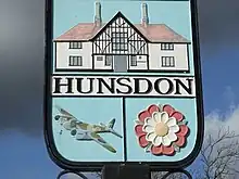
Village sign with RAF Mosquito included in the design

St Dunstan Church, Hunsdon

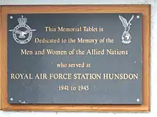
Memorial tablet on Hunsdon Village Hall
References
- Ordnance Survey: Landranger map sheet 167 Chelmsford (Harlow & Bishop’s Stortford) (Map). Ordnance Survey. 2012. ISBN 9780319232101.
- "Ordnance Survey Election Maps". www.ordnancesurvey.co.uk. Ordnance Survey. Retrieved 3 April 2016.
- "Civil Parish population 2011". Neighbourhood Statistics. Office for National Statistics. Retrieved 30 October 2016.
External links
![]() Media related to Hunsdon at Wikimedia Commons
Media related to Hunsdon at Wikimedia Commons
This article is issued from Wikipedia. The text is licensed under Creative Commons - Attribution - Sharealike. Additional terms may apply for the media files.