Hyderabad district, India
Hyderabad district is a most populous district in the state of Telangana in India that contains a part of the metropolitan area of Hyderabad. It is headed by a district collector who is drawn from the IAS cadre and is appointed by the state government. It is the smallest of all the districts in the state, but has the highest human density. Old MCH area, which is central region of Hyderabad city comes under this district.The district share boundaries with Rangareddy and Medhchal districts.
Hyderabad district | |
|---|---|
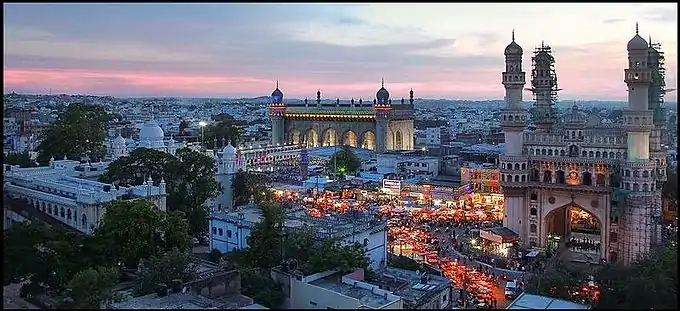 Panorama of Charminar complex | |
.svg.png.webp) Location in Telangana | |
| Coordinates (Hyderabad): 17.366°N 78.476°E | |
| Country | |
| State | Telangana |
| Mandalas | 16 |
| Established | 1948 |
| Headquarters | Hyderabad |
| Government | |
| • Parliament of India | Asaduddin Owaisi |
| • District collector | Sri Anudeep Durishetty, IAS[1] |
| • Parliament constituencies | 1. Hyderabad, 2. Secunderabad |
| • Assembly constituencies | |
| Area | |
| • District of Telangana | 217 km2 (84 sq mi) |
| Population (2011) | |
| • District of Telangana | 3,943,323 |
| • Density | 18,000/km2 (47,000/sq mi) |
| • Urban | 100% |
| Demographics | |
| • Literacy | 83.25% |
| • Sex ratio | 954 |
| Time zone | UTC+05:30 (IST) |
| Major highways | NH-44, NH-65, NH-163, NH-765, |
| Average annual precipitation | 786.8 mm |
| Website | hyderabad |
History

Hyderabad district was formed in 1948 after Operation Polo by merging Atraf-a-Balda District and Baghat District. Baghat was previously a Taluk in Atraf-e-Balda District, and was made a separate district in 1931–34 under the subedar of Medak division. After formation of Andhra Pradesash by merging Telugu speaking of Hyderabad state in 1956 Hyderabad district boundary was altered Tandur Taluka which is Telugu speaking region of Gulbarga district was merged in Hyderabad district and Parigi Taluka of Mahabubnagar district and Vikarabad Taluka of Medak District also merged in Hyderabad district.[2] In 1978 Hyderabad district was later split into Hyderabad Urban District and Hyderabad Rural District. Hyderabad Urban District was made by 4 Talukas are Charminar, Golkonda, Mushirabad and Secunderabad Talukas. Hyderabad rural district was later renamed as Ranga Reddy District.[3] Hyderabad Urban district subdivided in 16 Mandals in 1985 and consist of 2 Revenue division[4][5]
Administrative divisions
Hyderabad District includes the area of the core area Greater Hyderabad Municipal Corporation, Secunderabad Cantonment, and Osmania University. There are 16 administrative areas called mandals (or tehsils) in Hyderabad. They are:[6][7]
| # | Hyderabad revenue division | # | Secunderabad revenue division |
|---|---|---|---|
| 1 | Amberpet | 11 | Ameerpet |
| 2 | Asifnagar | 12 | Khairtabad |
| 3 | Bahadurpura | 13 | Marredpally |
| 4 | Bandlaguda | 14 | Musheerabad |
| 5 | Charminar | 15 | Trimulgherry |
| 6 | Golconda | 16 | Secunderabad |
| 7 | Himayathnagar | 17 | Secunderabad Cantonment |
| 8 | Nampally | ||
| 9 | Shaikpet | ||
| 10 | Saidabad | ||
Hyderabad district comprises 15 Assembly constituencies in the core of the Greater Hyderabad Municipal Corporation.[8]
Geography

Hyderabad district occupies an area of approximately 217 square kilometres (84 sq mi).[9]
Demographics
| Year | Pop. | ±% p.a. |
|---|---|---|
| 1901 | 499,082 | — |
| 1911 | 627,720 | +2.32% |
| 1921 | 556,913 | −1.19% |
| 1931 | 588,217 | +0.55% |
| 1941 | 810,790 | +3.26% |
| 1951 | 1,083,634 | +2.94% |
| 1961 | 1,191,668 | +0.95% |
| 1971 | 1,682,284 | +3.51% |
| 1981 | 2,251,009 | +2.96% |
| 1991 | 3,145,939 | +3.40% |
| 2001 | 3,829,753 | +1.99% |
| 2011 | 3,943,323 | +0.29% |
| source:[10] | ||
In the 2011 census Hyderabad district's population was 3,943,323, with a religious make-up of: Hindus (51.45%), Muslims (43.89%), Christians (2.22%), Jains (0.5%), Sikhs (0.29%) and Buddhists (0.03%);[11] 1.58% did not state any religion.[12] This gives it a ranking of 57th in India (out of a total of 640).[13] The district has a population density of 18,480 inhabitants per square kilometre (47,900/sq mi) .[13] Its population growth rate over the decade 2001–2011 was 4.71%.[13] Hyderabad has a sex ratio of 943 females for every 1000 males,[13] and a literacy rate of 80.96%.[13]
Climate
| Month | Jan | Feb | Mar | Apr | May | Jun | Jul | Aug | Sep | Oct | Nov | Dec | Year |
|---|---|---|---|---|---|---|---|---|---|---|---|---|---|
| Record high °C (°F) | 35.9 (96.6) |
39.1 (102.4) |
42.2 (108.0) |
43.3 (109.9) |
44.5 (112.1) |
45.5 (113.9) |
38.0 (100.4) |
37.6 (99.7) |
36.5 (97.7) |
36.7 (98.1) |
34.0 (93.2) |
35.0 (95.0) |
45.5 (113.9) |
| Average high °C (°F) | 29.7 (85.5) |
32.5 (90.5) |
36.1 (97.0) |
38.2 (100.8) |
39.7 (103.5) |
35.1 (95.2) |
31.5 (88.7) |
30.5 (86.9) |
31.2 (88.2) |
31.4 (88.5) |
30.2 (86.4) |
29.2 (84.6) |
33.0 (91.4) |
| Daily mean °C (°F) | 22.9 (73.2) |
25.3 (77.5) |
28.7 (83.7) |
31.4 (88.5) |
33.3 (91.9) |
29.9 (85.8) |
27.1 (80.8) |
26.6 (79.9) |
26.7 (80.1) |
26.1 (79.0) |
24.3 (75.7) |
22.2 (72.0) |
27.0 (80.7) |
| Average low °C (°F) | 15.9 (60.6) |
18.3 (64.9) |
21.5 (70.7) |
24.5 (76.1) |
26.6 (79.9) |
24.4 (75.9) |
22.9 (73.2) |
22.5 (72.5) |
22.3 (72.1) |
20.9 (69.6) |
17.8 (64.0) |
15.3 (59.5) |
21.1 (70.0) |
| Record low °C (°F) | 6.1 (43.0) |
8.9 (48.0) |
13.2 (55.8) |
16.0 (60.8) |
16.7 (62.1) |
17.8 (64.0) |
18.6 (65.5) |
18.7 (65.7) |
17.8 (64.0) |
11.7 (53.1) |
7.4 (45.3) |
7.1 (44.8) |
6.1 (43.0) |
| Average precipitation mm (inches) | 9.2 (0.36) |
10.2 (0.40) |
12.3 (0.48) |
27.2 (1.07) |
34.5 (1.36) |
113.8 (4.48) |
162.0 (6.38) |
203.9 (8.03) |
148.5 (5.85) |
113.9 (4.48) |
19.1 (0.75) |
5.0 (0.20) |
859.6 (33.84) |
| Average rainy days | 0.6 | 0.6 | 0.9 | 2.0 | 2.5 | 6.8 | 9.5 | 11.3 | 8.4 | 5.6 | 1.3 | 0.3 | 49.8 |
| Average relative humidity (%) (at 17:30 IST) | 41 | 33 | 29 | 30 | 31 | 52 | 65 | 70 | 67 | 59 | 49 | 44 | 48 |
| Average dew point °C (°F) | 12 (54) |
12 (54) |
13 (55) |
15 (59) |
15 (59) |
19 (66) |
20 (68) |
20 (68) |
20 (68) |
17 (63) |
15 (59) |
13 (55) |
16 (61) |
| Mean monthly sunshine hours | 272.8 | 265.6 | 272.8 | 276.0 | 279.0 | 180.0 | 136.4 | 133.3 | 162.0 | 226.3 | 243.0 | 251.1 | 2,698.3 |
| Mean daily sunshine hours | 8.8 | 9.4 | 8.8 | 9.2 | 9.0 | 6.0 | 4.4 | 4.3 | 5.4 | 7.3 | 8.1 | 8.1 | 7.4 |
| Average ultraviolet index | 9 | 11 | 12 | 12 | 12 | 12 | 12 | 12 | 12 | 11 | 9 | 8 | 11 |
| Source 1: India Meteorological Department (sun 1971–2000)[17][18][19] Time and Date (dewpoints, 2005-2015)[20][21] | |||||||||||||
| Source 2: Tokyo Climate Center (mean temperatures 1981–2010)[22] Weather Atlas[23] | |||||||||||||
Government
The collectorate administers the district on behalf of the state government. The Hyderabad District does not have elected officials at the district level due to the absence of a Zilla Parishad (District Legislature) although it has representations at the state (MLA) and Union level legislature (MP). In addition the entire district is contained within the jurisdiction of the GHMC, the city administration. Representatives are popularly elected to various wards of GHMC.
References
- hyderabad
.telangana .gov .in /about-district /whos-who / - "Hyderabad Legislative Assembly". ECI. AP Legislature. Archived from the original on 4 August 2013. Retrieved 14 October 2014.
- Law, Gwillim (25 September 2011). "Districts of India". Statoids. Retrieved 11 October 2011.
- "Archived copy" (PDF). Archived from the original (PDF) on 26 May 2012. Retrieved 5 November 2012.
{{cite web}}: CS1 maint: archived copy as title (link) - "Welcome to Revenue Department". Revenue Department, Hyderabad. 2014. Retrieved 25 August 2014.
- "Part-I State Administrative Divisions 2001–2011" (PDF). Census of India. p. 4,12. Retrieved 18 January 2015.
- "K Chandrasekhar Rao appoints collectors for new districts". Deccan Chronicle. 11 October 2016. Retrieved 13 October 2016.
- "Voters exceed Hyderabad's population! - Times of India". The Times of India.
- Srivastava, Dayawanti et al. (ed.) (2010). "States and Union Territories: Andhra Pradesh: Government". India 2010: A Reference Annual (54th ed.). New Delhi, India: Additional Director General, Publications Division, Ministry of Information and Broadcasting (India), Government of India. pp. 1111–1112. ISBN 978-81-230-1617-7.
{{cite book}}:|last1=has generic name (help) - Decadal Variation In Population Since 1901
- Hyderabad District Religion Census 2011
- "C-1 Population By Religious Community". Government of India, Ministry of Home Affairs. Retrieved 11 May 2016. On this page, select "Andhra Pradesh" from the download menu. "District – Hyderabad" is at line 672 of the excel file.
- "District Census 2011". Census2011.co.in. 2011. Retrieved 30 September 2011.
- "C-16 Population By Religion - Andhra Pradesh". census.gov.in.
- "Table C-16 Population by Mother Tongue: Andhra Pradesh (Urban)". Census of India. Registrar General and Census Commissioner of India.
- "What happened to the Christians of Andhra Pradesh" (PDF). Centre for Policy Studies. 2016: 9.
{{cite journal}}: Cite journal requires|journal=(help) - "Station: Hyderabad (A) Climatological Table 1981–2010" (PDF). Climatological Normals 1981–2010. India Meteorological Department. January 2015. pp. 331–332. Archived from the original (PDF) on 5 February 2020. Retrieved 13 February 2020.
- "Extremes of Temperature & Rainfall for Indian Stations (Up to 2012)" (PDF). India Meteorological Department. December 2016. p. M9. Archived from the original (PDF) on 5 February 2020. Retrieved 13 February 2020.
- "Table 3 Monthly mean duration of Sun Shine (hours) at different locations in India" (PDF). Daily Normals of Global & Diffuse Radiation (1971–2000). India Meteorological Department. December 2016. p. M-3. Archived from the original (PDF) on 5 February 2020. Retrieved 13 February 2020.
- "Climate & Weather Averages in Hyderabad, Telangana, India". Time and Date. Retrieved 18 July 2022.
- "Climatological Tables 1991-2020" (PDF). India Meteorological Department. p. 21. Archived from the original (PDF) on 1 January 2023. Retrieved 1 January 2023.
- "Normals Data: Hyderabad Airport - India Latitude: 17.45°N Longitude: 78.47°E Height: 530 (m)". Japan Meteorological Agency. Retrieved 29 February 2020.
- "Climate and monthly weather forecast Hyderabad, India". Weather Atlas. Retrieved 13 June 2022.
External links
Places adjacent to Hyderabad district, India | |
|---|---|
Hyderabad topics | |||||||||||
|---|---|---|---|---|---|---|---|---|---|---|---|
| History | |||||||||||
| Government | |||||||||||
| Public Buildings | |||||||||||
| Tourist attractions |
| ||||||||||
| Education | |||||||||||
| Higher education |
| ||||||||||
| Healthcare | |||||||||||
| Industry | |||||||||||
| Transport |
| ||||||||||
| Culture | |||||||||||
| Water bodies | |||||||||||
| National parks around Hyderabad | |||||||||||
| National parks around Hyderabad |
| ||||||||||
| Sport |
| ||||||||||
| Other topics | |||||||||||
| Topics | |
|---|---|
| Dynasties | |
| Districts |
|
| Commissionerates | |
| Major cities | |
| Tourism |
|
| Municipal corporations | |
| Related lists | |